83.216.213.19 - IP Lookup: Free IP Address Lookup, Postal Code Lookup, IP Location Lookup, IP ASN, Public IP
Country:
Region:
City:
Location:
Time Zone:
Postal Code:
ISP:
ASN:
language:
User-Agent:
Proxy IP:
Blacklist:
IP information under different IP Channel
ip-api
Country
Region
City
ASN
Time Zone
ISP
Blacklist
Proxy
Latitude
Longitude
Postal
Route
db-ip
Country
Region
City
ASN
Time Zone
ISP
Blacklist
Proxy
Latitude
Longitude
Postal
Route
IPinfo
Country
Region
City
ASN
Time Zone
ISP
Blacklist
Proxy
Latitude
Longitude
Postal
Route
IP2Location
83.216.213.19Country
Region
burgenland
City
zagersdorf
Time Zone
Europe/Vienna
ISP
Language
User-Agent
Latitude
Longitude
Postal
ipdata
Country
Region
City
ASN
Time Zone
ISP
Blacklist
Proxy
Latitude
Longitude
Postal
Route
Popular places and events near this IP address
Klingenbach
Municipality in Burgenland, Austria
Distance: Approx. 2237 meters
Latitude and longitude: 47.75,16.53333333
Klingenbach (Hungarian: Kelénpatak, Croatian: Klimpuh) is a town in the Eisenstadt-Umgebung district in the Austrian state of Burgenland. It is located near the border with Hungary with a border crossing into Sopron.

Siegendorf
Municipality in Burgenland, Austria
Distance: Approx. 2231 meters
Latitude and longitude: 47.78333333,16.53333333
Siegendorf (Croatian: Cindrof, Hungarian: Cinfalva) is a town in the district of Eisenstadt-Umgebung in the Austrian state of Burgenland.

Trausdorf an der Wulka
Municipality in Burgenland, Austria
Distance: Approx. 6094 meters
Latitude and longitude: 47.81666667,16.55
Trausdorf an der Wulka (Burgenland Croatian: Trajštof, Hungarian: Darázsfalu) is a town in the district of Eisenstadt-Umgebung in the Austrian state of Burgenland. It is on the Wulka river.

Wulkaprodersdorf
Municipality in Burgenland, Austria
Distance: Approx. 3405 meters
Latitude and longitude: 47.79388889,16.49583333
Wulkaprodersdorf (Croatian: Vulkaprodrštof, Hungarian: Vulkapordány, Vulka-Pordány) is a town in the district of Eisenstadt-Umgebung in the Austrian state of Burgenland.
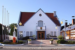
Zagersdorf
Municipality in Burgenland, Austria
Distance: Approx. 4 meters
Latitude and longitude: 47.76666667,16.51666667
Zagersdorf (Croatian: Cogrštof, Hungarian: Zárány) is a town in the district of Eisenstadt-Umgebung in the Austrian state of Burgenland.

Antau
Municipality in Burgenland, Austria
Distance: Approx. 2497 meters
Latitude and longitude: 47.76666667,16.48333333
Antau (German pronunciation: [ˈantaʊ̯] , Hungarian: Selegszántó, Seleg-Szántó, Croatian: Otava) is a town in the district of Mattersburg in the Austrian state of Burgenland.
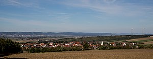
Baumgarten, Burgenland
Municipality in Burgenland, Austria
Distance: Approx. 3919 meters
Latitude and longitude: 47.73333333,16.5
Baumgarten (Hungarian: Sopronkertes, Sopron-Kertes, Croatian: Pajngrt) is a town in the district of Mattersburg in the Austrian state of Burgenland.
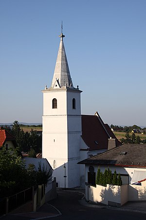
Draßburg
Municipality in Burgenland, Austria
Distance: Approx. 3113 meters
Latitude and longitude: 47.75,16.48333333
Draßburg (Hungarian: Darufalva, Daru-Falva, Croatian: Rasporak) is a town in the district of Mattersburg in the Austrian state of Burgenland. There are numerous members of the Burgenland-Croatian minority in the village.

Hirm
Municipality in Burgenland, Austria
Distance: Approx. 5322 meters
Latitude and longitude: 47.78333333,16.45
Hirm (German pronunciation: [hɪʁm] ; Hungarian: Félszerfalva, earlier, Hungarian: Félszerfalu; Croatian: Hirman or Hirin) is a town in the district of Mattersburg in the Austrian state of Burgenland. It lies on the Hirmer Bach, a tributary of the River Wulka, downstream from Krensdorf.
Schattendorf
Municipality in Burgenland, Austria
Distance: Approx. 5570 meters
Latitude and longitude: 47.71666667,16.51666667
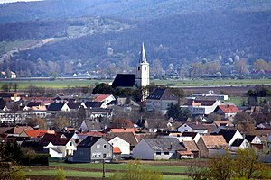
Schattendorf (Croatian: Šundrof, Hungarian: Somfalva) is a town in the district of Mattersburg in the Austrian state of Burgenland. The Rosalia-Kogelberg nature preserve lies within the district.

Zemendorf-Stöttera
Municipality in Burgenland, Austria
Distance: Approx. 4991 meters
Latitude and longitude: 47.76666667,16.45
Zemendorf-Stöttera (Hungarian: Zemenye-Selegd; Croatian: Cemendrof-Štetr (Štedra, Stodra)) is a town in the district of Mattersburg in the Austrian state of Burgenland.
Trausdorf Airport
Airport in Austria
Distance: Approx. 4757 meters
Latitude and longitude: 47.79930556,16.55780556
Trausdorf Airport (ICAO: LOAT) was a public use airstrip located 1 km south of Trausdorf an der Wulka, Burgenland, Austria.
Weather in this IP's area
scattered clouds
6 Celsius
4 Celsius
5 Celsius
7 Celsius
1004 hPa
79 %
1004 hPa
974 hPa
10000 meters
2.99 m/s
5.42 m/s
164 degree
43 %
