Country:
Region:
City:
Latitude and Longitude:
Time Zone:
Postal Code:
IP information under different IP Channel
ip-api
Country
Region
City
ASN
Time Zone
ISP
Blacklist
Proxy
Latitude
Longitude
Postal
Route
Luminati
Country
ASN
Time Zone
Europe/Brussels
ISP
SmartEye B.V
Latitude
Longitude
Postal
IPinfo
Country
Region
City
ASN
Time Zone
ISP
Blacklist
Proxy
Latitude
Longitude
Postal
Route
db-ip
Country
Region
City
ASN
Time Zone
ISP
Blacklist
Proxy
Latitude
Longitude
Postal
Route
ipdata
Country
Region
City
ASN
Time Zone
ISP
Blacklist
Proxy
Latitude
Longitude
Postal
Route
Popular places and events near this IP address

Aartselaar
Municipality in Flemish Community, Belgium
Distance: Approx. 2447 meters
Latitude and longitude: 51.13333333,4.38333333
Aartselaar (Dutch pronunciation: [ˈaːrtsəlaːr] , old spelling: Aertselaer) is a municipality located in the Belgian province of Antwerp. The municipality only comprises the town of Aartselaar proper. In 2021, Aartselaar had a total population of 14,455 people.

Hemiksem
Municipality in Flemish Community, Belgium
Distance: Approx. 1830 meters
Latitude and longitude: 51.15,4.35
Hemiksem (Dutch pronunciation: [ˈɦeːmɪksɛm], historical spellings Heymissen and Hemixem) is a municipality located in the Belgian province of Antwerp. The municipality only comprises the town of Hemiksem proper. In 2021, Hemiksem had a total population of 11,722.

Schelle
Municipality in Flemish Community, Belgium
Distance: Approx. 3765 meters
Latitude and longitude: 51.13333333,4.33333333
Schelle is also the German name for Šaľa, Slovakia. Schelle (Dutch pronunciation: [ˈsxɛlə] ) is a municipality located in the Belgian province of Antwerp. The municipality only comprises the town of Schelle proper.

Schoonselhof cemetery
Cemetery in Antwerp, Belgium
Distance: Approx. 1393 meters
Latitude and longitude: 51.16611111,4.36694444
Schoonselhof Cemetery (Antwerpen Schoonselhof) is located in Hoboken, Antwerp, a suburb of Antwerp, Belgium. Schoonselhof Cemetery has an islamic and Jewish section. There is also a Commonwealth war graves plot containing the graves of 1,557 British Commonwealth service personnel who died in the World Wars, 101 from World War I and 1,455 from World War II, besides 16 Polish and 1 French war burial, a United States airman attached to the British Royal Air Force, and 16 non-war graves, mainly of merchant seamen.

Olympisch Stadion (Antwerp)
Stadium at Antwerp, Belgium
Distance: Approx. 3409 meters
Latitude and longitude: 51.185,4.38222222
The Olympisch Stadion (Dutch pronunciation: [oːˈlɪmpiˌstaːdijɔn]) or Kielstadion (pronounced [ˈkilstaːdijɔn]) was built as the main stadium for the 1920 Summer Olympics in Antwerp. For those games, it hosted the athletics, equestrian, field hockey, football, gymnastics, modern pentathlon, rugby union, tug of war, weightlifting and korfball (demonstration) events. Following the Olympics it was converted to a football stadium.
Cleydael Castle
Castle in Belgium
Distance: Approx. 2015 meters
Latitude and longitude: 51.138,4.364
Cleydael Castle (Dutch: Kasteel Cleydael) is a moated castle in Aartselaar in the province of Antwerp, Belgium. Cleydael Castle is situated at an altitude of 8 meters. Parts of the building date from the 14th century.

Nachtegalen Park
Park located in Antwerp, Belgium
Distance: Approx. 3969 meters
Latitude and longitude: 51.18388889,4.40777778
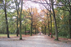
Nachtegalen Park (Dutch: Nightingale Park) is a park located in the Antwerp, Belgium municipality of Wilrijk. It served as the archery venue for the 1920 Summer Olympics. During World War II, the park was headquarters for the 89th German Army Corps, then it became command post of the 719th Infantry Division.

Maison Guiette
House by Le Corbusier in Antwerp, Belgium
Distance: Approx. 3464 meters
Latitude and longitude: 51.18366667,4.39325
Maison Guiette also known as Les Peupliers, is a house in Antwerp, Belgium, designed by Le Corbusier in 1926 and built in 1927. It was the studio and living quarters of René Guiette, a painter and art critic. One of the Franco-Swiss architect's lesser-known works, it is an early example of the International Style.

Craeybeckx Tunnel
Distance: Approx. 4023 meters
Latitude and longitude: 51.1803,4.4158
The Craeybeckx tunnel (in Dutch Craeybeckxtunnel and fully Lode Craeybeckxtunnel) is a road tunnel in Antwerp built in 1981 to reduce the noise from the traffic, for the benefit of the Sint-Augustinus hospital and the Middelheim hospital. The tunnel is 1600 m long and is the widest in Belgium. The construction is named after Lode Craeybeckx, the mayor of Antwerp between 1947 and 1976.

Sorghvliedt Castle
Castle in Belgium
Distance: Approx. 2369 meters
Latitude and longitude: 51.171,4.3533
Sorghvliedt Castle (Dutch: Kasteel Sorghvliedt) is a building in Belgium with a history dating back to the 16th century. It was originally a farm building called Wickeleynde owned by the merchant Jean Plaquet and his wife Maria Leydeckers. In 1660, it came into the hands of the du Bois family.

The Mad Maiden (Rik Wouters)
Distance: Approx. 4022 meters
Latitude and longitude: 51.181332,4.414055
The Mad Maiden or The Mad Virgin (Dutch: Het zotte geweld or De dwaze maagd) is a bronze statue by the Belgian artist Rik Wouters, created in 1912. The statue depicts Wouters' wife and muse, Nel Deurinckx, in a dynamic and ecstatic dancing pose. Wouters very often painted, drew and sculpted his wife in charming, everyday settings, while she was sleeping, reading, or doing domestic chores.

Shankheshwar Parshvanath Jain Temple
Jain temple in Belgium
Distance: Approx. 2571 meters
Latitude and longitude: 51.17355556,4.39638889
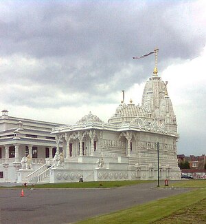
The Shankheshwar Parshvanath Jain Temple is a Jain temple located in the municipality Wilrijk of Antwerp Province, Belgium. It is currently the only Jain temple in continental Europe.
Weather in this IP's area
moderate rain
6 Celsius
4 Celsius
6 Celsius
7 Celsius
1001 hPa
96 %
1001 hPa
1000 hPa
6000 meters
3.6 m/s
150 degree
100 %
08:06:35
16:49:39
