Country:
Region:
City:
Latitude and Longitude:
Time Zone:
Postal Code:
IP information under different IP Channel
ip-api
Country
Region
City
ASN
Time Zone
ISP
Blacklist
Proxy
Latitude
Longitude
Postal
Route
Luminati
Country
Region
02
City
wroclaw
ASN
Time Zone
Europe/Warsaw
ISP
Korbank S. A.
Latitude
Longitude
Postal
IPinfo
Country
Region
City
ASN
Time Zone
ISP
Blacklist
Proxy
Latitude
Longitude
Postal
Route
db-ip
Country
Region
City
ASN
Time Zone
ISP
Blacklist
Proxy
Latitude
Longitude
Postal
Route
ipdata
Country
Region
City
ASN
Time Zone
ISP
Blacklist
Proxy
Latitude
Longitude
Postal
Route
Popular places and events near this IP address
St. Elizabeth's Church, Wrocław
Distance: Approx. 637 meters
Latitude and longitude: 51.11166667,17.03
St. Elizabeth's Church (Polish: Bazylika św. Elżbiety) of the Catholic Third Order of Saint Francis is a Gothic church in Wrocław, Poland.

Royal Palace, Wrocław
Palace residency in Wrocław, Poland
Distance: Approx. 468 meters
Latitude and longitude: 51.1075,17.02861111
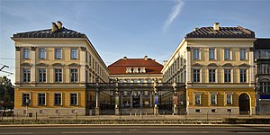
The Royal Palace (Polish: Pałac Królewski; German: Stadtschloss) is a palace in Wrocław, Poland. Originally a palace of the Prussian monarchy, it now houses the city museum.

Wrocław Academy of Music
School
Distance: Approx. 284 meters
Latitude and longitude: 51.111119,17.020931
The Karol Lipiński Academy of Music (Polish: Akademia Muzyczna im. Karola Lipińskiego, 'AMKL') is a university level school of music in Wrocław, Poland. It was established in November 1948 and is located on John Paul II Square.

New Synagogue (Breslau)
Former Reform synagogue in Breslau, Germany
Distance: Approx. 632 meters
Latitude and longitude: 51.10453611,17.02834444
The New Synagogue (German: Neue Synagoge; Polish: Nowa Synagoga) was a former Reform Jewish congregation and synagogue, located in Breslau, Germany (now Wrocław, Poland). It was one of the largest synagogues in the German Empire and a centre of Reform Judaism in Breslau. Designed by Edwin Oppler in the Romanesque Revival style and completed in 1872, the synagogue was destroyed during the Kristallnacht pogrom which swept across Nazi Germany on 9–10 November 1938.

White Stork Synagogue
Conservative synagogue in Wrocław, Poland
Distance: Approx. 190 meters
Latitude and longitude: 51.10805556,17.02472222
The White Stork Synagogue (Polish: Synagoga Pod Białym Bocianem) is a Conservative Jewish congregation and synagogue, located in Wrocław, in the Lower Silesian Voivodeship of Poland. Designed by Carl Ferdinand Langhans in the Neoclassical style and completed in 1829, the synagogue is located in the city's center, which was the northern edge of the former Jewish district. Rededicated in 2010 after a decade-long renovation, it is the religious and cultural centre of the local Jewish community, under the auspices of the Union of Jewish Religious Communities in Poland.
Wrocław Town Hall
Hall in Wrocław, Poland
Distance: Approx. 671 meters
Latitude and longitude: 51.10972222,17.03166667
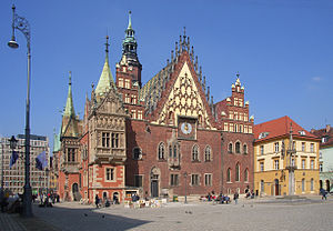
The Old Town Hall (Polish: Stary Ratusz, German: Breslauer Rathaus) of Wrocław stands at the center of the city’s Market Square (rynek). The Gothic town hall built from the 13th century is one of the main landmarks of the city. The Old Town Hall's long history reflects developments that have taken place in the city since its initial construction.

Monopol Hotel
Hotel in Wrocław, Poland
Distance: Approx. 669 meters
Latitude and longitude: 51.10611111,17.03083333
The Monopol Hotel is a historic five-star hotel located at Helena Modrzejewska Street, Wrocław, Lower Silesia, Poland.

Wrocław Opera
Opera house in Wrocław, Poland
Distance: Approx. 675 meters
Latitude and longitude: 51.1057,17.0306
The Wrocław Opera (Polish: Opera Wrocławska) is an opera company and opera house in the Old Town of Wrocław, Poland. The opera house was opened in 1841 and up to 1945 was named after the city's then German name, Oper Breslau.

St Dorothea Church, Wrocław
Church in Wrocław, Poland
Distance: Approx. 638 meters
Latitude and longitude: 51.10638889,17.03055556
The Church of Sts. Dorothea, Wenceslaus, and Stanislaus (Polish: Kościół św. Stanisława, św.

Aleksander Fredro Monument
Monument in Wrocław, Poland
Distance: Approx. 646 meters
Latitude and longitude: 51.10966,17.03131
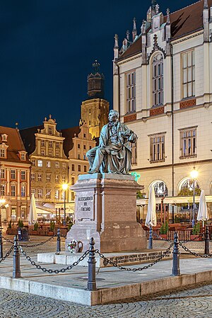
The Aleksander Fredro Monument (Polish: pomnik Aleksandra Fredry) is a bronze statue located in Wrocław, Poland dedicated to Polish Romantic-era poet, playwright and author Aleksander Fredro. Originally built in Lwów (German: Lemberg) in 1897 according to Leonard Marconi's design, the monument was transferred to Wrocław in 1956.
John Paul II Square, Wrocław
Square in Wrocław, Poland
Distance: Approx. 333 meters
Latitude and longitude: 51.11168,17.02176
The John Paul II Square (Polish: plac Jana Pawła II [plat͡s ˈjana ˈpavwa druˈɡʲɛɡɔ]) is a square and important transit point in Wrocław, Poland. The square is situated in the Szczepin district.

Salt Market Square, Wrocław
Square in Wrocław, Poland
Distance: Approx. 507 meters
Latitude and longitude: 51.109406,17.029362
The Salt Market Square or Salt Square (Polish: plac Solny [plat͡s ˈsɔlnɨ]; German: Salzring, [1827–1945] Blücherplatz) is a medieval market square in Wrocław, Poland. It is one of the three historic market squares in the city's old town, next to the Market Square and the New Market Square. It is located in the city center, on the southwestern corner of the Market Square.
Weather in this IP's area
fog
6 Celsius
4 Celsius
5 Celsius
7 Celsius
1031 hPa
99 %
1031 hPa
1017 hPa
50 meters
3.6 m/s
120 degree
100 %
06:50:00
16:20:55


