83.137.254.5 - IP Lookup: Free IP Address Lookup, Postal Code Lookup, IP Location Lookup, IP ASN, Public IP
Country:
Region:
City:
Location:
Time Zone:
Postal Code:
IP information under different IP Channel
ip-api
Country
Region
City
ASN
Time Zone
ISP
Blacklist
Proxy
Latitude
Longitude
Postal
Route
Luminati
Country
City
sainthelier
ASN
Time Zone
Europe/Jersey
ISP
Sure (Guernsey) Limited
Latitude
Longitude
Postal
IPinfo
Country
Region
City
ASN
Time Zone
ISP
Blacklist
Proxy
Latitude
Longitude
Postal
Route
IP2Location
83.137.254.5Country
Region
jersey
City
saint helier
Time Zone
Europe/Jersey
ISP
Language
User-Agent
Latitude
Longitude
Postal
db-ip
Country
Region
City
ASN
Time Zone
ISP
Blacklist
Proxy
Latitude
Longitude
Postal
Route
ipdata
Country
Region
City
ASN
Time Zone
ISP
Blacklist
Proxy
Latitude
Longitude
Postal
Route
Popular places and events near this IP address

Victoria College, Jersey
Boys' school in Jersey, Channel Islands
Distance: Approx. 359 meters
Latitude and longitude: 49.1856,-2.0966
Victoria College is a Government-run, fee-paying, academically selective day school for boys in St Helier, Jersey. Founded in 1852, the school is named after Queen Victoria. It is owned and administered by the Government of Jersey and is located on Mont Millais adjacent to Jersey College for Girls, the Government fee-paying secondary school for girls.

States Assembly
Parliament of Jersey, a British Crown Dependency
Distance: Approx. 365 meters
Latitude and longitude: 49.18365,-2.1052
The States Assembly (French: Assemblée des États; Jèrriais: Êtats d'Jèrri) is the parliament of Jersey, formed of the island's 37 deputies and the Connétable of each of the twelve parishes. The origins of the legislature of Jersey lie in the system of self-government according to Norman law guaranteed to the Channel Islands by John, King of England, following the division of Normandy in 1204. The States Assembly has exercised uncontested legislative powers since 1771, when the concurrent law-making power of the Royal Court of Jersey was abolished.
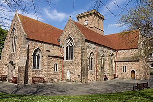
Parish Church of St Helier
Church in the parish of Saint Helier, Jersey
Distance: Approx. 477 meters
Latitude and longitude: 49.18349167,-2.10675833
The Parish Church of St Helier is the parish church of the parish of Saint Helier, Jersey. It is a Church of England church, one of the twelve 'Ancient Parish Churches' of Jersey, and serves as the Island's civic church and Pro-Cathedral.

Jersey Railway
Former railway line in Jersey
Distance: Approx. 573 meters
Latitude and longitude: 49.186,-2.107
The Jersey Railway was originally a 3+3⁄4 miles (6.0 km) long standard gauge railway on Jersey in the Channel Islands. Opened in 1870, it was converted to 3 ft 6 in (1,067 mm) narrow-gauge in 1884 and extended 7+3⁄4 miles (12.5 km). The line closed in 1936.

Jersey Eastern Railway
Former railway line in Jersey
Distance: Approx. 519 meters
Latitude and longitude: 49.182,-2.107
The Jersey Eastern Railway was a standard gauge railway that began operations on 6 August 1873 in Jersey. The line closed on 21 June 1929.

Jersey Heritage
Independent trust responsible for Jersey's major historic sites, museums, and public archives
Distance: Approx. 521 meters
Latitude and longitude: 49.1824,-2.1072
Jersey Heritage is an independent trust in Jersey which is responsible for the island's major historic sites, museums, and public archives. It holds collections of artefacts, works of art, documents, specimens, and information relating to Jersey's history, culture, and environment. The trust was formally registered in Jersey on 3 June 1983.

Jersey College for Girls
Girls' fee-paying school in Saint Saviour, Jersey
Distance: Approx. 591 meters
Latitude and longitude: 49.1865,-2.0936
Jersey College for Girls (JCG, Jèrriais: Lé collège jèrriais pour les fil'yes) is a government-run, fee-paying, academically selective secondary school for girls in Saint Saviour, Jersey. It was founded in 1880 in Saint Helier as Jersey Ladies' College. In 1887, the college moved to a purpose-built site on La Pouquelaye and in 1999, it moved again to its present site, on Mont Millais, across from Victoria College, the government fee-paying school for boys.
2012 Jersey gas holder fire
2012 fire outbreak at a gas holder in Jersey
Distance: Approx. 518 meters
Latitude and longitude: 49.18777778,-2.09777778
On 4 July 2012, fire broke out at a gas holder, owned by Jersey Gas, on Tunnell Street, in Saint Helier, Jersey. The Jersey Fire and Rescue Service brought the fire under control, and it burnt out during the early hours of 5 July. In the aftermath of the incident Jersey Gas was fined £65,000 by the island's Royal Court and ordered to pay legal costs of £11,000.
King Street, Saint Helier
Distance: Approx. 569 meters
Latitude and longitude: 49.1846,-2.1078
King Street (Jèrriais: Rue d'Driéthe), also known as Rue de Derrière, is one of the two parts of the high street of Saint Helier in Jersey. It is a pedestrianised shopping street which runs from Charing Cross at its west end to Queen Street at its east end. It includes a spur that links to Broad Street which is also called King Street in English, but Ruette Haguais in gallicised Jèrriais.

St Helier railway station (Jersey Railway)
Former railway station in Saint Helier, Jersey
Distance: Approx. 658 meters
Latitude and longitude: 49.182935,-2.109219
St Helier railway station was a railway station in Saint Helier, the capital of Jersey in the Channel Islands. Opened in 1870 by the Jersey Railway, it was situated on the western side of the Weighbridge area, now Liberation Square. The station was referred to as "St.

St Helier railway station (Jersey Eastern Railway)
Former railway station in Saint Helier, Jersey
Distance: Approx. 248 meters
Latitude and longitude: 49.182975,-2.103549
St Helier railway station was the terminus of the Jersey Eastern Railway (JER) in Saint Helier, the capital of Jersey in the Channel Islands. Opened in 1874, it was situated in a railway cutting at the base of Mont de la Ville below Fort Regent. The station was referred to as St.

Pomme d'Or Hotel
Hotel in Saint Helier, Jersey
Distance: Approx. 613 meters
Latitude and longitude: 49.18305556,-2.10861111
The Pomme d'Or Hotel is a hotel in Saint Helier, Jersey. It was founded in 1837 and was used as the Nazi naval headquarters during the Nazi occupation of the Channel Islands. It is the main focus for Jersey's Liberation Day celebrations.
Weather in this IP's area
overcast clouds
4 Celsius
4 Celsius
4 Celsius
6 Celsius
1029 hPa
100 %
1029 hPa
1027 hPa
10000 meters
1.03 m/s
100 %

