Country:
 Great Britain
Region:
City:
Latitude and Longitude:
Time Zone:
Postal Code:
IP information under different IP Channel
ip-api
Country
Region
City
ASN
Time Zone
ISP
Blacklist
Proxy
Latitude
Longitude
Postal
Route
IPinfo
Country
Region
City
ASN
Time Zone
ISP
Blacklist
Proxy
Latitude
Longitude
Postal
Route
MaxMind
Country
Region
City
ASN
Time Zone
ISP
Blacklist
Proxy
Latitude
Longitude
Postal
Route
Luminati
Country
GBRegion
eng
City
canningtown
ASN
Time Zone
Europe/London
ISP
AMAZON-AS
Latitude
Longitude
Postal
db-ip
Country
Region
City
ASN
Time Zone
ISP
Blacklist
Proxy
Latitude
Longitude
Postal
Route
ipdata
Country
Region
City
ASN
Time Zone
ISP
Blacklist
Proxy
Latitude
Longitude
Postal
Route
Popular places and events near this IP address

Thames Barrier
Flood defence system for London, England
Distance: Approx. 547 meters
Latitude and longitude: 51.49694444,0.03666667
The Thames Barrier is a retractable barrier system built to protect the floodplain of most of Greater London from exceptionally high tides and storm surges moving up from the North Sea. It has been operational since 1982. When needed, it is closed (raised) during high tide; at low tide, it can be opened to restore the river's flow towards the sea.
Port of London
Port along the banks of the River Thames
Distance: Approx. 438 meters
Latitude and longitude: 51.5,0.05
The Port of London is that part of the River Thames in England lying between Teddington Lock and the defined boundary (since 1968, a line drawn from Foulness Point in Essex via Gunfleet Old Lighthouse to Warden Point in Kent) with the North Sea and including any associated docks. Once the largest port in the world, it was the United Kingdom's largest port as of 2020. Usage is largely governed by the Port of London Authority ("PLA"), a public trust established in 1908; while mainly responsible for coordination and enforcement of activities it also has some minor operations of its own.

Silvertown railway station
Former railway station in London
Distance: Approx. 375 meters
Latitude and longitude: 51.5019,0.0452
Silvertown railway station was on the North London Line (NLL) serving the Silvertown area of east London, the station and the eastern section of the line it was on were closed in 2006. It was situated between Custom House (now a Docklands Light Railway and Elizabeth line station) and North Woolwich, the eastern terminus of the line.
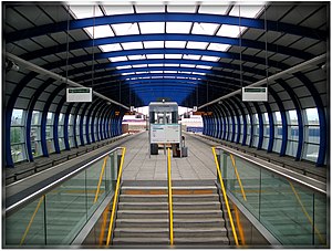
London City Airport DLR station
Docklands Light Railway station
Distance: Approx. 649 meters
Latitude and longitude: 51.503611,0.048889
London City Airport is a light metro station on the Docklands Light Railway (DLR) Stratford-Woolwich and Bank-Woolwich Lines; serving London City Airport in East London. It opened on 2 December 2005. It was first located on what was initially King George V branch, and was, until the extension to Woolwich Arsenal was completed, the reason for this branch.

Thames Barrier Park
Park in Silvertown, London
Distance: Approx. 732 meters
Latitude and longitude: 51.50083333,0.03416667
The Thames Barrier Park is a 7-hectare (17.3-acre) park in Silvertown in the London Borough of Newham and is named after its location on the north side of the River Thames next to the Thames Barrier. It is intended to aid the regeneration of the area by creating an attractive public space alongside residential and commercial developments. It is adjacent to Pontoon Dock DLR station.

Charlton Riverside
Human settlement in England
Distance: Approx. 866 meters
Latitude and longitude: 51.491939,0.037658
Charlton Riverside, previously known as New Charlton, is the area along the south bank of the river Thames at Charlton, London, which forms part of the Royal Borough of Greenwich. It was formerly a primarily industrial zone, known for the glass and rope making industries, but is now an area of regeneration.

MV Royal Iris
Twin screw, diesel-electric ferry
Distance: Approx. 365 meters
Latitude and longitude: 51.49539167,0.043
The MV Royal Iris is a twin screw, diesel-electric, Mersey Ferry. The vessel was built by William Denny & Brothers of Dumbarton (Yard No. 1448) and launched in December 1950, costing £256,000.

Barrier Gardens Pier
Pier on the River Thames in London
Distance: Approx. 379 meters
Latitude and longitude: 51.49555556,0.04166667
Barrier Gardens Pier is a pier on the River Thames near the Thames Barrier. It is owned and managed by the Port of London Authority (PLA) which took over the pier and adjoining Unity House from the Environment Agency and Sargent Brothers in 2009. The PLA use the pier as a base for their Driftwood craft and upper river harbour patrol vessels.

Holborn College
Distance: Approx. 770 meters
Latitude and longitude: 51.4918,0.0421
Kaplan Holborn College was a college of higher education in London, England, specialising in accounting, finance, law and business. It was originally established as Holborn Law College in 1969 to prepare young lawyers from overseas for the University of London International Programme – and then Wolverhampton University External – LLB exams and received the Queen's Award for Export Achievement in 1982 for its role in international education. For a short time it was based at 200 Greyhound Road in Fulham, where it offered part-time courses for England & Wales Solicitors' Finals as well as certificated courses in individual degree-level law subjects.
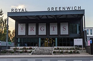
Royal Greenwich Trust School
Free school in Charlton Riverside, London, England
Distance: Approx. 803 meters
Latitude and longitude: 51.4916,0.0413
Royal Greenwich Trust School is a free school which opened in the Charlton Riverside area of the Royal Borough of Greenwich in London, England in September 2016. The campus is located along the A206 near the banks of the River Thames, close to the Thames Barrier. It is adjacent to Windrush Primary School and Maryon Park.

St Mark's Church, Silvertown
Former church in east London, now a music venue
Distance: Approx. 466 meters
Latitude and longitude: 51.502719,0.042894
St Mark's Church, Silvertown or St Mark's Church, Victoria Docks is a former church building in Silvertown in east London, located on North Woolwich Road. It takes one of its names from the nearby Royal Docks. It was listed as Grade II* in 1971 and now houses the Brick Lane Music Hall.

Tate Institute
Distance: Approx. 468 meters
Latitude and longitude: 51.5024,0.047
The Tate Institute was a community facility established by Henry Tate in Silvertown in 1887. The building was established to create an apolitical and non-sectarian environment. The Institute closed in 1933 and the building was used as a local library until 1961.
Weather in this IP's area
broken clouds
16 Celsius
15 Celsius
15 Celsius
16 Celsius
1023 hPa
85 %
1023 hPa
1023 hPa
10000 meters
3.09 m/s
30 degree
75 %
06:43:12
19:03:12