83.104.150.223 - IP Lookup: Free IP Address Lookup, Postal Code Lookup, IP Location Lookup, IP ASN, Public IP
Country:
Region:
City:
Location:
Time Zone:
Postal Code:
IP information under different IP Channel
ip-api
Country
Region
City
ASN
Time Zone
ISP
Blacklist
Proxy
Latitude
Longitude
Postal
Route
Luminati
Country
Region
wls
City
hengoed
ASN
Time Zone
Europe/London
ISP
Vodafone Limited
Latitude
Longitude
Postal
IPinfo
Country
Region
City
ASN
Time Zone
ISP
Blacklist
Proxy
Latitude
Longitude
Postal
Route
IP2Location
83.104.150.223Country
Region
scotland
City
aberdeen
Time Zone
Europe/London
ISP
Language
User-Agent
Latitude
Longitude
Postal
db-ip
Country
Region
City
ASN
Time Zone
ISP
Blacklist
Proxy
Latitude
Longitude
Postal
Route
ipdata
Country
Region
City
ASN
Time Zone
ISP
Blacklist
Proxy
Latitude
Longitude
Postal
Route
Popular places and events near this IP address

Aberdeen railway station
Railway station in Aberdeen City, Scotland, UK
Distance: Approx. 27 meters
Latitude and longitude: 57.1436,-2.0985
Aberdeen railway station is the main railway station in Aberdeen, Scotland. It is the busiest railway station in Scotland north of the major cities of Glasgow and Edinburgh. It is located on Guild Street in the city centre, next to Union Square.

Trinity Centre, Aberdeen
Shopping mall in Aberdeen, Scotland
Distance: Approx. 222 meters
Latitude and longitude: 57.14555556,-2.09944444
The Trinity Centre (known as The Mall Aberdeen from 2006 to December 2009, and before that as Trinity Shopping Centre) is a one floor shopping centre in Aberdeen, Scotland. It has a two level car park. There are 408 spaces and the main entrance is on Wapping Street.
Tivoli Theatre, Aberdeen
Theatre in Aberdeen, Scotland
Distance: Approx. 160 meters
Latitude and longitude: 57.1451,-2.0975
The Tivoli Theatre is a theatre in Aberdeen, Scotland, opened in 1872 as Her Majesty's Theatre and was built by the Aberdeen Theatre and Opera House Company Ltd, under architects James Matthews of Aberdeen and Charles J. Phipps, a London-based architect brought in to consult. The auditorium was rebuilt in 1897 by theatre architect Frank Matcham, but then closed temporarily in 1906, following the opening of the larger His Majesty's Theatre. The smaller theatre was extensively reconstructed in 1909, again by Frank Matcham, and re-opened in July 1910 as the Tivoli.

Union Street, Aberdeen
Street in Aberdeen, Scotland, United Kingdom
Distance: Approx. 319 meters
Latitude and longitude: 57.1457098,-2.1018608
Union Street is a major street and shopping thoroughfare in Aberdeen, Scotland. It is named after the Acts of Union 1800 with Ireland. The street is approximately one mile long (1.6 km) and a feat of engineering skill involving the partial levelling of St.

Union Bridge, Aberdeen
Bridge
Distance: Approx. 321 meters
Latitude and longitude: 57.14583333,-2.10166667
Union Bridge is a bridge on Union Street, Aberdeen, Scotland. It is the largest single-span granite bridge in the world, at 130 feet (40 metres). It was built by Thomas Fletcher under some influence from Thomas Telford.

Aberdeen Guild Street railway station
Disused railway station in Aberdeen, Scotland
Distance: Approx. 165 meters
Latitude and longitude: 57.1449,-2.0965
Aberdeen Guild Street railway station was the former terminus of the Aberdeen Railway. This station opened to passengers on 2 August 1854 as the new terminus of the Aberdeen Railway, replacing the former temporary terminus at Ferryhill. It also served as the terminus of the Deeside Railway, which had an agreement to use the station and the portion of track between it and Ferryhill junction.
Guild Street, Aberdeen
Street in Aberdeen, Scotland, United Kingdom
Distance: Approx. 132 meters
Latitude and longitude: 57.14484,-2.09749
Guild Street is a main street in the city centre of Aberdeen, Scotland, close to the harbour.
Union Square Aberdeen
Shopping mall in Aberdeen, Scotland
Distance: Approx. 187 meters
Latitude and longitude: 57.14361111,-2.095
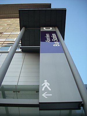
Union Square is a shopping centre located in the centre of Aberdeen, Scotland, which opened to the public on Thursday, 29 October 2009. The centre contains a covered shopping mall and retail park. Located on Guild Street and Market Street, the development adjoins onto the side of Aberdeen railway station and Aberdeen bus station creating a transport hub.

St John's, Aberdeen
Church in Aberdeen, Scotland
Distance: Approx. 188 meters
Latitude and longitude: 57.143324,-2.101135
St John the Evangelist — also known as St John's — off Crown Street is a Scottish Episcopal Church in Aberdeen, Scotland.
Aberdeen Clayhills Carriage Maintenance Depot
Railway maintenance depot in Aberdeen, Scotland
Distance: Approx. 50 meters
Latitude and longitude: 57.143253,-2.09815
Aberdeen Clayhills Carriage Maintenance Depot is a stabling point located in Aberdeen, Scotland. The depot is situated on the Denburn Valley Line and is located near Aberdeen station.

Guild Street drill hall, Aberdeen
Distance: Approx. 169 meters
Latitude and longitude: 57.14517,-2.0974
The Guild Street drill hall is a former military installation in Aberdeen, Scotland.

Aberdeen Market
Former shopping mall in Aberdeen, Scotland
Distance: Approx. 293 meters
Latitude and longitude: 57.14632778,-2.09784167
Aberdeen Market was a shopping centre which faced on to Market Street in Aberdeen, Scotland.
Weather in this IP's area
overcast clouds
5 Celsius
1 Celsius
4 Celsius
5 Celsius
1013 hPa
97 %
1013 hPa
1011 hPa
10000 meters
4.63 m/s
160 degree
100 %


