Country:
 Venezuela
Region:
City:
Latitude and Longitude:
Time Zone:
Postal Code:
IP information under different IP Channel
ip-api
Country
Region
City
ASN
Time Zone
ISP
Blacklist
Proxy
Latitude
Longitude
Postal
Route
IPinfo
Country
Region
City
ASN
Time Zone
ISP
Blacklist
Proxy
Latitude
Longitude
Postal
Route
MaxMind
Country
Region
City
ASN
Time Zone
ISP
Blacklist
Proxy
Latitude
Longitude
Postal
Route
Luminati
Country
VERegion
p
City
acarigua
ASN
Time Zone
America/Caracas
ISP
THUNDERNET, C.A.
Latitude
Longitude
Postal
db-ip
Country
Region
City
ASN
Time Zone
ISP
Blacklist
Proxy
Latitude
Longitude
Postal
Route
ipdata
Country
Region
City
ASN
Time Zone
ISP
Blacklist
Proxy
Latitude
Longitude
Postal
Route
Popular places and events near this IP address

Acarigua
City in Portuguesa State, Venezuela
Distance: Approx. 345 meters
Latitude and longitude: 9.55972222,-69.20194444
Acarigua (Spanish pronunciation: [akaˈɾiɣwa]), founded as San Miguel de Acarigua in 1620, is a city in northwestern Venezuela, in the northern part of the state of Portuguesa and its former capital. It encompasses the Páez municipality. It is a major commercial center for the northern Llanos region of South America.
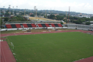
Estadio General José Antonio Paez
Venezuelan sports stadium
Distance: Approx. 1871 meters
Latitude and longitude: 9.57083333,-69.21027778
The Estadio General José Antonio Páez is a sports infrastructure stadium in Acarígua, Venezuela. It is currently used mostly for football matches and is the home stadium of Portuguesa Fútbol Club the building was built in that place by the booming development of this locality llanera; owes its name to the recognized hero of Venezuelan independence and the first president of Venezuela, Jose Antonio Páez. It is the headquarters of the Portuguese Football Club, currently located in the First Division of Venezuela.

Araure
Place in Portuguesa, Venezuela
Distance: Approx. 2050 meters
Latitude and longitude: 9.56666667,-69.21666667
Araure (Spanish pronunciation: [aˈɾawɾe]) is a town in the Venezuelan state of Portuguesa. This town is the seat of the Araure Municipality and, according to the 2001 Venezuelan census, the municipality has a population of 111,908.
Estadio BR Julio Hernández Molina
Distance: Approx. 1950 meters
Latitude and longitude: 9.5697745,-69.2128372
The Estadio BR Julio Hernández Molina is a multi-use stadium located in Araure, Portuguesa, Venezuela. This stadium was inaugurated on October 25, 1967, and holds 11,000 people. It is currently used mostly for baseball games, and previously served as the home stadium of the Llaneros de Acarigua, Llaneros de Portuguesa and Pastora de los Llanos former teams that played in the Venezuelan Professional Baseball League.

Battle of Araure
Distance: Approx. 2050 meters
Latitude and longitude: 9.56666667,-69.21666667
The Battle of Araure was fought during the short-lived Second Republic of Venezuela on 5 December 1813, in the city of Araure in Portuguesa State, Venezuela. Simon Bolivar's force defeated General José Ceballos.
Roman Catholic Diocese of Acarigua–Araure
Roman Catholic diocese in Venezuela
Distance: Approx. 1382 meters
Latitude and longitude: 9.5691,-69.2026
The Roman Catholic Diocese of Acarigua–Araure (Latin: Acariguaruen(sis)) is a Latin suffragan diocese in the ecclesiastical province of the Metropolitan of Barquisimeto in Venezuela. Its cathedral episcopal see is Catedral de Nuestra Señora de la Corteza, in the city of Acarigua.
Oswaldo Guevara Mujica Airport
Airport
Distance: Approx. 4036 meters
Latitude and longitude: 9.55333333,-69.2375
Oswaldo Guevara Mujica Airport (Spanish: Aeropuerto General de Brigada Oswaldo Guevara Mujica) (IATA: AGV, ICAO: SVAC), is an airport serving Acarigua, a city in the Portuguesa state of Venezuela. The Acarigua VOR-DME (Ident: AGV) and non-directional beacon (Ident: AGV) are located on the field.

Acarigua prison riot
2019 prison riot in Acarigua, Venezuela
Distance: Approx. 1077 meters
Latitude and longitude: 9.56605556,-69.20375
A group of inmates were involved in a prison riot on 24 May 2019 in the police station cellblocks in Acarigua, Portuguesa state, Venezuela. The riot allegedly began when inmate Wilfredo Ramos was killed following ten days of protests against the denial of visits by relatives.
Weather in this IP's area
overcast clouds
23 Celsius
24 Celsius
23 Celsius
23 Celsius
1009 hPa
93 %
1009 hPa
988 hPa
10000 meters
0.88 m/s
0.94 m/s
346 degree
98 %
06:26:04
18:33:25