Country:
Region:
City:
Latitude and Longitude:
Time Zone:
Postal Code:
IP information under different IP Channel
ip-api
Country
Region
City
ASN
Time Zone
ISP
Blacklist
Proxy
Latitude
Longitude
Postal
Route
Luminati
Country
ASN
Time Zone
Asia/Dubai
ISP
Horizonsat FZ LLC
Latitude
Longitude
Postal
IPinfo
Country
Region
City
ASN
Time Zone
ISP
Blacklist
Proxy
Latitude
Longitude
Postal
Route
db-ip
Country
Region
City
ASN
Time Zone
ISP
Blacklist
Proxy
Latitude
Longitude
Postal
Route
ipdata
Country
Region
City
ASN
Time Zone
ISP
Blacklist
Proxy
Latitude
Longitude
Postal
Route
Popular places and events near this IP address

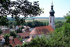
Moosburg an der Isar
Town in Bavaria, Germany
Distance: Approx. 2232 meters
Latitude and longitude: 48.46666667,11.93333333
Moosburg an der Isar (Central Bavarian: Mooschbuag on da Isa) is a town in the Landkreis Freising of Bavaria, Germany. The oldest town between Regensburg and Italy, it lies on the river Isar at an altitude of 421 m (1381 ft). It has 20,237 inhabitants (2022) and covers an area of 44 km2.

Amper
River in Germany
Distance: Approx. 3539 meters
Latitude and longitude: 48.50027778,11.95666667
The Amper, called the Ammer upstream of the Ammersee, through which it runs, is the largest tributary of the Isar in southern Bavaria, Germany. It flows generally north-eastward, reaching the Isar in Moosburg, about 185 kilometres (115 mi) from its source in the Ammergau Alps, with a flow of 45 m³/s. Including its tributary, Linder, it is 209.5 km (130.2 mi) long.
Langenpreising
Municipality in Bavaria, Germany
Distance: Approx. 3955 meters
Latitude and longitude: 48.43333333,11.96666667
Langenpreising is a municipality in the district of Erding in Bavaria in Germany.

Wartenberg, Bavaria
Municipality in Bavaria, Germany
Distance: Approx. 7347 meters
Latitude and longitude: 48.405,11.98888889
Wartenberg is a municipality in the district of Erding in Bavaria in Germany.

Mauern
Municipality in Bavaria, Germany
Distance: Approx. 7090 meters
Latitude and longitude: 48.51666667,11.9
Mauern is a municipality in the district of Freising in Bavaria in Germany.

Wang, Bavaria
Municipality in Bavaria, Germany
Distance: Approx. 3611 meters
Latitude and longitude: 48.5,11.95
Wang is a municipality in the district of Freising in Bavaria in Germany.

Bruckberg, Lower Bavaria
Municipality in Bavaria, Germany
Distance: Approx. 7674 meters
Latitude and longitude: 48.53333333,12
Bruckberg is a municipality in the district of Landshut in Bavaria in Germany. Until 30 April 1978 it belonged to the upper bavarian district of Freising.
Buch am Erlbach
Municipality in Bavaria, Germany
Distance: Approx. 6727 meters
Latitude and longitude: 48.45,12.05
Buch is a municipality in the district of Landshut in Bavaria in Germany. The name "Buch am Erlbach" means "beech at alder brook".

Dorfen (river)
River in Bavaria
Distance: Approx. 5331 meters
Latitude and longitude: 48.432,11.9172
Dorfen is a river of Bavaria, Germany. It flows into the Isar near Moosburg.

Sempt
River in Germany
Distance: Approx. 4121 meters
Latitude and longitude: 48.4945,12.0036
Sempt is a river of Bavaria, Germany. It flows into the Mittlere-Isar-Kanal, which is connected with the Isar, west of Eching.
Mauerner Bach
River in Germany
Distance: Approx. 3123 meters
Latitude and longitude: 48.492,11.9396
Mauerner Bach is a river of Bavaria, Germany. It is a left tributary of the Amper in Wang.

Strogen (river)
River in Germany
Distance: Approx. 1132 meters
Latitude and longitude: 48.4667,11.9784
Strogen is a river of Bavaria, Germany. It is a right tributary of the Sempt, is approximately 40 km in length, and drains a basin of approximately 146 km2 (56 sq mi). Its source is northwest of Buch am Buchrain in the district Erding.
Weather in this IP's area
broken clouds
9 Celsius
9 Celsius
6 Celsius
10 Celsius
1030 hPa
72 %
1030 hPa
980 hPa
10000 meters
0.2 m/s
0.35 m/s
191 degree
55 %
07:06:21
16:45:13

