Country:
Region:
City:
Latitude and Longitude:
Time Zone:
Postal Code:
IP information under different IP Channel
ip-api
Country
Region
City
ASN
Time Zone
ISP
Blacklist
Proxy
Latitude
Longitude
Postal
Route
Luminati
Country
ASN
Time Zone
Asia/Dubai
ISP
Horizonsat FZ LLC
Latitude
Longitude
Postal
IPinfo
Country
Region
City
ASN
Time Zone
ISP
Blacklist
Proxy
Latitude
Longitude
Postal
Route
db-ip
Country
Region
City
ASN
Time Zone
ISP
Blacklist
Proxy
Latitude
Longitude
Postal
Route
ipdata
Country
Region
City
ASN
Time Zone
ISP
Blacklist
Proxy
Latitude
Longitude
Postal
Route
Popular places and events near this IP address

Tripoli, Libya
Capital and largest city of Libya
Distance: Approx. 395 meters
Latitude and longitude: 32.88722222,13.19138889
Tripoli (; Arabic: طرابلس الغرب, romanized: Ṭarābulus al-Gharb, lit. 'Western Tripoli') is the capital and largest city of Libya, with a population of about 1.317 million people in 2021. It is located in the northwest of Libya on the edge of the desert, on a point of rocky land projecting into the Mediterranean Sea and forming a bay. It includes the port of Tripoli and the country's largest commercial and manufacturing center.

Red Castle Museum
National museum in Tripoli, Libya
Distance: Approx. 1113 meters
Latitude and longitude: 32.89583333,13.18027778
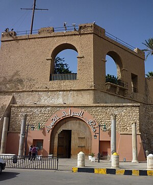
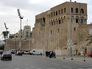
The Red Castle Museum, also known as As-saraya Al-hamra Museum (Arabic: متحف السرايا الحمراء, romanized: Matḥaf al-Sarāyā al-Ḥamrāʼ), the Archaeological Museum of Tripoli or Jamahiriya Museum, is a national museum in Libya. It is located in the historic building known as the Red Castle of Tripoli (Arabic: السراي الحمراء, romanized: al-Sarāy al-Ḥamrāʼ), sometimes also referred to as Red Saraya, on the promontory above and adjacent to the old-town district with medina Ghadema. Designed in conjunction with UNESCO, the museum covers 5,000 years from prehistory to the independence revolution (1953) era.

Tripoli Cathedral
Mosque and former Roman Catholic church in Libya
Distance: Approx. 343 meters
Latitude and longitude: 32.89055556,13.18583333
Algeria Square Mosque or Jamal Abdul Nasser Mosque (Arabic: جامع جمال عبد الناصر), formerly Tripoli Cathedral (Italian: La Cattedrale di Tripoli; Arabic: كاتدرائية طرابلس), is a mosque and former Roman Catholic church located in Tripoli, the capital of Libya. It is situated on the Algeria/Elgazayer Square (Maidan al Jazair/Maydan elgazayer) then Piazza della Cattedrale in the city centre. It was constructed as a cathedral in the 1920s during the Italian Libya colonial era, and converted into a mosque in 1970, with the St.

Martyrs' Square, Tripoli
Square in Tripoli, Libya
Distance: Approx. 992 meters
Latitude and longitude: 32.895,13.18111111
The Martyrs' Square (Arabic: ميدان الشهداء Maydān ash-Shuhadā'); known as Green Square (الساحة الخضراء as-Sāḥah al-Khaḍrā') under the Gaddafi government; Independence Square (ميدان الاستقلال Maydān al-Istiqlāl) during the monarchy; and originally (during Italian colonial rule) known as Piazza Italia ("Italy Square") is a downtown landmark at the bay in the city of Tripoli, Libya. The main commercial center of the city surrounds the square. The Square is also a main tourist attraction in Tripoli.

Museum of Libya
Museum in Tripoli, Libya
Distance: Approx. 207 meters
Latitude and longitude: 32.88778611,13.18940833
The Museum of Libya is a museum located in Tripoli, Libya. It was originally built as the Royal Palace, completed in 1939. It was later used by King Idris during his reign.

Royal Palace of Tripoli
Distance: Approx. 184 meters
Latitude and longitude: 32.88777778,13.18916667
The Royal Palace (Arabic: قصر الخلد) was the residence of the Libyan monarch in the capital city, Tripoli. Another residence was the Al-Manar Palace in Benghazi, which was donated by King Idris of Libya as the first campus of the University of Libya. Another residence at Bab Zaytun was further to the east in Tobruk.
List of ambassadors of China to Libya
Distance: Approx. 352 meters
Latitude and longitude: 32.88485,13.185565
The Chinese Ambassador to Libya is the official representative of the People's Republic of China to the State of Libya.

Battle of Tripoli (1911)
A battle that occurred during the Italo-Turkish War of 1911–1912
Distance: Approx. 391 meters
Latitude and longitude: 32.88722778,13.19134444
The Battle of Tripoli was fought in October 1911, during the initial stages of the Italo-Turkish War, and saw the capture of Tripoli, capital city of Tripolitania (and present-day Libya), by Italian landing forces. It marked the beginning of the land campaign in Libya of the Italo-Turkish War as well as the beginning of the Italian colonization of Libya.

40th anniversary of the Libyan Revolution
2009 national event in Libya
Distance: Approx. 395 meters
Latitude and longitude: 32.88722222,13.19138889
The 40th anniversary of the Libyan Revolution (Arabic: الذكرى الأربعون للثورة الليبية) was a ruby jubilee anniversary in the Great Socialist People's Libyan Arab Jamahiriya celebrated on 1 September 2009 in honor of the 1969 Libyan coup d'état.

Red Castle of Tripoli
Landmark in Libya
Distance: Approx. 1131 meters
Latitude and longitude: 32.8961,13.1804
The Red Castle, in Arabic As-saraya Al-hamra (السرايا الحمراء), sometimes also Red Fort or Red Saraya, is a major landmark on the waterfront of Tripoli, bordering Martyrs' Square. It has been the home of the Red Castle Museum (under various names) since 1919, and of the Libyan Department of Archaeology since 1952.
Al-Naqah Mosque
Mosque in Tripoli, Libya
Distance: Approx. 1156 meters
Latitude and longitude: 32.89536,13.17885
The al-Naqah Mosque or Naga Mosque (Arabic: الجامع الناقة, lit. 'mosque of the [female] camel') is a historic mosque in Tripoli, Libya.

Galleria De Bono
Building in Tripoli, Libya
Distance: Approx. 821 meters
Latitude and longitude: 32.89361111,13.18194444
The Galleria De Bono is a historic building located in Tripoli, Libya.
Weather in this IP's area
clear sky
23 Celsius
23 Celsius
23 Celsius
23 Celsius
1024 hPa
54 %
1024 hPa
1022 hPa
10000 meters
3.96 m/s
4.39 m/s
99 degree
07:29:44
18:12:04
