82.199.215.172 - IP Lookup: Free IP Address Lookup, Postal Code Lookup, IP Location Lookup, IP ASN, Public IP
Country:
Region:
City:
Location:
Time Zone:
Postal Code:
ISP:
ASN:
language:
User-Agent:
Proxy IP:
Blacklist:
IP information under different IP Channel
ip-api
Country
Region
City
ASN
Time Zone
ISP
Blacklist
Proxy
Latitude
Longitude
Postal
Route
db-ip
Country
Region
City
ASN
Time Zone
ISP
Blacklist
Proxy
Latitude
Longitude
Postal
Route
IPinfo
Country
Region
City
ASN
Time Zone
ISP
Blacklist
Proxy
Latitude
Longitude
Postal
Route
IP2Location
82.199.215.172Country
Region
kirkuk
City
kirkuk
Time Zone
Asia/Baghdad
ISP
Language
User-Agent
Latitude
Longitude
Postal
ipdata
Country
Region
City
ASN
Time Zone
ISP
Blacklist
Proxy
Latitude
Longitude
Postal
Route
Popular places and events near this IP address

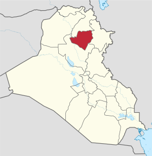
Kirkuk
City in Kirkuk Governorate, Iraq
Distance: Approx. 6850 meters
Latitude and longitude: 35.46666667,44.31666667
Kirkuk (Arabic: كركوك; Kurdish: کەرکووک, romanized: Kerkûk; Syriac: ܟܪܟܘܟ, romanized: Kerkouk; Turkish: Kerkük) is a city in Iraq, serving as the capital of the Kirkuk Governorate, located 238 kilometres (148 miles) north of Baghdad. The city is home to a diverse population of Kurds, Iraqi Turkmens and Arabs. Kirkuk sits on the ruins of the original Kirkuk Citadel which sits near the Khasa River.
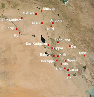
Arrapha
Distance: Approx. 2170 meters
Latitude and longitude: 35.45,44.3833
Arrapha or Arrapkha (Akkadian: Arrapḫa; Arabic: أررابخا ,عرفة) was an ancient city in what today is northeastern Iraq, thought to be located at city of Kirkuk. In 1948, Arrapha became the name of the residential area in Kirkuk which was built by the North Oil Company as a settlement for its workers.

Kirkuk Citadel
Castle in Kirkuk, Iraq
Distance: Approx. 376 meters
Latitude and longitude: 35.46972222,44.39583333
The Kirkuk Citadel (Arabic: قلعة كركوك; Kurdish: قەڵای کەرکووک; Turkish: Kerkük Kalesi) is in the centre of Kirkuk, Iraq, and is considered to be the oldest part of the city. The citadel stands on an tell 40 meters high located on a plateau across the Khasa River.

Qishla of Kirkuk
Ottoman army barracks in Kirkuk, Iraq
Distance: Approx. 482 meters
Latitude and longitude: 35.47125,44.38856
The Qishla of Kirkuk is a historical building in Kirkuk, Iraq. According to the Ottoman Calendars (Arabic: السالنامات العثمانية), the Qishla was built in 1863 to be the headquarters of the Ottoman army in Kirkuk. The building is located in the city centre, occupying about 6 acres (24,000 m2).
Kirkuk Olympic Stadium
Iraqi football stadium
Distance: Approx. 3830 meters
Latitude and longitude: 35.443164,44.421308
Kirkuk Olympic Stadium (Arabic: ملعب كركوك الأولمبي) is a multi-use stadium in Kirkuk, Iraq. It is currently used mostly for football matches and it also has an athletics track. The stadium holds 25,000.

Kirkuk International Airport
International airport in Kirkuk, Iraq
Distance: Approx. 3930 meters
Latitude and longitude: 35.46944444,44.34888889
Kirkuk International Airport (IATA: KIK, ICAO: ORKK) is an airport located in Kirkuk, Iraq. The airport officially opened in 16 October 2022 for civil visitors. Since 2003, the airport was used by the U.S. Air Force as a military airport.
Battle of Kirkuk (1991)
Part of the Iraqi uprisings following the Gulf War
Distance: Approx. 6850 meters
Latitude and longitude: 35.46666667,44.31666667
The Battle of Kirkuk (Sorani Kurdish: جەنگی کەرکوک) was one of the biggest battles of the 1991 uprisings in Iraq.

Battle of Kirkuk (2016)
Battle between Iraqi Kurdish forces and ISIL in Iraq
Distance: Approx. 389 meters
Latitude and longitude: 35.47,44.3958
The Battle of Kirkuk took place in the city of Kirkuk in northern Iraq between Kurdistan and allies and the Islamic State of Iraq and the Levant. The battle occurred less than a week after the beginning of the Battle of Mosul launched by Iraqi security forces and allies.

1924 Kirkuk massacre
1924 massacre in Iraq
Distance: Approx. 738 meters
Latitude and longitude: 35.47,44.4
The Kirkuk Massacre of 1924 was a massacre perpetrated against the people of Kirkuk by the Assyrian Levies on May 4, 1924 following a series of attacks on the Assyrian Levies in Kirkuk and previous years after their settlement in Iraq. One notable attack which led to hostility between the Assyrians and Muslims was in August 1923 in Mosul in which two Assyrian children were killed by Muslims and no one was brought to justice. In early 1924 the British deployed the Assyrian levies to Kirkuk province in order to capture the city of Sulaymaniyah, which was controlled by Kurd Sheikh Mahmud.

Mosque of the Prophet Daniel, Kirkuk
Mosque in Kirkuk, Iraq
Distance: Approx. 311 meters
Latitude and longitude: 35.4687559,44.3955293
The Mosque of Prophet Daniel (Arabic: جامع النبي دانيال) (Turkish: Peygamber Daniel Camii) is a historic mosque of Kirkuk, Iraq. It is one of the mosques which are part of the Kirkuk Citadel territory. The mosque contains a shrine, in which local tradition affirms that Daniel and Shadrach, Meshach, and Abednego are buried in.
1959 Kirkuk massacre
1959 massacre in Iraq
Distance: Approx. 738 meters
Latitude and longitude: 35.47,44.4
The 1959 Kirkuk massacre was a massacre of Iraqi Turkmen in Kirkuk, Iraq, which lasted from 14 July to 16 July 1959. The perpetrators were Kurds from the Iraqi Communist Party, the massacre also changed the previously positive Turkmen-Kurdish relationship in Iraq and created a long-lasting ethnic-based stigma. The event is deeply rooted in the collective memory of the Iraqi Turkmen.

Imam Sultan Saqi Shrine
Shrine and cemetery in Kirkuk, Iraq
Distance: Approx. 4191 meters
Latitude and longitude: 35.4516518,44.3506184
The Imam Sultan Saqi Shrine (Arabic: مرقد الامام سلطان ساقي) is a historic shrine for the Twelver Shi'ite community of Turkmen, located in the Tisin neighbourhood of Kirkuk in Iraq. It contains a tomb dedicated to Imam Sultan Saqi, a descendant of Ja'far ibn Abi Talib. A local cemetery also exists around the mausoleum.
Weather in this IP's area
few clouds
11 Celsius
10 Celsius
11 Celsius
11 Celsius
1022 hPa
56 %
1022 hPa
979 hPa
10000 meters
2.38 m/s
2.37 m/s
358 degree
11 %
