82.192.5.60 - IP Lookup: Free IP Address Lookup, Postal Code Lookup, IP Location Lookup, IP ASN, Public IP
Country:
Region:
City:
Location:
Time Zone:
Postal Code:
ISP:
ASN:
language:
User-Agent:
Proxy IP:
Blacklist:
IP information under different IP Channel
ip-api
Country
Region
City
ASN
Time Zone
ISP
Blacklist
Proxy
Latitude
Longitude
Postal
Route
db-ip
Country
Region
City
ASN
Time Zone
ISP
Blacklist
Proxy
Latitude
Longitude
Postal
Route
IPinfo
Country
Region
City
ASN
Time Zone
ISP
Blacklist
Proxy
Latitude
Longitude
Postal
Route
IP2Location
82.192.5.60Country
Region
tirol
City
fieberbrunn
Time Zone
Europe/Vienna
ISP
Language
User-Agent
Latitude
Longitude
Postal
ipdata
Country
Region
City
ASN
Time Zone
ISP
Blacklist
Proxy
Latitude
Longitude
Postal
Route
Popular places and events near this IP address
Fieberbrunn
Municipality in Tyrol, Austria
Distance: Approx. 1883 meters
Latitude and longitude: 47.46638889,12.55
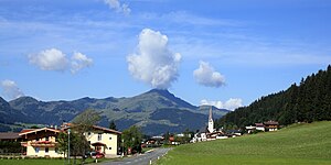
Fieberbrunn is a market town in the Austrian state of Tyrol in the Kitzbühel district. It is located at 47°28′N 12°33′E, in the Kitzbühel Alps. Fieberbrunn is the most populous municipality in the Pillerseetal valley.

Sankt Jakob in Haus
Municipality in Tyrol, Austria
Distance: Approx. 2084 meters
Latitude and longitude: 47.50083333,12.55972222
Sankt Jakob in Haus is a municipality in the Kitzbühel district in the Austrian state of Tyrol located 13.60 km (8.45 mi) northeast of Kitzbühel as well as 2.50 km (1.55 mi) above Fieberbrunn. It is the smallest community in the district. The village was mentioned in documents for the first time in 1308 but settlement already began in the 10th century.

Sankt Ulrich am Pillersee
Municipality in Tyrol, Austria
Distance: Approx. 3920 meters
Latitude and longitude: 47.51666667,12.56666667
Sankt Ulrich am Pillersee is a municipality in the Kitzbühel district, in midwestern Austria, and is located 16.4 kilometres (10.2 mi) northeast of Kitzbühel as well as 11 kilometres (6.8 mi) west of Sankt Johann in Tirol.
2009–10 Biathlon World Cup – World Cup 2
Distance: Approx. 5347 meters
Latitude and longitude: 47.46666667,12.61666667
The 2009–10 Biathlon World Cup - World Cup 2 is the second event of the season and was held in Hochfilzen, Austria from Friday December 11 until Sunday December 13, 2009.

2010–11 Biathlon World Cup – World Cup 2
Distance: Approx. 5347 meters
Latitude and longitude: 47.46666667,12.61666667
The 2010–11 Biathlon World Cup - World Cup 2 was held in Hochfilzen, Austria, from 10 December until 12 December 2010.
Lauchsee
Distance: Approx. 1809 meters
Latitude and longitude: 47.470944,12.534392
The Lauchsee is a large moor lake, 2.3 hectares in area, in the Tyrolean district of Kitzbühel. It lies on the territory of the municipality of Fieberbrunn above the Pletzerbach at an elevation of 859 m above sea level (AA). The lake has two small islands and its maximum depth is 4.3 metres.

Wiesensee (Tirol)
Lake in Austria
Distance: Approx. 4643 meters
Latitude and longitude: 47.4966,12.6085
Wiesensee (German pronunciation: [ˈviːzənzeː]) is a small lake in the northwest corner of the Hochfilzen municipality of Tyrol, Austria.

Pillersee Valley
Distance: Approx. 1482 meters
Latitude and longitude: 47.48638889,12.53083333
The Pillersee Valley (German: Pillerseetal) is a valley in the district of Kitzbühel in the Austrian state of Tyrol, on the border with Salzburg state.
Unterberg (Tyrol)
Distance: Approx. 5063 meters
Latitude and longitude: 47.51056,12.60389
The Unterberg is a 1,187 m high, wooded, conical mountain peak above the Pillersee valley, near St. Ulrich am Pillersee and St. Jakob im Haus, Kitzbühel District, in Austria.
2011–12 Biathlon World Cup – World Cup 2
Distance: Approx. 5347 meters
Latitude and longitude: 47.46666667,12.61666667
The 2011–12 Biathlon World Cup – World Cup 2 is held in Hochfilzen, Austria, from 9 December until 11 December 2011.
2011–12 Biathlon World Cup – World Cup 3
Distance: Approx. 5347 meters
Latitude and longitude: 47.46666667,12.61666667
The 2011–12 Biathlon World Cup – World Cup 3 was held in Hochfilzen, Austria, from 15 December until 18 December 2011. This was the second World Cup event in Hochfilzen in 2011–12 season, due to the lack of snow in Annecy.

Schloss Rosenegg
Hotel in Fieberbrunn, Austria
Distance: Approx. 1436 meters
Latitude and longitude: 47.4876,12.532
Schloss Rosenegg is a schloss (castle) in Rosenegg, Fieberbrunn, Austria. It was built by Baron Rosenberg in 1187 and takes its name from the Rosenberg family, which governed the surrounding area from 1534 to 1872. Since 1938, it has been operated as a hotel, now rated at four stars.
Weather in this IP's area
light rain
2 Celsius
1 Celsius
2 Celsius
3 Celsius
1015 hPa
85 %
1015 hPa
876 hPa
10000 meters
1.51 m/s
1.93 m/s
172 degree
74 %
