82.152.177.31 - IP Lookup: Free IP Address Lookup, Postal Code Lookup, IP Location Lookup, IP ASN, Public IP
Country:
Region:
City:
Location:
Time Zone:
Postal Code:
ISP:
ASN:
language:
User-Agent:
Proxy IP:
Blacklist:
IP information under different IP Channel
ip-api
Country
Region
City
ASN
Time Zone
ISP
Blacklist
Proxy
Latitude
Longitude
Postal
Route
db-ip
Country
Region
City
ASN
Time Zone
ISP
Blacklist
Proxy
Latitude
Longitude
Postal
Route
IPinfo
Country
Region
City
ASN
Time Zone
ISP
Blacklist
Proxy
Latitude
Longitude
Postal
Route
IP2Location
82.152.177.31Country
Region
thuringen
City
eisenberg
Time Zone
Europe/Berlin
ISP
Language
User-Agent
Latitude
Longitude
Postal
ipdata
Country
Region
City
ASN
Time Zone
ISP
Blacklist
Proxy
Latitude
Longitude
Postal
Route
Popular places and events near this IP address
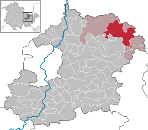
Eisenberg, Thuringia
Town in Thuringia, Germany
Distance: Approx. 78 meters
Latitude and longitude: 50.96805556,11.90138889
Eisenberg is a town in Thuringia, Germany. It is the capital of the district Saale-Holzland. Neighboring municipalities are Jena (25 kilometres (16 miles) in west) and Gera (15 kilometres (9 miles) in south east).

Heideland
Municipality in Thuringia, Germany
Distance: Approx. 3014 meters
Latitude and longitude: 50.95,11.93333333
Heideland is a municipality in the Saale-Holzland district, in Thuringia, Germany.

Hartmannsdorf, Saale-Holzland
Municipality in Thuringia, Germany
Distance: Approx. 5699 meters
Latitude and longitude: 50.96666667,11.98333333
Hartmannsdorf is a municipality in the district Saale-Holzland, in Thuringia, Germany.

Petersberg, Thuringia
Municipality in Thuringia, Germany
Distance: Approx. 5089 meters
Latitude and longitude: 50.98472222,11.83416667
Petersberg is a municipality in the district Saale-Holzland, in Thuringia, Germany.

Weißenborn, Thuringia
Municipality in Thuringia, Germany
Distance: Approx. 5439 meters
Latitude and longitude: 50.92166667,11.88055556
Weißenborn is a municipality in the district Saale-Holzland, in Thuringia, Germany. It is located near the A4 and A9 Motorways.

Crossen an der Elster
Municipality in Thuringia, Germany
Distance: Approx. 5375 meters
Latitude and longitude: 50.97638889,11.97777778
Crossen an der Elster is a village and municipality in the district Saale-Holzland, in Thuringia, Germany. The White_Elster is the name of the small river which flows through the municipality, so 'Crossen on the Elster' would be the English equivalent. It is home to the Crossen Palace, a Baroque building with an Italian-style decorated ballroom.

Gösen
Municipality in Thuringia, Germany
Distance: Approx. 3199 meters
Latitude and longitude: 50.99222222,11.87611111
Gösen is a municipality in the district Saale-Holzland-Kreis, in Thuringia, Germany.

Hainspitz
Municipality in Thuringia, Germany
Distance: Approx. 4474 meters
Latitude and longitude: 50.96194444,11.83916667
Hainspitz is a municipality in the district Saale-Holzland, in Thuringia, Germany.

Rauda
Municipality in Thuringia, Germany
Distance: Approx. 3014 meters
Latitude and longitude: 50.95,11.93333333
Rauda is a municipality in the district Saale-Holzland, in Thuringia, Germany.

Tautenhain, Thuringia
Municipality in Thuringia, Germany
Distance: Approx. 5101 meters
Latitude and longitude: 50.92388889,11.91805556
Tautenhain is a municipality in the district Saale-Holzland, in Thuringia, Germany.
Heideland-Elstertal-Schkölen
Distance: Approx. 5384 meters
Latitude and longitude: 50.976,11.978
Heideland-Elstertal-Schkölen (until January 2012: Heideland-Elstertal) is a Verwaltungsgemeinschaft ("collective municipality") in the district Saale-Holzland, in Thuringia, Germany. The seat of the Verwaltungsgemeinschaft is in Crossen an der Elster.
Crossen Palace
Distance: Approx. 5236 meters
Latitude and longitude: 50.97805556,11.97527778
Crossen Palace is a Baroque palace in the municipality of Crossen an der Elster in the east of the German federal state of Thuringia, located between Gera in the south and Zeitz in the north. It is situated on the hillside of White Elster valley. The palace houses a ballroom with Italian Trompe-l'œil decorations in Baroque style.
Weather in this IP's area
overcast clouds
6 Celsius
3 Celsius
6 Celsius
6 Celsius
998 hPa
73 %
998 hPa
965 hPa
10000 meters
3.84 m/s
10.14 m/s
197 degree
100 %

