82.150.139.247 - IP Lookup: Free IP Address Lookup, Postal Code Lookup, IP Location Lookup, IP ASN, Public IP
Country:
Region:
City:
Location:
Time Zone:
Postal Code:
ISP:
ASN:
language:
User-Agent:
Proxy IP:
Blacklist:
IP information under different IP Channel
ip-api
Country
Region
City
ASN
Time Zone
ISP
Blacklist
Proxy
Latitude
Longitude
Postal
Route
db-ip
Country
Region
City
ASN
Time Zone
ISP
Blacklist
Proxy
Latitude
Longitude
Postal
Route
IPinfo
Country
Region
City
ASN
Time Zone
ISP
Blacklist
Proxy
Latitude
Longitude
Postal
Route
IP2Location
82.150.139.247Country
Region
groningen
City
hoogezand
Time Zone
Europe/Amsterdam
ISP
Language
User-Agent
Latitude
Longitude
Postal
ipdata
Country
Region
City
ASN
Time Zone
ISP
Blacklist
Proxy
Latitude
Longitude
Postal
Route
Popular places and events near this IP address

Hoogezand-Sappemeer
Former municipality in Groningen, Netherlands
Distance: Approx. 1498 meters
Latitude and longitude: 53.15,6.75
Hoogezand-Sappemeer (Dutch pronunciation: [ɦoːɣəˌzɑnt sɑpəˈmeːr] ) is a former municipality in the Northeastern Netherlands. It was the third most-populous municipality in the province of Groningen, after Groningen and Oldambt. It was formed in 1949 by the merger of the former municipalities of Hoogezand (well-known for its ship building industry) and Sappemeer.

Sappemeer
Town in Groningen, Netherlands
Distance: Approx. 1055 meters
Latitude and longitude: 53.16333333,6.77666667
Sappemeer (Dutch pronunciation: [ˌsɑpəˈmeːr]) is a town in the Dutch province of Groningen. It is located in the municipality of Midden-Groningen to the east of Hoogezand. Sappemeer was a separate municipality until 1949, when it merged with Hoogezand.

Hoogezand
Town in Groningen, Netherlands
Distance: Approx. 719 meters
Latitude and longitude: 53.15722222,6.75333333
Hoogezand (Dutch pronunciation: [ˌɦoːɣəˈzɑnt]) is a town in the municipality of Midden-Groningen, in the province of Groningen in northeast Netherlands.
Kropswolde
Village in Groningen, Netherlands
Distance: Approx. 3093 meters
Latitude and longitude: 53.14583333,6.72305556
Kropswolde (Dutch pronunciation: [krɔpsˈʋɔldə]) is a village in the Dutch province of Groningen. It is located in the municipality of Midden-Groningen, about 3 km southwest of the town of Hoogezand and 5 km northeast of the town of Zuidlaren.

Martenshoek
Neighbourhood and former village in Midden-Groningen, Groningen, Netherlands
Distance: Approx. 1934 meters
Latitude and longitude: 53.16666667,6.73333333
Martenshoek (Dutch pronunciation: [ˌmɑrtənsˈɦuk]) is a neighbourhood of Hoogezand and former village in the Dutch province of Groningen. It is located in the municipality of Midden-Groningen, about 2 km west of the town of Hoogezand.

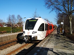
Hoogezand-Sappemeer railway station
Railway station in Hoogezand-Sappemeer, Netherlands
Distance: Approx. 749 meters
Latitude and longitude: 53.15944444,6.77166667
Hoogezand-Sappemeer (Dutch pronunciation: [ɦoːɣəˌzɑnt sɑpəˈmeːr] ; abbreviation: Hgz) is an unstaffed railway station in Hoogezand in the Netherlands. It is located on the Harlingen–Nieuweschans railway between Martenshoek and Sappemeer Oost in the province of Groningen. Train services started in 1868 and the current station building was completed in 1989.
Kropswolde railway station
Railway station in the Dutch village of Kropswolde
Distance: Approx. 2650 meters
Latitude and longitude: 53.16166667,6.72138889
Kropswolde (Dutch pronunciation: [krɔpsˈʋɔldə]; abbreviation: Kw) is an unstaffed railway station in Foxhol near Kropswolde in the Netherlands. The station was opened on 1 May 1868 and is located on the Harlingen–Nieuweschans railway between Groningen Europapark and Martenshoek in the province of Groningen. Train services are operated by Arriva.

Martenshoek railway station
Railway station in Martenshoek, Netherlands
Distance: Approx. 1414 meters
Latitude and longitude: 53.16055556,6.74
Martenshoek (Dutch pronunciation: [ˌmɑrtənsˈɦuk]; abbreviation: Mth) is an unstaffed railway station in Martenshoek in the Netherlands. The station opened on 1 Jan 1905 and is located on the Harlingen–Nieuweschans railway between Groningen and Nieuweschans. The services are operated by Arriva.

Sappemeer Oost railway station
Railway station in Hoogezand-Sappemeer, Netherlands
Distance: Approx. 2247 meters
Latitude and longitude: 53.15888889,6.79444444
Sappemeer Oost (Dutch pronunciation: [ˌsɑpəˈmeːr oːst]; abbreviation: Spm), previously named Borgercompagniesterweg (1887–1900), was an unstaffed railway station in Sappemeer in the Netherlands. It was located on the Harlingen–Nieuweschans railway between Hoogezand-Sappemeer and Zuidbroek. Train services started on 1 January 1887 and have since been provided by Maatschappij tot Exploitatie van Staatsspoorwegen (1887–1937), Nederlandse Spoorwegen (1938–2000), NoordNed (2000–2005), and Arriva (2005–present).
Scholte railway stop
Distance: Approx. 2910 meters
Latitude and longitude: 53.15888889,6.80444444
Scholte (Dutch pronunciation: [ˈsxɔltə]) was a railway stop (Dutch: stopplaats) in the province of Groningen in the Netherlands. It was situated on the Harlingen–Nieuweschans railway between the railway stations of Sappemeer Oost and Zuidbroek. It was in service for the employees of the company Scholten between 1933 and 1935.

Foxhol
Village in Groningen, Netherlands
Distance: Approx. 2744 meters
Latitude and longitude: 53.16778,6.72125
Foxhol is a village in the Dutch province of Groningen. It is part of the municipality of Midden-Groningen. In 1842, the potato starch factory Eureka was founded in Foxhol by Willem Albert Scholten.
Kolham
Village in Groningen, Netherlands
Distance: Approx. 2523 meters
Latitude and longitude: 53.1815,6.7427
Kolham is a village in the Dutch province of Groningen. It is part of the municipality of Midden-Groningen. In 1959, natural gas was discovered at Kolham.
Weather in this IP's area
clear sky
-2 Celsius
-4 Celsius
-2 Celsius
-2 Celsius
1020 hPa
89 %
1020 hPa
1019 hPa
10000 meters
1.88 m/s
1.83 m/s
276 degree
6 %


