Country:
 Poland
Region:
City:
Latitude and Longitude:
Time Zone:
Postal Code:
IP information under different IP Channel
ip-api
Country
Region
City
ASN
Time Zone
ISP
Blacklist
Proxy
Latitude
Longitude
Postal
Route
IPinfo
Country
Region
City
ASN
Time Zone
ISP
Blacklist
Proxy
Latitude
Longitude
Postal
Route
MaxMind
Country
Region
City
ASN
Time Zone
ISP
Blacklist
Proxy
Latitude
Longitude
Postal
Route
Luminati
Country
PLRegion
20
City
nowogrod
ASN
Time Zone
Europe/Warsaw
ISP
Politechnika Bialostocka
Latitude
Longitude
Postal
db-ip
Country
Region
City
ASN
Time Zone
ISP
Blacklist
Proxy
Latitude
Longitude
Postal
Route
ipdata
Country
Region
City
ASN
Time Zone
ISP
Blacklist
Proxy
Latitude
Longitude
Postal
Route
Popular places and events near this IP address

Pisa (river)
River in Poland
Distance: Approx. 1037 meters
Latitude and longitude: 53.2303,21.8723
The Pisa (Polish pronunciation: [ˈpisa]; German: Pissek) is a river in north-eastern Poland with a length of 82 km and a basin area of 4,510 km2. It belongs to the Masurian Lake District of the Warmian-Masurian Voivodeship. The Pisa river flows from Lake Roś near the town of Pisz, and is a tributary of the Narew, connecting the Lakeland region with the Vistula.
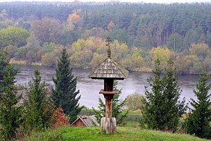
Nowogród
Place in Podlaskie Voivodeship, Poland
Distance: Approx. 397 meters
Latitude and longitude: 53.22638889,21.87944444
Nowogród [nɔˈvɔɡrut] is a small town in northeastern Poland, located about 13 kilometres (8 miles) away from the city of Łomża, Łomża County, Podlaskie Voivodeship, with 1,998 inhabitants (2004). It is centered on the area known as Skansen Kurpiowski which is an open-air museum, with several examples of mostly 19th century architecture from the region of Kurpie. The museum is dedicated to local Kurpie culture and is a popular folk tourist attraction.
Gmina Nowogród
Gmina in Podlaskie Voivodeship, Poland
Distance: Approx. 397 meters
Latitude and longitude: 53.22638889,21.87944444
Gmina Nowogród is an urban-rural gmina (administrative district) in Łomża County, Podlaskie Voivodeship, in north-eastern Poland. Its seat is the town of Nowogród, which lies approximately 16 kilometres (10 mi) north-west of Łomża and 87 km (54 mi) west of the regional capital Białystok. The gmina covers an area of 100.98 square kilometres (39.0 sq mi), and as of 2006 its total population is 3,977 (out of which the population of Nowogród amounts to 2,014, and the population of the rural part of the gmina is 1,963).
Dzierzgi
Village in Podlaskie Voivodeship, Poland
Distance: Approx. 2988 meters
Latitude and longitude: 53.2,21.86666667
Dzierzgi [ˈd͡ʑɛʐɡi] is a village in the administrative district of Gmina Nowogród, within Łomża County, Podlaskie Voivodeship, in north-eastern Poland. It lies approximately 4 kilometres (2 mi) south of Nowogród, 15 km (9 mi) west of Łomża, and 88 km (55 mi) west of the regional capital Białystok.
Grzymały, Łomża County
Village in Podlaskie Voivodeship, Poland
Distance: Approx. 4442 meters
Latitude and longitude: 53.19555556,21.93027778
Grzymały [ɡʐɨˈmawɨ] is a village in the administrative district of Gmina Nowogród, within Łomża County, Podlaskie Voivodeship, in north-eastern Poland.
Jankowo-Młodzianowo
Village in Podlaskie Voivodeship, Poland
Distance: Approx. 4379 meters
Latitude and longitude: 53.2,21.83333333
Jankowo-Młodzianowo [janˈkɔvɔ mwɔd͡ʑaˈnɔvɔ] is a village in the administrative district of Gmina Nowogród, within Łomża County, Podlaskie Voivodeship, in north-eastern Poland. It lies approximately 5 kilometres (3 mi) south-west of Nowogród, 18 km (11 mi) west of Łomża, and 90 km (56 mi) west of the regional capital Białystok.
Mątwica
Village in Podlaskie Voivodeship, Poland
Distance: Approx. 2313 meters
Latitude and longitude: 53.21666667,21.91666667
Mątwica [mɔntˈfit͡sa] is a village in the administrative district of Gmina Nowogród, within Łomża County, Podlaskie Voivodeship, in north-eastern Poland. It lies approximately 3 kilometres (2 mi) south-east of Nowogród, 13 km (8 mi) north-west of Łomża, and 85 km (53 mi) west of the regional capital Białystok.
Morgowniki
Village in Podlaskie Voivodeship, Poland
Distance: Approx. 976 meters
Latitude and longitude: 53.23333333,21.88333333
Morgowniki [mɔrɡɔvˈniki] is a village in the administrative district of Gmina Nowogród, within Łomża County, Podlaskie Voivodeship, in north-eastern Poland. It lies approximately 16 kilometres (10 mi) north-west of Łomża and 87 km (54 mi) west of the regional capital Białystok.
Ptaki, Łomża County
Village in Podlaskie Voivodeship, Poland
Distance: Approx. 1971 meters
Latitude and longitude: 53.24083333,21.87277778
Ptaki [ˈptaki] is a village in the administrative district of Gmina Nowogród, within Łomża County, Podlaskie Voivodeship, in north-eastern Poland. It lies approximately 2 kilometres (1 mi) north of Nowogród, 17 km (11 mi) north-west of Łomża, and 88 km (55 mi) west of the regional capital Białystok.
Sławiec
Village in Podlaskie Voivodeship, Poland
Distance: Approx. 3474 meters
Latitude and longitude: 53.2,21.91666667
Sławiec [ˈswavjɛt͡s] is a village in the administrative district of Gmina Nowogród, within Łomża County, Podlaskie Voivodeship, in north-eastern Poland. It lies approximately 4 kilometres (2 mi) south-east of Nowogród, 12 km (7 mi) west of Łomża, and 84 km (52 mi) west of the regional capital Białystok. After the joint German-Soviet invasion of Poland, which started World War II, the village was occupied by the Soviet Union from 1939 to 1941, and then by Nazi Germany from 1941 to 1944.
Sulimy, Podlaskie Voivodeship
Village in Podlaskie Voivodeship, Poland
Distance: Approx. 4093 meters
Latitude and longitude: 53.19555556,21.84694444
Sulimy [suˈlimɨ] is a village in the administrative district of Gmina Nowogród, within Łomża County, Podlaskie Voivodeship, in north-eastern Poland. It lies approximately 4 kilometres (2 mi) south of Nowogród, 15 km (9 mi) west of Łomża, and 88 km (55 mi) west of the regional capital Białystok.
Dębniki, Łomża County
Village in Podlaskie Voivodeship, Poland
Distance: Approx. 3552 meters
Latitude and longitude: 53.23333333,21.83333333
Dębniki [dɛmbˈniki] is a village in the administrative district of Gmina Zbójna, within Łomża County, Podlaskie Voivodeship, in north-eastern Poland. It lies approximately 3 kilometres (2 mi) south-east of Zbójna, 19 km (12 mi) north-west of Łomża, and 90 km (56 mi) west of the regional capital Białystok.
Weather in this IP's area
clear sky
2 Celsius
-3 Celsius
2 Celsius
2 Celsius
1028 hPa
81 %
1028 hPa
1012 hPa
10000 meters
5.12 m/s
12.68 m/s
128 degree
07:06:38
17:27:47