Country:
 Great Britain
Region:
City:
Latitude and Longitude:
Time Zone:
Postal Code:
IP information under different IP Channel
ip-api
Country
Region
City
ASN
Time Zone
ISP
Blacklist
Proxy
Latitude
Longitude
Postal
Route
IPinfo
Country
Region
City
ASN
Time Zone
ISP
Blacklist
Proxy
Latitude
Longitude
Postal
Route
MaxMind
Country
Region
City
ASN
Time Zone
ISP
Blacklist
Proxy
Latitude
Longitude
Postal
Route
Luminati
Country
GBRegion
eng
City
chorley
ASN
Time Zone
Europe/London
ISP
TalkTalk
Latitude
Longitude
Postal
db-ip
Country
Region
City
ASN
Time Zone
ISP
Blacklist
Proxy
Latitude
Longitude
Postal
Route
ipdata
Country
Region
City
ASN
Time Zone
ISP
Blacklist
Proxy
Latitude
Longitude
Postal
Route
Popular places and events near this IP address

Charnock Richard services
Motorway service area in Lancashire, England
Distance: Approx. 1923 meters
Latitude and longitude: 53.6304,-2.6918
Charnock Richard Services is a motorway service area between Junctions 27 and 28 of the M6 in England. The services are in the Lancashire borough of Chorley and were the first on the M6 when they opened in 1963. Originally operated by Trust House Forte, the services are currently operated by Welcome Break.

Charnock Richard
Human settlement in England
Distance: Approx. 872 meters
Latitude and longitude: 53.634,-2.674
Charnock Richard is a small village and civil parish in the borough of Chorley, Lancashire, in England. The population of the civil parish taken at the 2011 census was 1,748.
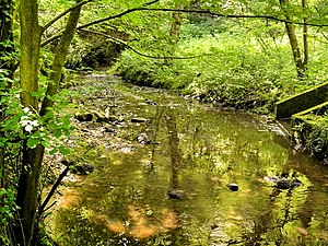
River Chor
River in Lancashire, England
Distance: Approx. 1077 meters
Latitude and longitude: 53.6469,-2.6559
The River Chor is a largely culverted stream in the Lancashire town of Chorley. Its name was back-formed from "Chorley". The source of the river is in the hills near Heapey.
Camelot Theme Park
Former British amusement park
Distance: Approx. 1984 meters
Latitude and longitude: 53.63527778,-2.6975
Camelot Theme Park was a resort and theme park located in the English county of Lancashire. The park's theme was the well-known legend of Camelot, and the park decor incorporated pseudo-medieval elements. It was located on a 140-acre (57 ha; 0.22 sq mi) site near the village of Charnock Richard, 3 miles (4.8 km) west of Chorley.
Southlands High School
Academy in Chorley, Lancashire, United Kingdom
Distance: Approx. 1308 meters
Latitude and longitude: 53.6408,-2.6494
Southlands High School is a coeducational secondary school in Chorley, Lancashire, United Kingdom. It has approximately 1,000 students per annum.

Bolton Green
Human settlement in England
Distance: Approx. 1358 meters
Latitude and longitude: 53.653,-2.675
Bolton Green is a village in the Borough of Chorley, Lancashire, England. Bolton Green Hall farmhouse is a Grade II* listed building dating from 1612.
Coppull Mill
Cotton mill in Chorley, Lancashire, England
Distance: Approx. 1660 meters
Latitude and longitude: 53.6271,-2.6615
Coppull Mill is a former cotton spinning mill in Coppull, Chorley, Lancashire. It was opened in 1906 by the Coppull Ring Spinning Co, followed by its sister mill, Mavis Mill in 1908. Together they employed 700 workers.
Mavis Mill
Cotton mill in Lancashire, England
Distance: Approx. 1625 meters
Latitude and longitude: 53.6272,-2.6628
Mavis Mill was a cotton spinning mill in Coppull, Chorley, Lancashire Mavis Mill was built in 1908 alongside the Coppull Ring Mill, which still survives under a change of use to an enterprise centre. The mill was taken over by the Lancashire Cotton Corporation in 1941, but was subsequently demolished to make a car park. The spinning machines were driven by a 2000 hp triple-expansion four-cylinder engine by J & E Wood, 1909, which had a 26 ft flywheel with 36 ropes.
Lancashire College
Distance: Approx. 1976 meters
Latitude and longitude: 53.6554,-2.651
Lancashire Adult Learning is an adult education college located in Lancashire, England . Courses offered by the college are aimed primarily at adult learners rather than recent school leavers, and include short courses, weekly courses, ESOL programmes and Functional Skills.

Coppull railway station
Former railway station in England
Distance: Approx. 2084 meters
Latitude and longitude: 53.6236,-2.6589
Coppull railway station is a closed railway station in Coppull, England, situated on Station Road in the centre of the village. Coppull was in the historic county of Lancashire and remains in the county's modern version.
Charnock Richard F.C.
Association football club in England
Distance: Approx. 1049 meters
Latitude and longitude: 53.6322,-2.6733
Charnock Richard Football Club is a football club based in Charnock Richard, near Chorley, Lancashire, England. They are currently members of the North West Counties League Premier Division and play at Mossie Park.
Chorley Rural District
Rural district in Lancashire, England (1894–1974)
Distance: Approx. 2082 meters
Latitude and longitude: 53.6591,-2.6595
Chorley Rural District was a rural district in the administrative county of Lancashire, England from 1894 to 1974. The district was created by the Local Government Act 1894 as the successor to the Chorley Rural Sanitary District. It comprised an area surrounding but did not include the Municipal Borough of Chorley.
Weather in this IP's area
moderate rain
14 Celsius
14 Celsius
13 Celsius
15 Celsius
1008 hPa
78 %
1008 hPa
999 hPa
10000 meters
4.63 m/s
160 degree
20 %
07:43:54
18:07:18