Country:
 Great Britain
Region:
City:
Latitude and Longitude:
Time Zone:
Postal Code:
IP information under different IP Channel
ip-api
Country
Region
City
ASN
Time Zone
ISP
Blacklist
Proxy
Latitude
Longitude
Postal
Route
IPinfo
Country
Region
City
ASN
Time Zone
ISP
Blacklist
Proxy
Latitude
Longitude
Postal
Route
MaxMind
Country
Region
City
ASN
Time Zone
ISP
Blacklist
Proxy
Latitude
Longitude
Postal
Route
Luminati
Country
GBRegion
eng
City
durham
ASN
Time Zone
Europe/London
ISP
TalkTalk
Latitude
Longitude
Postal
db-ip
Country
Region
City
ASN
Time Zone
ISP
Blacklist
Proxy
Latitude
Longitude
Postal
Route
ipdata
Country
Region
City
ASN
Time Zone
ISP
Blacklist
Proxy
Latitude
Longitude
Postal
Route
Popular places and events near this IP address
Cassop
Human settlement in England
Distance: Approx. 2378 meters
Latitude and longitude: 54.739,-1.465
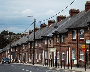
Cassop (formerly New Cassop) is a village and former civil parish, now in the parish of Cassop-cum-Quarrington, in the County Durham district, in the ceremonial county of Durham, England. It has a population of about 500 and is located near the city of Durham. A former mining village, mining is no longer the main occupation of Cassop's inhabitants due to extensive mine closure over the last 30 years.
Bowburn
Human settlement in England
Distance: Approx. 2445 meters
Latitude and longitude: 54.74,-1.53
Bowburn is a village in County Durham, England. It is situated about 3 miles (4.8 km) to the south-east of Durham, on the A177, between Coxhoe to the south-east, and High Shincliffe to the north-west. It is part of the Cassop-cum-Quarrington parish.
Quarrington Hill
Distance: Approx. 2404 meters
Latitude and longitude: 54.73138889,-1.47833333
Quarrington Hill is a village in County Durham, in England. It is situated a short distance to the north of Kelloe. Having been part of the extensive parish of Kelloe, it merged with the village of Cassop during the 19th century to form the parish of Cassop-cum-Quarrington, it is now in the parish of Coxhoe.
Old Quarrington
Distance: Approx. 1787 meters
Latitude and longitude: 54.73433,-1.49921
Old Quarrington is a hamlet in County Durham, in England. It is situated between Bowburn and Quarrington Hill. It is also known locally as Heugh Hall, which was the name of a local colliery.
Old Cassop
Distance: Approx. 1236 meters
Latitude and longitude: 54.74935,-1.47723
Old Cassop is a hamlet in County Durham, in England. It is situated a few miles to the south-east of Durham. Old Cassop lies within the Cassop-cum-Quarrington civil parish.

Shadforth
Distance: Approx. 2347 meters
Latitude and longitude: 54.762,-1.466
Shadforth is a village in County Durham, England, a few miles east of Durham. The historic centre of the village is a conservation area. The population at the 2011 census was 2,118.
Cassop-cum-Quarrington
Civil parish in County Durham, England
Distance: Approx. 1076 meters
Latitude and longitude: 54.74078,-1.49346
Cassop-cum-Quarrington is a civil parish in County Durham, England. According to the 2001 census it had a population of 4,735, increasing to 5,219 at the 2011 census. The parish covers a number of settlements: Bowburn Cassop Old Cassop Old Quarrington Parkhill Tursdale Unlike the ecclesiastical parish of Cassop-cum-Quarrington with Bowburn, the civil parish does not include Quarrington Hill.

Sherburn House
Human settlement in England
Distance: Approx. 2512 meters
Latitude and longitude: 54.76666667,-1.52333333
Sherburn House is a hamlet in the civil parish of Shincliffe, in County Durham, England. It is situated approximately 2 miles (3 km) south-east of Durham between Sherburn and Shincliffe Village. Sherburn House is the location of Sherburn Hospital.

Whitwell House
Human settlement in England
Distance: Approx. 2388 meters
Latitude and longitude: 54.764,-1.525
Whitwell House is a place in the civil parish of Shincliffe, in County Durham, England situated a few miles to the south-east of Durham. It now consists of the hamlet of Whitwell Grange, but was from 1836 was the site of the village of Whitwell Colliery. The village declined following the closure of the colliery in 1875 and was described as 'almost deserted' by 1894.
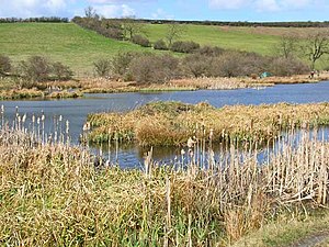
Cassop Vale
Protected area in County Durham, England
Distance: Approx. 1338 meters
Latitude and longitude: 54.74261111,-1.48038889
Cassop Vale is a Site of Special Scientific Interest in the Durham City district of County Durham, England. It lies between the villages of Bowburn and Cassop, 7 km south-east of the centre of Durham.. The site is important as one of the larger areas of grassland developed on magnesium limestone.
Quarrington Hill Grasslands
Distance: Approx. 2475 meters
Latitude and longitude: 54.73083333,-1.47777778
Quarrington Hill Grasslands is a Site of Special Scientific Interest in County Durham, England. The site consists of three separate areas, two closely adjacent to the east of the village of Quarrington Hill, the third immediately west of the village, which lies 8 km south-east of Durham City. The area is important for its magnesian limestone grassland communities, which are largely confined to County Durham and increasingly scarce even there.
Sherburn Hill (SSSI)
Site of Special Scientific Interest in County Durham, England
Distance: Approx. 2208 meters
Latitude and longitude: 54.76972222,-1.48944444
Sherburn Hill is a Site of Special Scientific Interest in County Durham, England. It lies just south of the road between the villages of Sherburn and Sherburn Hill, some 5.5 km east of Durham city. A disused quarry occupies part of the site.
Weather in this IP's area
overcast clouds
14 Celsius
14 Celsius
14 Celsius
15 Celsius
1005 hPa
91 %
1005 hPa
993 hPa
4751 meters
2.1 m/s
3.01 m/s
343 degree
100 %
06:26:25
19:41:05