Country:
 Great Britain
Region:
City:
Latitude and Longitude:
Time Zone:
Postal Code:
IP information under different IP Channel
ip-api
Country
Region
City
ASN
Time Zone
ISP
Blacklist
Proxy
Latitude
Longitude
Postal
Route
IPinfo
Country
Region
City
ASN
Time Zone
ISP
Blacklist
Proxy
Latitude
Longitude
Postal
Route
MaxMind
Country
Region
City
ASN
Time Zone
ISP
Blacklist
Proxy
Latitude
Longitude
Postal
Route
Luminati
Country
GBRegion
wls
City
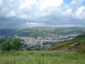
pontypridd
ASN
Time Zone
Europe/London
ISP
TalkTalk
Latitude
Longitude
Postal
db-ip
Country
Region
City
ASN
Time Zone
ISP
Blacklist
Proxy
Latitude
Longitude
Postal
Route
ipdata
Country
Region
City
ASN
Time Zone
ISP
Blacklist
Proxy
Latitude
Longitude
Postal
Route
Popular places and events near this IP address

Ynysybwl
Human settlement in Wales
Distance: Approx. 2113 meters
Latitude and longitude: 51.64,-3.3675
Ynysybwl (Welsh: Ynys-y-bŵl [ənɪsəˈbʊl]) is a village in Cwm Clydach in Wales. It is situated in the county borough of Rhondda Cynon Taf, roughly 15 miles (24 km) north-north-west of Cardiff, 4 miles (6 km) north of Pontypridd and 16 miles (26 km) south of Merthyr Tydfil, and forms part of the community of Ynysybwl and Coed-y-Cwm. Cwm Clydach is flanked by the Rhondda and Cynon Valleys.

Trehafod railway station
Railway station in Rhondda Cynon Taf, Wales
Distance: Approx. 1413 meters
Latitude and longitude: 51.6101,-3.3806
Trehafod railway station is a railway station serving the township of Trehafod in Rhondda Cynon Taf, Wales. It is located on the Rhondda Line. It was first opened on this site by the Taff Vale Railway in 1892.

Trehafod
Human settlement in Wales
Distance: Approx. 1478 meters
Latitude and longitude: 51.6096,-3.3811
Trehafod is a village and community in the Rhondda Valley, between Porth and Pontypridd in the county borough of Rhondda Cynon Taf, Wales, with a population of 698 in the 2011 census.(The earlier name Hafod was altered in 1905 to avoid confusion with Hafod near Swansea. Until then, Trehafod (first record of the name is found in 1851) had been part of Hafod). Administratively, Trehafod is split between the electoral division of Cymmer (Rhondda) to the west and Rhondda (Pontypridd) to the east.
Llwyncelyn, Rhondda Cynon Taf
Human settlement in Wales
Distance: Approx. 2138 meters
Latitude and longitude: 51.6132,-3.3986
Llwyncelyn is a district of Porth, Rhondda Cynon Taf. Consisting of five long terraces and two modern housing developments, Llwyncelyn has one shop and a parish church, St. Luke's Church.
Cymmer, Rhondda Cynon Taf
Human settlement in Wales
Distance: Approx. 1958 meters
Latitude and longitude: 51.61492,-3.39692
Cymmer (Welsh: Y Cymer) is a village and community in the Rhondda Valley, Wales. It is so named because of being located at the 'confluence' of the Rhondda Fawr and Rhondda Fach river valleys. Several collieries were opened here in the middle part of the nineteenth century.

Rhondda Heritage Park
Tourist attraction in Trehafod, Rhondda
Distance: Approx. 1653 meters
Latitude and longitude: 51.6107416,-3.3875442
Rhondda Heritage Park, Trehafod, Rhondda, South Wales, is a tourist attraction which offers an insight into the life of the coal mining community that existed in the area until the 1980s. Visitors can experience the life of the coal miners on a guided tour through one of the mine shafts of the Lewis Merthyr colliery. Tours are led by former colliery workers.

Glyncoch
Human settlement in Wales
Distance: Approx. 2103 meters
Latitude and longitude: 51.622,-3.34
Glyncoch is a village to the north of Pontypridd in Rhondda Cynon Taf, Wales. It is also the name of an electoral ward.

Hopkinstown
Human settlement in Wales
Distance: Approx. 1941 meters
Latitude and longitude: 51.605426,-3.358087
Hopkinstown (Welsh: Trehopcyn) is a small village to the west of Pontypridd in the county borough of Rhondda Cynon Taf, Wales, alongside the River Rhondda. Hopkinstown is a former coalmining and industrial community, now a district in the town of Pontypridd within the Rhondda electoral ward. Neighbouring settlements are Pwllgwaun, Trehafod and Pantygraigwen, and the sub-districts of Troed-Rhiw-Trwyn and Gyfeillion.

Great Western Mine
Distance: Approx. 1363 meters
Latitude and longitude: 51.6091,-3.3665
Great Western Mine, also known as Hetty Pit, was a coal mine, at Hopkinstown, near Pontypridd, Glamorgan in South Wales.

Jerusalem Chapel, Ynysybwl
Former chapel in Ynysybwl, Rhondda Cynon Taf, Wales
Distance: Approx. 1831 meters
Latitude and longitude: 51.6357,-3.3582
Jerusalem, Ynysybwl was a Calvinistic Methodist chapel in Thompson Street, Ynysybwl, Glamorgan, Wales. Services at Jerusalem were conducted in the Welsh language.

Noddfa Chapel, Ynysybwl
Chapel in Ynysybwl, Rhondda Cynon Taf, Wales
Distance: Approx. 1987 meters
Latitude and longitude: 51.637577,-3.359359
Noddfa is a Baptist chapel in the High Street, Ynysybwl, Rhondda Cynon Taf, Wales.
Gyfeillon Platform railway station
Disused railway station in Pontypridd, Rhondda Cynon Taf
Distance: Approx. 1667 meters
Latitude and longitude: 51.6075,-3.3603
Gyfeillon Platform railway station, also known as Gyfeillon Halt railway station, co-served the town of Pontypridd, in the historical county of Glamorganshire, Wales, from 1905 to 1918 on the Taff Vale Railway.
Weather in this IP's area
light rain
14 Celsius
13 Celsius
12 Celsius
14 Celsius
1011 hPa
81 %
1011 hPa
980 hPa
10000 meters
1.79 m/s
4.47 m/s
222 degree
100 %
07:43:06
18:13:42