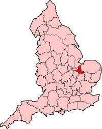
Country:
 Great Britain
Region:
City:
Latitude and Longitude:
Time Zone:
Postal Code:
IP information under different IP Channel
ip-api
Country
Region
City
ASN
Time Zone
ISP
Blacklist
Proxy
Latitude
Longitude
Postal
Route
IPinfo
Country
Region
City
ASN
Time Zone
ISP
Blacklist
Proxy
Latitude
Longitude
Postal
Route
MaxMind
Country
Region
City
ASN
Time Zone
ISP
Blacklist
Proxy
Latitude
Longitude
Postal
Route
Luminati
Country
GBRegion
eng
City
ely
ASN
Time Zone
Europe/London
ISP
TalkTalk
Latitude
Longitude
Postal
db-ip
Country
Region
City
ASN
Time Zone
ISP
Blacklist
Proxy
Latitude
Longitude
Postal
Route
ipdata
Country
Region
City
ASN
Time Zone
ISP
Blacklist
Proxy
Latitude
Longitude
Postal
Route
Popular places and events near this IP address
Isle of Ely
Historic region around the city of Ely in Cambridgeshire, England
Distance: Approx. 2216 meters
Latitude and longitude: 52.4,0.25833333
The Isle of Ely () is a historic region around the city of Ely in Cambridgeshire, England. Between 1889 and 1965, it formed an administrative county.

King's Ely
Private school in Ely, Cambridgeshire, England
Distance: Approx. 2489 meters
Latitude and longitude: 52.3978,0.2616
King's Ely (renamed from "The King's School" in March 2012) is a cathedral school and now an all through co-educational fee-charging day and boarding school in the city of Ely in England. It was founded in 970 AD, making it one of the oldest schools in the world. It was given its first royal charter by King Henry VIII in 1541, its second by Queen Elizabeth I in 1562, and its third by King Charles II in 1666.
Ely City F.C.
Association football club in England
Distance: Approx. 1577 meters
Latitude and longitude: 52.41026111,0.24695833
Ely City Football Club is a football club based in Ely, Cambridgeshire, England. They are currently members of the Eastern Counties League Premier Division and play at the Unwin Sports Ground.

Ely College
School in Ely, Cambridgeshire, England
Distance: Approx. 2164 meters
Latitude and longitude: 52.4071,0.2577
Ely College is a secondary academy school located in Ely, Cambridgeshire.

Witchford Village College
Academy in Witchford, Cambridgeshire, England
Distance: Approx. 1743 meters
Latitude and longitude: 52.39077,0.21206
Witchford Village College (sometimes abbreviated to W.V.C.) is a secondary school in the village of Witchford, near Ely, Cambridgeshire, England. Before becoming an academy the school was a specialist Sports College. With approximately 820 pupils on roll, the college has fewer pupils than the national average (~950).

Witchford
Village in Cambridgeshire, England
Distance: Approx. 2324 meters
Latitude and longitude: 52.387,0.206
Witchford is a village and civil parish about 2.5 miles (4 km) west of Ely, Cambridgeshire, England. The 2011 Census recorded the parish's population as 2,385.

Countess Free Church
Church in Ely, Cambridgeshire, England
Distance: Approx. 2465 meters
Latitude and longitude: 52.40106111,0.26231944
The Countess Free Church is a church based in the centre of Ely, Cambridgeshire, and holding events across the city. The church meets on a Sunday morning at 10.30am as well as activities and groups for people of all ages through the week, including a strong community focus by hosting various groups and activities mid-week. The church buildings are located in Chapel Street, near Ely Cathedral.

Oliver Cromwell's House
House in Ely, Cambridgeshire, England, UK
Distance: Approx. 2296 meters
Latitude and longitude: 52.3988,0.2591
Oliver Cromwell's House in Ely, Cambridgeshire, England was the family home of Oliver Cromwell. The kitchen dates from around 1215, other parts being built later. The house was the vicarage of St Mary's Church (which is adjacent to it) until 1986.

St Etheldreda's Church, Ely
Roman Catholic diocesan shrine and parish church in Ely, Cambridgeshire, England
Distance: Approx. 2396 meters
Latitude and longitude: 52.401725,0.261408
St Etheldreda's Church is a Roman Catholic parish church in Ely, Cambridgeshire, England. It is part of the Diocese of East Anglia within the Province of Westminster. The church notably contains the national shrine and relics of St Etheldreda, an Anglo-Saxon queen and abbess who died on 23 June AD 679 and went on to become one of the most popular of the medieval saints in England.

Bishop's Palace, Ely
Grade I listed building in East Cambridgeshire, United Kingdom
Distance: Approx. 2453 meters
Latitude and longitude: 52.3986,0.2614
The Bishop's Palace, Ely was one of the residences of the Bishop of Ely from the 15th century until 1941. It is a Grade I listed building. The palace was built in the 15th century by Bishop John Alcock however just two towers from the original building remain.

Sextry Barn, Ely
Distance: Approx. 2298 meters
Latitude and longitude: 52.3985,0.259
The Sextry Barn was a 13th-century tithe barn in Ely, Cambridgeshire, England. It was one of the largest medieval barns in Europe, and was demolished in 1842. It was used to store the corn tithes due to Ely Cathedral, and took its name from the sacrist of the monastery who was in charge of it.

St Mary's Church, Ely
Church
Distance: Approx. 2348 meters
Latitude and longitude: 52.3986,0.2598
St Mary's Church is a church in Ely, Cambridgeshire, located near Ely Cathedral to the west of the Bishop's Palace. Principally constructed in the 13th century, it was designated as a Grade I listed building in 1950. Sextry Barn, which stood immediately to the west of the churchyard, was a large 13th-century tithe barn.
Weather in this IP's area
scattered clouds
16 Celsius
16 Celsius
14 Celsius
18 Celsius
1012 hPa
75 %
1012 hPa
1012 hPa
10000 meters
6.17 m/s
200 degree
40 %
07:30:03
17:57:59