Country:
 Czech Republic
Region:
City:
Latitude and Longitude:
Time Zone:
Postal Code:
IP information under different IP Channel
ip-api
Country
Region
City
ASN
Time Zone
ISP
Blacklist
Proxy
Latitude
Longitude
Postal
Route
IPinfo
Country
Region
City
ASN
Time Zone
ISP
Blacklist
Proxy
Latitude
Longitude
Postal
Route
MaxMind
Country
Region
City
ASN
Time Zone
ISP
Blacklist
Proxy
Latitude
Longitude
Postal
Route
Luminati
Country
CZRegion
10
City
prague
ASN
Time Zone
Europe/Prague
ISP
Quantcom, a.s.
Latitude
Longitude
Postal
db-ip
Country
Region
City
ASN
Time Zone
ISP
Blacklist
Proxy
Latitude
Longitude
Postal
Route
ipdata
Country
Region
City
ASN
Time Zone
ISP
Blacklist
Proxy
Latitude
Longitude
Postal
Route
Popular places and events near this IP address

Řevnice
Town in Central Bohemian, Czech Republic
Distance: Approx. 3548 meters
Latitude and longitude: 49.91388889,14.23583333
Řevnice (Czech pronunciation: [ˈr̝ɛvɲɪtsɛ]) is a town in Prague-West District in the Central Bohemian Region of the Czech Republic. It has about 3,800 inhabitants.
Černošice
Town in Central Bohemian, Czech Republic
Distance: Approx. 4282 meters
Latitude and longitude: 49.95305556,14.32527778
Černošice (Czech pronunciation: [ˈtʃɛrnoʃɪtsɛ]) is a town in Prague-West District in the Central Bohemian Region of the Czech Republic. It has about 7,700 inhabitants.

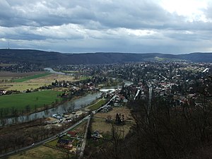
Dobřichovice
Town in Central Bohemian, Czech Republic
Distance: Approx. 242 meters
Latitude and longitude: 49.9275,14.27722222
Dobřichovice is a town in Prague-West District in the Central Bohemian Region of the Czech Republic. It has about 3,800 inhabitants.

Prague-West District
District in the Czech Republic
Distance: Approx. 1534 meters
Latitude and longitude: 49.93333333,14.3
Prague-West District (Czech: okres Praha-západ) is a district in the Central Bohemian Region of the Czech Republic. Its capital is Prague. The most populated town of the district is Jesenice.

Řitka
Municipality in Central Bohemian, Czech Republic
Distance: Approx. 3920 meters
Latitude and longitude: 49.89444444,14.29944444
Řitka is a municipality and village in Prague-West District in the Central Bohemian Region of the Czech Republic. It has about 1,400 inhabitants.

Mořinka
Municipality in Central Bohemian, Czech Republic
Distance: Approx. 3369 meters
Latitude and longitude: 49.93916667,14.23722222
Mořinka is a municipality and village in Beroun District in the Central Bohemian Region of the Czech Republic. It has about 200 inhabitants.

Černolice
Municipality in Central Bohemian, Czech Republic
Distance: Approx. 2396 meters
Latitude and longitude: 49.90972222,14.29944444
Černolice is a municipality and village in Prague-West District in the Central Bohemian Region of the Czech Republic. It has about 600 inhabitants.

Jíloviště
Municipality in Central Bohemian, Czech Republic
Distance: Approx. 4456 meters
Latitude and longitude: 49.9275,14.34277778
Jíloviště is a municipality and village in Prague-West District in the Central Bohemian Region of the Czech Republic. It has about 700 inhabitants.

Karlík
Municipality in Central Bohemian, Czech Republic
Distance: Approx. 1761 meters
Latitude and longitude: 49.93555556,14.25944444
Karlík is a municipality and village in Prague-West District in the Central Bohemian Region of the Czech Republic. It has about 500 inhabitants.

Lety (Prague-West District)
Municipality in Central Bohemian, Czech Republic
Distance: Approx. 1949 meters
Latitude and longitude: 49.92111111,14.25527778
Lety is a municipality and village in Prague-West District in the Central Bohemian Region of the Czech Republic. It has about 1,600 inhabitants.

Vonoklasy
Municipality in Central Bohemian, Czech Republic
Distance: Approx. 2520 meters
Latitude and longitude: 49.95,14.27666667
Vonoklasy is a municipality and village in Prague-West District in the Central Bohemian Region of the Czech Republic. It has about 600 inhabitants.

Všenory
Municipality in Central Bohemian, Czech Republic
Distance: Approx. 1676 meters
Latitude and longitude: 49.92888889,14.30388889
Všenory is a municipality and village in Prague-West District in the Central Bohemian Region of the Czech Republic. It has about 1,700 inhabitants.
Weather in this IP's area
clear sky
15 Celsius
14 Celsius
13 Celsius
16 Celsius
1016 hPa
71 %
1016 hPa
991 hPa
10000 meters
3.09 m/s
130 degree
07:29:39
18:05:58