Country:
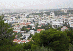
 Greece
Region:
City:
Latitude and Longitude:
Time Zone:
Postal Code:
IP information under different IP Channel
ip-api
Country
Region
City
ASN
Time Zone
ISP
Blacklist
Proxy
Latitude
Longitude
Postal
Route
IPinfo
Country
Region
City
ASN
Time Zone
ISP
Blacklist
Proxy
Latitude
Longitude
Postal
Route
MaxMind
Country
Region
City
ASN
Time Zone
ISP
Blacklist
Proxy
Latitude
Longitude
Postal
Route
Luminati
Country
GRRegion
i
City
vrilissia
ASN
Time Zone
Europe/Athens
ISP
Nova Telecommunications & Media Single Member S.A
Latitude
Longitude
Postal
db-ip
Country
Region
City
ASN
Time Zone
ISP
Blacklist
Proxy
Latitude
Longitude
Postal
Route
ipdata
Country
Region
City
ASN
Time Zone
ISP
Blacklist
Proxy
Latitude
Longitude
Postal
Route
Popular places and events near this IP address

Vrilissia
Municipality in Greece
Distance: Approx. 749 meters
Latitude and longitude: 38.03333333,23.83333333
Vrilissia (Greek: Βριλήσσια) is a suburban town and a municipality of the North Athens regional unit, in the Attica region. It is located in the Athens basin, at the southwestern foot of the Penteli Mountain. At the 2021 census, the municipality had 32,417 residents.
Melissia
Municipal unit in Greece
Distance: Approx. 2035 meters
Latitude and longitude: 38.05,23.83333333
Melissia (Greek: Μελίσσια) is a town and a suburb in the northeastern part of the Athens agglomeration, Greece. Since the 2011 local government reform it is part of the municipality Penteli, of which it is the seat and a municipal unit. The municipal unit has an area of 3.956 km2.
American Community Schools
School in Chalandri, Athens, Greece
Distance: Approx. 1838 meters
Latitude and longitude: 38.018221,23.815459
ACS Athens – American Community Schools of Athens is a private school offering international JK–12 education to local, national and international students in Greece. ACS Athens embraces American educational philosophy, principles and values. It is located in Chalandri in the Athens area.

Doukissis Plakentias station
Athens Metro and Athens Suburban Railway station
Distance: Approx. 1294 meters
Latitude and longitude: 38.02336111,23.83305556
Doukissis Plakentias (Greek: Δουκίσσης Πλακεντίας), sometimes known simply as Plakentias, is an Athens Metro and Suburban Railway station situated at the end of Doukissis Plakentias Avenue in Chalandri, a municipality in the regional unit of North Athens, Attica, Greece. It is named after the Duchess of Plaisance, a philhellene who owned much of the land in the part of Attica where the station now stands. The metro station lies underground, while the Suburban Railway station lies within the median strip of the A6 motorway (Attiki Odos).
Institute for Language and Speech Processing
Greek non-profit private foundation
Distance: Approx. 1998 meters
Latitude and longitude: 38.0367,23.8025
The Institute for Language and Speech Processing (ILSP) (Greek: Ινστιτούτο Επεξεργασίας του Λόγου, ΙΕΛ) is an Athens based, Greek non-profit private foundation focusing on applied research in various areas mainly related to language technology. In 1991 ILSP was established as a research institute; it operates under the auspices of the General Secretariat for Research and Innovation, Ministry of Development and Investment. ILSP is the oldest institute of Athena Research & Innovation Center in Information, Communication and Science Technologies.

Sismanogleio General Hospital
Hospital in Athens, Greece
Distance: Approx. 1474 meters
Latitude and longitude: 38.046,23.828
Sismanogleio General Hospital (Γενικό Νοσοκομείο Σισμανόγλειο) in Vrilissia, Athens is one of the largest public hospitals in Greece. Its name in Katharevousa is Sismanogleion (Σισμανόγλειον). During the 2009 swine flu pandemic Seismanogleion treated the first swine flu patient in Greece.

Kifisias railway station
Athens Suburban Railway station
Distance: Approx. 2129 meters
Latitude and longitude: 38.04194444,23.80333333
Kifisias railway station (Greek: Σιδηροδρομικός Σταθμός Κηφισίας, romanized: Sidirodromikós Stathmós Kifisías) is a station located on Kifisias Avenue in Marousi, a municipality of the regional unit of North Athens, Attica, Greece, located in the median strip of the A6 motorway (Attiki Odos), at the interchange of Kifisias Avenue, from which the station is named. It was first opened on 30 July 2004, along with the first section of the Athens Airport–Patras railway. The station consists of an island platform and a train storage line.

Chalandri metro station
Athens Metro station
Distance: Approx. 1309 meters
Latitude and longitude: 38.02166667,23.82083333
Chalandri (Greek: Χαλάνδρι), also known as Halandri on signage, is a station on Athens Metro Line 3. It opened on 24 July 2004 and served as the original northern terminus for four days, until Doukissis Plakentias opened. The eastbound platform has a mural by Rena Papaspirou, titled Images Through Matter (2010).

Agia Paraskevi metro station
Athens Metro station
Distance: Approx. 2061 meters
Latitude and longitude: 38.01722222,23.8125
Agia Paraskevi (Greek: Αγία Παρασκευή), also known as Aghia Paraskevi on signage, is a station on Athens Metro Line 3. It opened on 30 December 2010, although its construction necessitated disruption of metro services east of Ethniki Amyna.
Phlya
Distance: Approx. 1745 meters
Latitude and longitude: 38.0262565,23.806835
Phlya (Ancient Greek: Φλύα or Φλυά) was a deme of ancient Attica that lay in the Mesogaea. It must have been a place of importance from the number of temples which it contained, and from its frequent mention in inscriptions. The site of Phlya is located near modern Chalandri.

Pentelis railway station
Athens Suburban Railway station
Distance: Approx. 253 meters
Latitude and longitude: 38.03333333,23.82194444
Pentelis railway station (Greek: Σιδηροδρομικός Σταθμός Πεντέλης, romanized: Sidirodromikós Stathmós Pentélis) is a station located in the municipality of Vrilissia near the borders of the municipalities of Maroussi and Chalandri Greece. It was first opened on 21 February 2007 and is located in the median strip of the A6 motorway, at the interchange of Pentelis Avenue, at the intersection of which with the railway line SKA - Athens International Airport has been built, from which the station is named. The station consists of an island platform and a train storage line.
Rizarios Ecclesiastical School of Athens
Εducational Ιnstitution in Chalandri, Greece
Distance: Approx. 2208 meters
Latitude and longitude: 38.0306,23.7998
Rizarios (or Rizareios) Ecclesiastical School of Athens (Greek: Ριζάρειος Εκκλησιαστική Σχολή Αθηνών ή Ριζάρειος Σχολή) is a Greek Orthodox historical educational institution founded at 1841, by Manthos and Georgios Rizaris, who was members of the Society of Friends (Filiki Eteria).
Weather in this IP's area
clear sky
25 Celsius
25 Celsius
24 Celsius
26 Celsius
1017 hPa
41 %
1017 hPa
991 hPa
10000 meters
4.02 m/s
6.26 m/s
132 degree
07:26:42
18:57:21