81.9.194.166 - IP Lookup: Free IP Address Lookup, Postal Code Lookup, IP Location Lookup, IP ASN, Public IP
Country:
 Spain
SpainRegion:
City:
Location:
Time Zone:
Postal Code:
ISP:
ASN:
language:
User-Agent:
Proxy IP:
Blacklist:
IP information under different IP Channel
ip-api
Country
Region
City
ASN
Time Zone
ISP
Blacklist
Proxy
Latitude
Longitude
Postal
Route
db-ip
Country
Region
City
ASN
Time Zone
ISP
Blacklist
Proxy
Latitude
Longitude
Postal
Route
IPinfo
Country
Region
City
ASN
Time Zone
ISP
Blacklist
Proxy
Latitude
Longitude
Postal
Route
IP2Location
81.9.194.166Country
esRegion
castilla-la mancha
City
sesena
Time Zone
Europe/Madrid
ISP
Language
User-Agent
Latitude
Longitude
Postal
ipdata
Country
Region
City
ASN
Time Zone
ISP
Blacklist
Proxy
Latitude
Longitude
Postal
Route
Popular places and events near this IP address

Jarama
Tributary of the Tagus river
Distance: Approx. 9190 meters
Latitude and longitude: 40.03083333,-3.64972222
Jarama (Spanish pronunciation: [xaˈɾama]) is a river in central Spain. It flows north to south and passes east of Madrid where the El Atazar Dam is built on a tributary, the Lozoya River. It flows into the river Tagus in Aranjuez.

Ciempozuelos
Municipality in Community of Madrid, Spain
Distance: Approx. 9090 meters
Latitude and longitude: 40.15916667,-3.61833333
Ciempozuelos (Spanish: [θjempoˈθwelos] ) is a municipality in Spain located in the Community of Madrid. The municipality spans across a total area of 49.64 km2 and, as of 1 January 2020, it has a registered population of 25,383 (2022).

Borox
Municipality in Castile-La Mancha, Spain
Distance: Approx. 5199 meters
Latitude and longitude: 40.06666667,-3.73333333
Borox is a municipality located in the province of Toledo, Castile-La Mancha, Spain. According to the 2006 census (INE), the municipality had a population of 2640 inhabitants.
Esquivias
Municipality in Castile-La Mancha, Spain
Distance: Approx. 5879 meters
Latitude and longitude: 40.1,-3.76666667
Esquivias is a municipality located in the province of Toledo, Castile-La Mancha, Spain. According to the 2006 census (INE), the municipality has a population of 4,812 inhabitants. The author Cervantes lived here after marrying Catalina, a girl from the village, in 1584.

Seseña
Municipality in Castilla–La Mancha, Spain
Distance: Approx. 122 meters
Latitude and longitude: 40.10361111,-3.69805556
Seseña is a municipality of Spain located in the province of Toledo, Castilla–La Mancha. It is part of La Sagra comarca. As of 1 January 2020, the municipality has a population of 27,066.

Yeles
Municipality in Castile-La Mancha, Spain
Distance: Approx. 8794 meters
Latitude and longitude: 40.11666667,-3.8
Yeles is a municipality located in the province of Toledo, Castile-La Mancha, Spain. According to the 2021 census (INE), the municipality has a population of 5,779 inhabitants.
R-4 motorway (Spain)
Highway in Spain
Distance: Approx. 3635 meters
Latitude and longitude: 40.0777,-3.6739
The R-4 is a Spanish radial toll motorway originating from Madrid and passing through Valdemoro, connecting to the N-400, A-40 and AP-36. The road is managed by Cintra.

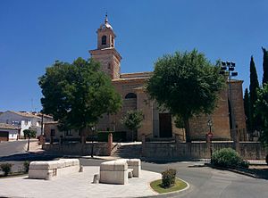
Church of Nuestra Señora de la Asunción (Valdemoro)
Church in Valdemoro
Distance: Approx. 9494 meters
Latitude and longitude: 40.188753,-3.678983
The Church of Nuestra Señora de la Asunción (Spanish: Iglesia de Nuestra Señora de la Asunción) is a church located in Valdemoro, Spain. It was declared Bien de Interés Cultural in 1981. Built in Baroque style, it has a nave measuring 60 x 28 meters, with side chapels.

Cerro de los Batallones
Spanish fossil site
Distance: Approx. 7643 meters
Latitude and longitude: 40.17222222,-3.71416667
Cerro de los Batallones (Hill of the Battalions) is a hill at Torrejón de Velasco, Madrid, Spain where a number of fossil sites from the Upper Miocene (MN10) have been found. Nine sites have been discovered with predominantly vertebrate fossils, invertebrates and plants being less represented. The first deposits were discovered accidentally in July 1991.
Weather in this IP's area
light rain
12 Celsius
11 Celsius
8 Celsius
13 Celsius
1013 hPa
75 %
1013 hPa
946 hPa
10000 meters
9.32 m/s
14.99 m/s
194 degree
100 %