Country:
Region:
City:
Latitude and Longitude:
Time Zone:
Postal Code:
IP information under different IP Channel
ip-api
Country
Region
City
ASN
Time Zone
ISP
Blacklist
Proxy
Latitude
Longitude
Postal
Route
Luminati
Country
ASN
Time Zone
Europe/Berlin
ISP
ISPpro Internet KG
Latitude
Longitude
Postal
IPinfo
Country
Region
City
ASN
Time Zone
ISP
Blacklist
Proxy
Latitude
Longitude
Postal
Route
db-ip
Country
Region
City
ASN
Time Zone
ISP
Blacklist
Proxy
Latitude
Longitude
Postal
Route
ipdata
Country
Region
City
ASN
Time Zone
ISP
Blacklist
Proxy
Latitude
Longitude
Postal
Route
Popular places and events near this IP address

University of Augsburg
Distance: Approx. 2606 meters
Latitude and longitude: 48.33388889,10.89833333
The University of Augsburg (German: Universität Augsburg) is a university located in the Universitätsviertel section of Augsburg, Germany. It was founded in 1970 and is organized in 8 Faculties. The University of Augsburg is a relatively young campus university with approx.

Augsburg-Inningen
District in Bavaria, Germany
Distance: Approx. 2751 meters
Latitude and longitude: 48.314,10.858
Inningen is one of the 17 Planungsräume (English: Planning District) of Augsburg, Bavaria, Germany. It consists solely of the 41st Stadtbezirk (English: Ward or City Ward), with which it shares a name and is coterminous. As of January 1, 2006, Inningen was reported to have a population 4,735, and an area of 13.42 km2 (5.18 km2).

Augsburg Arena
Football stadium in Augsburg, Germany
Distance: Approx. 1528 meters
Latitude and longitude: 48.32305556,10.88611111
Augsburg Arena, currently known commercially as the WWK Arena (German pronunciation: [ˌveːveːˈkaː ʔaˌʁeːnaː]; officially stylised as WWK ARENA, also "Schwabenstadion"), is a football stadium in Augsburg, Bavaria, Germany. It is used mostly for football matches and hosts the home matches of FC Augsburg. The stadium has a capacity of 30,660 with 19,060 seats and standing room for 11,034.
Augsburg-Göggingen
Distance: Approx. 3584 meters
Latitude and longitude: 48.339,10.872
Göggingen is one of the 17 Planungsräume (English: Planning district, singular Planungsraum) of Augsburg, Bavaria, Germany. The Planungsraum is made up of three Stadtbezirke (English: wards, singular Stadtbezirk), the 37th, 38th and 40th Stadtbezirke, which are named Göggingen-Nordwest (Northwest), Göggingen-Nordost (Northeast) and Göggingen-Süd (South), respectively. Located in the western part of Augsburg, Göggingen is numbered as the 14th Planungsraum and has an area of 10.79 km2 (4.17 mi2).
Augsburg-Universitätsviertel
Distance: Approx. 740 meters
Latitude and longitude: 48.308,10.904
Augsburg-Universitätsviertel (English: University Quarter) is one of the 17 Planungsräume (English: Planning district, singular Planungsraum) of Augsburg, Bavaria, Germany. It consists of one Stadtbezirk, (English: Ward) out of the 41 that make up the city, the 32nd, with which its planning district is coterminous. The Universitätsviertel houses the main campus of the University of Augsburg, which was founded in 1970.

Augsburg-Haunstetten
Distance: Approx. 740 meters
Latitude and longitude: 48.308,10.904
Augsburg-Haunstetten, also known as Haunstetten-Siebenbrunn is one of the seventeen Planungsräume (English: Planning district, singular: Planungsraum) of Augsburg, Bavaria, Germany. It is the largest of the seventeen Planungsräume with an area of 32.59 km² (12.58 mi²). It is one of the most heavily populated subdivisions of Augsburg, with over 25,000 inhabitants.
Stempflesee
Distance: Approx. 3611 meters
Latitude and longitude: 48.339228,10.917747
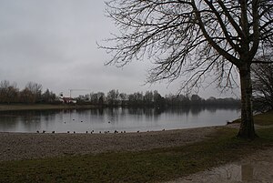
Stempflesee is an artificial lake in Augsburg-Haunstetten, Swabia, Bavaria, Germany. Its surface area is 0. 014 km2.
Ilsesee
Distance: Approx. 3188 meters
Latitude and longitude: 48.28222222,10.90055556
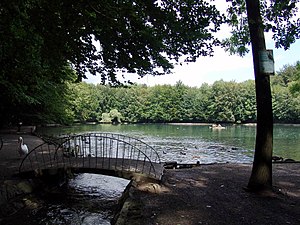
Ilsesee is a lake in Augsburg, Bavaria, Germany. At an elevation of, its surface area is ca. 12 ha.
Brunnenbach (Lochbach)
River in Germany
Distance: Approx. 2666 meters
Latitude and longitude: 48.28944444,10.91166667
Brunnenbach is a river of Bavaria, Germany. In earlier centuries, from at least 1412, the Brunnenbach supplied the city of Augsburg with drinking water. It originates in several springs in the Lech meadows south of the city.

Augsburg Messe station
Railway station in Augsburg, Göggingen
Distance: Approx. 3179 meters
Latitude and longitude: 48.33855556,10.88602778
Augsburg Messe station is a railway station in the town of Augsburg, located in Swabia, Bavaria, Germany.
Leopold Mozart Centre
University of music in Augsburg, Germany
Distance: Approx. 2606 meters
Latitude and longitude: 48.33388889,10.89833333
The Leopold Mozart Centre (German: Leopold-Mozart-Zentrum (LMZ) in Augsburg, Germany, is a university of music, founded as part of the University of Augsburg in 2008. It is located in the buildings of the former Musikhochschule as well as buildings on the university campus. The Leopold Mozart Centre was founded after the model of the Hochschule für Musik Mainz as part of the University of Mainz.

Inningen station
Railway station in Inningen, Germany
Distance: Approx. 1930 meters
Latitude and longitude: 48.31141,10.86876
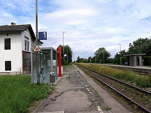
Inningen station (German: Bahnhof Inningen) is a train station in the Augsburg district Inningen, located in Swabia, Bavaria, Germany. It is served by DB Regio Bayern and Bayerische Regiobahn. AVV Bus service is available at the nearby Inningen Ost bus stop.
Weather in this IP's area
overcast clouds
0 Celsius
-1 Celsius
-1 Celsius
2 Celsius
1018 hPa
99 %
1018 hPa
957 hPa
6000 meters
1.54 m/s
260 degree
100 %
07:27:17
16:35:53


