81.89.228.101 - IP Lookup: Free IP Address Lookup, Postal Code Lookup, IP Location Lookup, IP ASN, Public IP
Country:
Region:
City:
Location:
Time Zone:
Postal Code:
ISP:
ASN:
language:
User-Agent:
Proxy IP:
Blacklist:
IP information under different IP Channel
ip-api
Country
Region
City
ASN
Time Zone
ISP
Blacklist
Proxy
Latitude
Longitude
Postal
Route
db-ip
Country
Region
City
ASN
Time Zone
ISP
Blacklist
Proxy
Latitude
Longitude
Postal
Route
IPinfo
Country
Region
City
ASN
Time Zone
ISP
Blacklist
Proxy
Latitude
Longitude
Postal
Route
IP2Location
81.89.228.101Country
Region
colorado
City
greenwood village
Time Zone
America/Denver
ISP
Language
User-Agent
Latitude
Longitude
Postal
ipdata
Country
Region
City
ASN
Time Zone
ISP
Blacklist
Proxy
Latitude
Longitude
Postal
Route
Popular places and events near this IP address
Cherry Creek High School
Public high school in Greenwood Village, Colorado, United States
Distance: Approx. 3719 meters
Latitude and longitude: 39.63055556,-104.88
Cherry Creek High School (commonly Cherry Creek, Creek, or CCHS) is the oldest of seven high schools in the Cherry Creek School District in the Denver metropolitan area. It is located in Greenwood Village, Colorado, and is the largest high school in the Denver metro area, with an 80-acre (320,000 m2) campus and approximately 3,800 students. Cherry Creek High School is ranked 16th in Colorado and 716th nationally, and ranked 2nd in Colorado for public schools behind Stargate Charter School.

Colorado Department of Military and Veterans Affairs
American government agency
Distance: Approx. 3569 meters
Latitude and longitude: 39.591573,-104.8413708
The Colorado Department of Military and Veterans Affairs is the principal department of the Colorado state government that supervises both the Colorado National Guard (including the Colorado Army National Guard and Colorado Air National Guard), and non-military state safety agencies. The Department consists of the Department of Military Affairs, and the Division of Veterans' Affairs, and is headed by the Adjutant General of Colorado.
Smoky Hill High School
Public school in Aurora, Colorado, United States
Distance: Approx. 3294 meters
Latitude and longitude: 39.62787,-104.7996
Smoky Hill High School, commonly Smoky or SHHS, is located in Aurora, Colorado, United States. It has an attendance of 2,133. Smoky Hill is part of the Cherry Creek School District and was the second high school built by the district in 1974.

Cherry Creek, Colorado
Census Designated Place in Colorado, United States
Distance: Approx. 2784 meters
Latitude and longitude: 39.6094629,-104.8644692
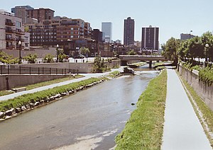
Cherry Creek is an unincorporated community and a census-designated place (CDP) located in and governed by Arapahoe County, Colorado, United States. The CDP is a part of the Denver–Aurora–Lakewood, CO Metropolitan Statistical Area. The population of the Cherry Creek CDP was 11,488 at the United States Census 2020.
Nine Mile station
Light rail station in Aurora, Colorado
Distance: Approx. 3854 meters
Latitude and longitude: 39.6577,-104.8446
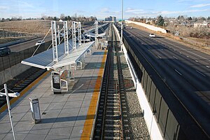
Nine Mile station is an island platformed RTD light rail station in Aurora, Colorado, United States. The station was opened on November 17, 2006, and is operated by the Regional Transportation District as part of the H and R lines. When it opened in 2006, it was the terminus of the H Line Southeast Corridor trains traveling along Interstate 225.
Dayton station
Light rail station in Aurora, Colorado
Distance: Approx. 4083 meters
Latitude and longitude: 39.6428,-104.8781
Dayton station is an island platformed RTD light rail station in Aurora, Colorado, United States. Operating as part of the H and R lines, the station was opened on November 17, 2006, and is operated by the Regional Transportation District.

Cherry Creek State Park
State park In Colorado, United States
Distance: Approx. 1056 meters
Latitude and longitude: 39.63055556,-104.84583333
Cherry Creek State Park is a state park in Arapahoe County, Colorado, United States. The park consists of a natural prairie and wetland environment with an 880-acre (3.6 km2) reservoir at its center which is shared by powerboats, sailboats, and paddle craft. An imported-sand swim beach is situated on the north-eastern side along with ample parking.
St. Mark Coptic Orthodox Church (Centennial, Colorado)
Church in Colorado , United States of America
Distance: Approx. 3887 meters
Latitude and longitude: 39.588798,-104.842671
St Mark Coptic Orthodox Church (Coptic: // transliteration: ti.eklyseya en.remenkimi en.orthodoxos ente fi.ethowab Markos) is one of the oldest Coptic Orthodox parishes to be established in North America.

Downslope Distilling
Distance: Approx. 3688 meters
Latitude and longitude: 39.59444444,-104.81694444
Downslope Distilling is a craft beverage distillery in Centennial, Colorado, United States.
Melvin School
United States historic place
Distance: Approx. 2943 meters
Latitude and longitude: 39.62668,-104.80353
The Melvin School is a former homestead located at 4950 S. Laredo St. in Aurora, Colorado. It was moved to its current site from its original location, 3 miles away.

Cherry Creek Dam
Dam in southeast metro Denver, Colorado, USA
Distance: Approx. 3360 meters
Latitude and longitude: 39.648,-104.8605
Cherry Creek Dam (National ID # CO01280) is a dam in Arapahoe County, Colorado, southeast of Denver. The earthen dam was constructed between 1948 and 1950 by the United States Army Corps of Engineers with a height of 141 feet (43 m) and a length of 14,300 feet (4,400 m) at its crest. It impounds Cherry Creek, a tributary of the South Platte River, for flood control.

2021 Colorado mid-air collision
2021 mid-air collision in Colorado, United States
Distance: Approx. 1241 meters
Latitude and longitude: 39.625,-104.85194444
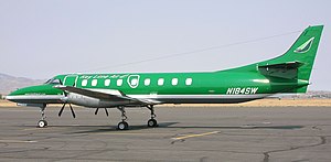
On 12 May 2021, Key Lime Air Flight 970, a Fairchild Swearingen Metroliner operating a chartered cargo flight from Salida to Centennial, Colorado collided in mid-air with a private Cirrus SR22. Despite having sustained severe damage, the Swearingen Metroliner managed to land safely while the Cirrus SR22 deployed its CAPS system and safely parachuted to the ground. All three occupants on board both aircraft survived uninjured.
Weather in this IP's area
scattered clouds
-6 Celsius
-11 Celsius
-8 Celsius
-5 Celsius
1033 hPa
52 %
1033 hPa
834 hPa
10000 meters
3.09 m/s
190 degree
40 %


