81.89.224.50 - IP Lookup: Free IP Address Lookup, Postal Code Lookup, IP Location Lookup, IP ASN, Public IP
Country:
Region:
City:
Location:
Time Zone:
Postal Code:
ISP:
ASN:
language:
User-Agent:
Proxy IP:
Blacklist:
IP information under different IP Channel
ip-api
Country
Region
City
ASN
Time Zone
ISP
Blacklist
Proxy
Latitude
Longitude
Postal
Route
db-ip
Country
Region
City
ASN
Time Zone
ISP
Blacklist
Proxy
Latitude
Longitude
Postal
Route
IPinfo
Country
Region
City
ASN
Time Zone
ISP
Blacklist
Proxy
Latitude
Longitude
Postal
Route
IP2Location
81.89.224.50Country
Region
nordrhein-westfalen
City
herford
Time Zone
Europe/Berlin
ISP
Language
User-Agent
Latitude
Longitude
Postal
ipdata
Country
Region
City
ASN
Time Zone
ISP
Blacklist
Proxy
Latitude
Longitude
Postal
Route
Popular places and events near this IP address

Herford Abbey
Oldest women's religious house in the Duchy of Saxony
Distance: Approx. 286 meters
Latitude and longitude: 52.113056,8.670278
Herford Abbey (German: Frauenstift Herford) was the oldest women's religious house in the Duchy of Saxony. It was founded as a house of secular canonesses in 789, initially in Müdehorst (near the modern Bielefeld) by a nobleman called Waltger, who moved it in about 800 onto the lands of his estate Herivurth (later Oldenhervorde) which stood at the crossing of a number of important roads and fords over the Aa and the Werre. The present city of Herford grew up on this site around the abbey.
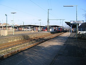
Herford station
Railway station in Herford, Germany
Distance: Approx. 843 meters
Latitude and longitude: 52.11944444,8.66388889
Herford station is a junction station with four platforms and seven platform tracks in the town of Herford in the German state of North Rhine-Westphalia. It lies on the quadruple track, electrified Hamm–Minden railway, a section of the original route of the historic Cologne-Minden Railway Company. In Herford Station, the line to Altenbeken branches off to the south and the Ravensberg Railway branches off towards the north to Bünde and Rahden with a connection to the Löhne–Rheine railway.

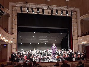
Nordwestdeutsche Philharmonie
German orchestra
Distance: Approx. 698 meters
Latitude and longitude: 52.11638889,8.68333333
The Nordwestdeutsche Philharmonie (North West German Philharmonic) is a German symphony orchestra based in Herford. Founded in 1950, the orchestra is one of the Landesorchester of the state of North Rhine-Westphalia, along with the Philharmonie Südwestfalen and the Landesjugendorchester NRW. The orchestra is funded partly by the state of North Rhine-Westphalia and an association of communities in the region Ostwestfalen-Lippe. Members of the association are the cities Bad Salzuflen, Bünde, Detmold, Herford, Lemgo, Minden and Paderborn and the districts Herford und Lippe.
Ravensberg Basin
Distance: Approx. 516 meters
Latitude and longitude: 52.11666667,8.66666667
The Ravensberg Basin (German: Ravensberger Mulde) or Ravensberg Hills (Ravensberger Hügelland) is a natural region in the governorate of Detmold (Ostwestfalen-Lippe) in the northeastern part of the German state of North Rhine-Westphalia; small elements also fall within the neighbouring state of Lower Saxony. It is part of the lower Weser Uplands and includes the hilly basin country between the Wiehen Hills in the north, Lippe Uplands in the east, Teutoburg Forest in the south and Osnabrück Hills in the west. The heart of the Ravensberg Basin is almost coincident with the cultural region of the Ravensberg Land.
Vivani
Chocolate manufacturer
Distance: Approx. 1091 meters
Latitude and longitude: 52.1161,8.6577
Vivani Organic Chocolate is a brand of chocolate created by EcoFinia GmbH, a subsidiary of Ludwig Weinrich GmbH & Co. KG., based in Herford, Germany. First introduced in 2000 at the international organic food fair, BioFach, Vivani chocolate is predominantly sold in organic supermarkets and shops, where it claims market leadership in organic chocolate bars.

Ravensberg Land
Distance: Approx. 516 meters
Latitude and longitude: 52.11666667,8.66666667
Ravensberg Land (German: Ravensberger Land) is a cultural landscape in the district of Ostwestfalen-Lippe in the northeast of the German federal state of North Rhine-Westphalia. It lies between the Wiehen Hills to the north, the Teutoburg Forest to the south, the state border with Lower Saxony to the west and the large bend in the River Weser and the boundary of Lippe district to the east. It thus essentially encompasses the Westphalian part of the Ravensberg Hills.

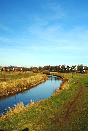
Aa (Werre)
River in Germany
Distance: Approx. 1015 meters
Latitude and longitude: 52.1236,8.6703
Aa (also: Westfälische Aa, "Westphalian Aa") is a river of North Rhine-Westphalia, Germany. It is a left tributary of the Werre, which it joins in Herford. It is formed by the confluence of two small streams in Bielefeld-Milse.

Bowerre
Former river in Germany
Distance: Approx. 520 meters
Latitude and longitude: 52.11777778,8.66777778
The Bowerre is a former branch of the river Werre in the centre of the town of Herford, North Rhine-Westphalia, Germany. The Bowerre formed the border between the Altstadt ("old town") and Neustadt ("new town") until the 1960s. It was the site of a linen mill from the 13th century until 1972, when the old course of the Werre was filled in, partly due to poor water quality.

Butterbach
River in Germany
Distance: Approx. 1236 meters
Latitude and longitude: 52.1258,8.6739
Butterbach, also known as Putchemühlenbach, is a small river of North Rhine-Westphalia, Germany. It is 4.4 km long and flows into the Werre in Herford.

Ellersieker Bach
River in Germany
Distance: Approx. 1288 meters
Latitude and longitude: 52.1061,8.6861
Ellersieker Bach is a river of North Rhine-Westphalia, Germany. It is 2.8 km long and flows into the Werre in Herford.

Stadttheater Herford
Distance: Approx. 740 meters
Latitude and longitude: 52.12055556,8.67861111
Stadttheater Herford is a theatre in Herford, North Rhine-Westphalia, Germany. It is a venue without an ensemble of its own.

Herford – Minden-Lübbecke II
Federal electoral district of Germany
Distance: Approx. 258 meters
Latitude and longitude: 52.11555556,8.67
Herford – Minden-Lübbecke II is an electoral constituency (German: Wahlkreis) represented in the Bundestag. It elects one member via first-past-the-post voting. Under the current constituency numbering system, it is designated as constituency 132.
Weather in this IP's area
overcast clouds
4 Celsius
4 Celsius
3 Celsius
4 Celsius
1034 hPa
96 %
1034 hPa
1019 hPa
0.99 m/s
0.94 m/s
196 degree
100 %

