Country:
Region:
City:
Latitude and Longitude:
Time Zone:
Postal Code:
IP information under different IP Channel
ip-api
Country
Region
City
ASN
Time Zone
ISP
Blacklist
Proxy
Latitude
Longitude
Postal
Route
Luminati
Country
City
douglas
ASN
Time Zone
Europe/Isle_of_Man
ISP
Domicilium (IOM) Limited
Latitude
Longitude
Postal
IPinfo
Country
Region
City
ASN
Time Zone
ISP
Blacklist
Proxy
Latitude
Longitude
Postal
Route
db-ip
Country
Region
City
ASN
Time Zone
ISP
Blacklist
Proxy
Latitude
Longitude
Postal
Route
ipdata
Country
Region
City
ASN
Time Zone
ISP
Blacklist
Proxy
Latitude
Longitude
Postal
Route
Popular places and events near this IP address
King William's College
Distance: Approx. 2064 meters
Latitude and longitude: 54.0792,-4.635
King William's College (nicknamed KWC or King Bill's; Manx: Colleish Ree Illiam) is a co-educational private school for pupils aged 3 to 18, located near Castletown on the Isle of Man. It is a member of the International Baccalaureate and Headmasters' and Headmistresses' Conference organisations. The College operates at two sites in or near Castletown: a main senior school campus on the shore of Castletown Bay, and a prep school (called The Buchan School) in the Westhill part of Castletown, two miles from the main campus.

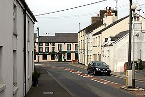
Ballasalla
Human settlement in the United Kingdom
Distance: Approx. 67 meters
Latitude and longitude: 54.097,-4.631
Ballasalla (from Manx Balley Sallagh 'place of willows') is a village in the parish of Malew in the south-east of the Isle of Man. The village is situated close to the Isle of Man Airport and 2 miles (3 km) north-east of the town of Castletown.

Rushen Abbey
Monastery on the Isle of Man, United Kingdom
Distance: Approx. 442 meters
Latitude and longitude: 54.09888889,-4.6375
Rushen Abbey is a former abbey on the Isle of Man, located in Ballasalla. Originally home for monks of the Savignac order, it soon came under Cistercian control and remained so until its dissolution. The abbey is located two miles (three kilometres) from Castle Rushen, the politically most important site on the island in medieval times.

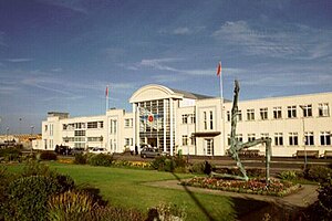
Isle of Man Airport
Airport on the Isle of Man
Distance: Approx. 1667 meters
Latitude and longitude: 54.08333333,-4.62333333
Isle of Man Airport (Manx: Purt Aer Vannin, also known as Ronaldsway Airport) (IATA: IOM, ICAO: EGNS) is the main civilian airport on the Isle of Man. It is located in the south of the island at Ronaldsway near Castletown, 6 nautical miles (11 km; 6.9 mi) southwest of Douglas, the island's capital. Along with the Isle of Man Sea Terminal, it is one of the two main gateways to the island.

Derbyhaven
Human settlement on the Isle of Man
Distance: Approx. 2158 meters
Latitude and longitude: 54.0784,-4.6265
Derbyhaven (Manx: Camys y Ree) ("King's Harbour" or "King's Cove") is a hamlet near Castletown in the southern parish of Malew, Isle of Man. It is located on the isthmus connecting Langness Peninsula to the rest of the island, on the bay of the same name, and also on Castletown Bay on the other side of the isthmus. In the 17th century it was a significant port.

Battle of Ronaldsway
Battle in 1275 in the southern part of the Isle of Man between a Scottish army and the Manx
Distance: Approx. 2036 meters
Latitude and longitude: 54.081,-4.618
The Battle of Ronaldsway took place in 1275 at Ronaldsway in the southern part of the Isle of Man between a Scottish army and the Manx. The battle crushed the final attempt by the Manx to re-establish the Norse Sudreyar dynasty. As the battle resulted in the death of the last Norse King of Mann, Guðrøðr Magnússon, and the emigration to Norway of the remaining members of the Manx royal family, it also led to the firm establishment of Scottish rule on the Isle of Man.

Malew
Parish on the Isle of Man
Distance: Approx. 2128 meters
Latitude and longitude: 54.11666667,-4.63333333
Malew ( mə-LOO; Manx: Malew) is one of the seventeen parishes of the Isle of Man. It is located in the south of the Island (part of the traditional South Side division) in the sheading of Rushen. Administratively, part of the historic parish of Malew is now covered by the town of Castletown.

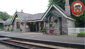
Ballasalla railway station
Railway station in the Isle of Man
Distance: Approx. 174 meters
Latitude and longitude: 54.09611111,-4.63027778
Ballasalla Railway Station (Manx: Stashoon Raad Yiarn Valley Sallagh) is located in the village of Ballasalla in the south of the Isle of Man, close to the airport, and is served on a seasonal basis by the Isle of Man Railway. It forms part of the sole remaining section of the once extensive network (46 miles, 74 km) that operated across the island. Ballasalla was the usual crossing point for trains, making it popular with photographers, until the introduction of the 2015 timetable which saw all trains passing at Castletown.

Castletown railway station
Station on the Isle of Man
Distance: Approx. 2403 meters
Latitude and longitude: 54.07888889,-4.64944444
Castletown Railway Station (Manx: Stashoon Raad Yiarn Valley Chashtal) is an intermediate station on the Isle of Man Railway on the Isle of Man forming part of sole remaining section of the once extensive network that operated across the island. The station is the busiest of the railway's intermediate stations, being the closest to a number of local visitor attractions. In peak season service trains often pass here, making the station one of the railway's more active stopping places.

Ronaldsway railway station
Railway station in Isle of Man
Distance: Approx. 1294 meters
Latitude and longitude: 54.0881,-4.6425
Ronaldsway Halt (Manx: Stadd Roonysvaie) is a request stop on the Isle of Man Railway between Castletown and Ballasalla at Ronaldsway, near the Isle of Man Airport.

Manx Aviation and Military Museum
Military museum in Castletown, Isle of Man
Distance: Approx. 1637 meters
Latitude and longitude: 54.0834,-4.6376
The Manx Aviation and Military Museum is a museum dedicated to the history of aviation and the military on the Isle of Man. Established in 2000, the museum is run by volunteers and features c. 9,000 exhibits.
Silverdale Glen
Distance: Approx. 1498 meters
Latitude and longitude: 54.11,-4.64
Silverdale Glen is a National Glen, and recreational area. It is situated near the village of Ballasalla, in the parish of Malew, on the Isle of Man. The recreation site consists of a small boating lake, café, playing fields, and a playground with a Victorian water-powered carousel.
Weather in this IP's area
broken clouds
12 Celsius
12 Celsius
12 Celsius
12 Celsius
1032 hPa
94 %
1032 hPa
1029 hPa
10000 meters
1.54 m/s
360 degree
75 %
07:45:27
16:20:47