Country:
Region:
City:
Latitude and Longitude:
Time Zone:
Postal Code:
IP information under different IP Channel
ip-api
Country
Region
City
ASN
Time Zone
ISP
Blacklist
Proxy
Latitude
Longitude
Postal
Route
Luminati
Country
ASN
Time Zone
Europe/Berlin
ISP
ISPpro Internet KG
Latitude
Longitude
Postal
IPinfo
Country
Region
City
ASN
Time Zone
ISP
Blacklist
Proxy
Latitude
Longitude
Postal
Route
db-ip
Country
Region
City
ASN
Time Zone
ISP
Blacklist
Proxy
Latitude
Longitude
Postal
Route
ipdata
Country
Region
City
ASN
Time Zone
ISP
Blacklist
Proxy
Latitude
Longitude
Postal
Route
Popular places and events near this IP address

Hermsdorf, Thuringia
Town in Thuringia, Germany
Distance: Approx. 1061 meters
Latitude and longitude: 50.89805556,11.85666667
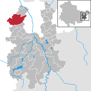
Hermsdorf (German pronunciation: [ˈhɛʁmsˌdɔʁf] ) is a town in the Saale-Holzland district of the state of Thuringia in eastern Germany. It is especially known for the motorway junction "Hermsdorfer Kreuz" where the two German autobahns A 4 (Frankfurt - Dresden) and A 9 (Berlin - Munich) meet. Hermsdorf-Klosterlausnitz station is on the Weimar–Gera railway.

Kraftsdorf
Municipality in Thuringia, Germany
Distance: Approx. 3674 meters
Latitude and longitude: 50.87583333,11.91388889
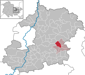
Kraftsdorf is a municipality in the district of Greiz, in Thuringia, Germany.

Mörsdorf, Thuringia
Municipality in Thuringia, Germany
Distance: Approx. 5289 meters
Latitude and longitude: 50.87138889,11.80027778
Mörsdorf is a municipality in the district Saale-Holzland, in Thuringia, Germany.

Reichenbach, Thuringia
Municipality in Thuringia, Germany
Distance: Approx. 3003 meters
Latitude and longitude: 50.86666667,11.88333333
Reichenbach is a municipality in the district Saale-Holzland, in Thuringia, Germany.

Sankt Gangloff
Municipality in Thuringia, Germany
Distance: Approx. 5172 meters
Latitude and longitude: 50.85,11.9
Sankt Gangloff or St. Gangloff is a municipality in the district Saale-Holzland, in Thuringia, Germany.

Weißenborn, Thuringia
Municipality in Thuringia, Germany
Distance: Approx. 3425 meters
Latitude and longitude: 50.92166667,11.88055556
Weißenborn is a municipality in the district Saale-Holzland, in Thuringia, Germany. It is located near the A4 and A9 Motorways.
Bad Klosterlausnitz
Municipality in Thuringia, Germany
Distance: Approx. 2759 meters
Latitude and longitude: 50.91666667,11.86666667
Bad Klosterlausnitz is a municipality in the district Saale-Holzland, in Thuringia, Germany.

Schleifreisen
Municipality in Thuringia, Germany
Distance: Approx. 3096 meters
Latitude and longitude: 50.89055556,11.82416667
Schleifreisen is a municipality in the district Saale-Holzland, in Thuringia, Germany.

Tautenhain, Thuringia
Municipality in Thuringia, Germany
Distance: Approx. 4993 meters
Latitude and longitude: 50.92388889,11.91805556
Tautenhain is a municipality in the district Saale-Holzland, in Thuringia, Germany.
Hermsdorf (Verwaltungsgemeinschaft)
Distance: Approx. 1061 meters
Latitude and longitude: 50.89805556,11.85666667
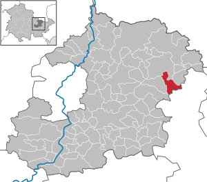
Hermsdorf (German pronunciation: [ˈhɛʁmsˌdɔʁf] ) is a Verwaltungsgemeinschaft ("collective municipality") in the district Saale-Holzland, in Thuringia, Germany. The seat of the Verwaltungsgemeinschaft is in Hermsdorf.
Thuringian Holzland
Distance: Approx. 4658 meters
Latitude and longitude: 50.92694444,11.83194444
The Thuringian Holzland (German: Thüringer Holzland) is an upland region in the state of Thuringia, Germany.

Hermsdorf-Klosterlausnitz station
Railway station in Hermsdorf, Germany
Distance: Approx. 1476 meters
Latitude and longitude: 50.903611,11.858333
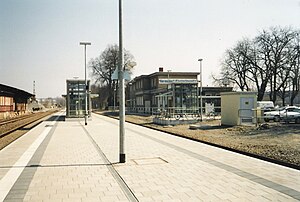
Hermsdorf-Klosterlausnitz station is a station on the Weimar–Gera railway, which forms part of the Mid-Germany Railway (Mitte-Deutschland-Verbindung), in the German state of Thuringia. The station is located in the town of Hermsdorf and the tracks separate the old and new town. During the modernisation of the Mid-Germany Railway, the station received a new island platform and was reduced to two through tracks.
Weather in this IP's area
broken clouds
4 Celsius
0 Celsius
3 Celsius
5 Celsius
1015 hPa
68 %
1015 hPa
973 hPa
10000 meters
4.71 m/s
10.84 m/s
215 degree
72 %
07:30:37
16:24:21
