Country:
 Switzerland
Region:
City:
Latitude and Longitude:
Time Zone:
Postal Code:
IP information under different IP Channel
ip-api
Country
Region
City
ASN
Time Zone
ISP
Blacklist
Proxy
Latitude
Longitude
Postal
Route
IPinfo
Country
Region
City
ASN
Time Zone
ISP
Blacklist
Proxy
Latitude
Longitude
Postal
Route
MaxMind
Country
Region
City
ASN
Time Zone
ISP
Blacklist
Proxy
Latitude
Longitude
Postal
Route
Luminati
Country
CHRegion
ag
City
wildegg
ASN
Time Zone
Europe/Zurich
ISP
green.ch AG
Latitude
Longitude
Postal
db-ip
Country
Region
City
ASN
Time Zone
ISP
Blacklist
Proxy
Latitude
Longitude
Postal
Route
ipdata
Country
Region
City
ASN
Time Zone
ISP
Blacklist
Proxy
Latitude
Longitude
Postal
Route
Popular places and events near this IP address

Auenstein, Aargau
Municipality in Aargau, Switzerland
Distance: Approx. 2086 meters
Latitude and longitude: 47.41666667,8.13333333
Auenstein is a municipality in the district of Brugg in the canton of Aargau in Switzerland. It is located about 3 km (1.9 mi) north west of Lenzburg.

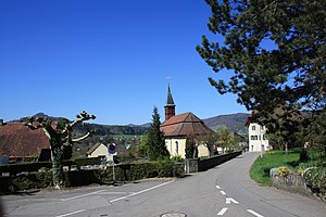
Veltheim, Aargau
Municipality in Aargau, Switzerland
Distance: Approx. 1948 meters
Latitude and longitude: 47.43333333,8.15
Veltheim is a municipality in the district of Brugg in the canton of Aargau in Switzerland.
Holderbank, Aargau
Municipality in Aargau, Switzerland
Distance: Approx. 1813 meters
Latitude and longitude: 47.43333333,8.16666667
Holderbank is a municipality in the district of Lenzburg in the canton of Aargau in Switzerland.
Möriken-Wildegg
Municipality in Aargau, Switzerland
Distance: Approx. 1685 meters
Latitude and longitude: 47.41666667,8.18333333
Möriken-Wildegg is a municipality in the district of Lenzburg in the canton of Aargau in Switzerland.
Niederlenz
Municipality in Aargau, Switzerland
Distance: Approx. 2574 meters
Latitude and longitude: 47.4,8.18333333
Niederlenz is a municipality in the district of Lenzburg in the canton of Aargau in Switzerland.

Rupperswil
Municipality in Aargau, Switzerland
Distance: Approx. 2853 meters
Latitude and longitude: 47.4,8.13333333
Rupperswil is a municipality in the district of Lenzburg in the canton of Aargau in Switzerland.

Aabach (Seetal)
River in Switzerland
Distance: Approx. 61 meters
Latitude and longitude: 47.4176,8.1618
The Aabach is a small river that runs through the Swiss cantons of Lucerne and Aargau, in the Aare catchment area. It flows from south to north through the valley called Seetal (lit.: Lake Valley) and ends in the Aare.

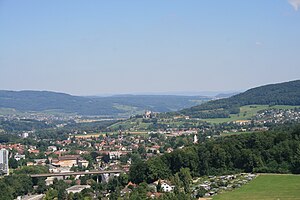
Lenzburg railway station
Railway station in Switzerland
Distance: Approx. 3013 meters
Latitude and longitude: 47.39118889,8.17036944
Lenzburg railway station (German: Bahnhof Lenzburg) is a railway station in the municipality of Lenzburg in the Swiss canton of Aargau. The station is located on the Heitersberg line, part of the Zurich to Olten main line, to the west of the junction with the Rupperswil–Immensee line and to the east of the junction with the Zofingen–Wettingen line. The Seetal line, which, despite being a standard gauge Swiss Federal Railways line, retains some characteristics of a roadside tramway, terminates at a platform across the street from the main station.
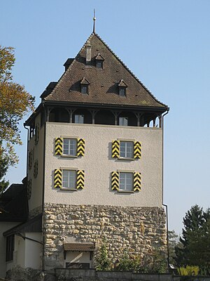
Auenstein Castle
Castle in Switzerland
Distance: Approx. 1616 meters
Latitude and longitude: 47.41541111,8.13976944
Auenstein Castle (German: Schloss Auenstein) is a castle in the municipality of Auenstein in the Swiss canton of Aargau.
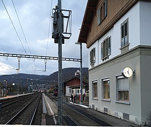
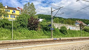
Wildegg railway station
Railway station in Switzerland
Distance: Approx. 290 meters
Latitude and longitude: 47.41526806,8.16299
Wildegg railway station (German: Bahnhof Wildegg) is a railway station in the municipality of Möriken-Wildegg, in the Swiss canton of Aargau. It is an intermediate stop on the Baden–Aarau line and is served by local and long-distance trains.
Holderbank railway station
Railway station in Switzerland
Distance: Approx. 1308 meters
Latitude and longitude: 47.42862694,8.16659
Holderbank railway station (German: Bahnhof Holderbank) is a railway station in the municipality of Holderbank, in the Swiss canton of Aargau. It is an intermediate stop on the Baden–Aarau line.

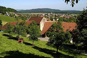
Wildegg Castle
Building in Aargau, Switzerland
Distance: Approx. 785 meters
Latitude and longitude: 47.42051944,8.17041944
Wildegg Castle is a small castle in the municipality of Möriken-Wildegg in the canton of Aargau in Switzerland.
Weather in this IP's area
overcast clouds
14 Celsius
14 Celsius
13 Celsius
15 Celsius
1005 hPa
97 %
1005 hPa
964 hPa
10000 meters
0.37 m/s
0.74 m/s
134 degree
95 %
07:36:08
18:53:12