Country:
Region:
City:
Latitude and Longitude:
Time Zone:
Postal Code:
IP information under different IP Channel
ip-api
Country
Region
City
ASN
Time Zone
ISP
Blacklist
Proxy
Latitude
Longitude
Postal
Route
Luminati
Country
ASN
Time Zone
Europe/Helsinki
ISP
Sofor Oy
Latitude
Longitude
Postal
IPinfo
Country
Region
City
ASN
Time Zone
ISP
Blacklist
Proxy
Latitude
Longitude
Postal
Route
db-ip
Country
Region
City
ASN
Time Zone
ISP
Blacklist
Proxy
Latitude
Longitude
Postal
Route
ipdata
Country
Region
City
ASN
Time Zone
ISP
Blacklist
Proxy
Latitude
Longitude
Postal
Route
Popular places and events near this IP address

Kauhava
Town in Southern Ostrobothnia, Finland
Distance: Approx. 389 meters
Latitude and longitude: 63.1,23.06666667
Kauhava is a town and municipality of Finland. It is part of the Southern Ostrobothnia region, 400 kilometres (250 mi) northwest of Helsinki and by the main railway from Helsinki to Oulu. The town has a population of 15,110 (31 August 2024) and covers an area of 1,328.09 square kilometres (512.78 sq mi) of which 14.63 km2 (5.65 sq mi) is water.

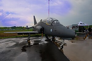
Kauhava Airfield
Airport in Kauhava, Finland
Distance: Approx. 2560 meters
Latitude and longitude: 63.12416667,23.05111111
Kauhava Airfield (IATA: KAU, ICAO: EFKA; Finnish: Kauhavan lentokenttä) is an airfield located in Kauhava, Finland, 3 kilometres (2 mi) north of Kauhava town centre. The airfield used to be a military airport until the end of 2014, owned and operated by Finavia. Training Air Wing of the Finnish Air Force was based at the airport.
Weather in this IP's area
broken clouds
7 Celsius
4 Celsius
7 Celsius
8 Celsius
980 hPa
84 %
980 hPa
976 hPa
10000 meters
5.17 m/s
13.86 m/s
230 degree
73 %
08:51:20
15:34:05