81.31.215.85 - IP Lookup: Free IP Address Lookup, Postal Code Lookup, IP Location Lookup, IP ASN, Public IP
Country:
Region:
City:
Location:
Time Zone:
Postal Code:
ISP:
ASN:
language:
User-Agent:
Proxy IP:
Blacklist:
IP information under different IP Channel
ip-api
Country
Region
City
ASN
Time Zone
ISP
Blacklist
Proxy
Latitude
Longitude
Postal
Route
db-ip
Country
Region
City
ASN
Time Zone
ISP
Blacklist
Proxy
Latitude
Longitude
Postal
Route
IPinfo
Country
Region
City
ASN
Time Zone
ISP
Blacklist
Proxy
Latitude
Longitude
Postal
Route
IP2Location
81.31.215.85Country
Region
england
City
lewes
Time Zone
Europe/London
ISP
Language
User-Agent
Latitude
Longitude
Postal
ipdata
Country
Region
City
ASN
Time Zone
ISP
Blacklist
Proxy
Latitude
Longitude
Postal
Route
Popular places and events near this IP address

Lewes
County town and civil parish in East Sussex, England
Distance: Approx. 128 meters
Latitude and longitude: 50.87472222,0.01166667
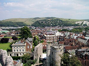
Lewes ( ) is the county town of East Sussex, England. The town is the administrative centre of the wider district of the same name. It lies on the River Ouse at the point where the river cuts through the South Downs.

Lewes District
Non-metropolitan district in England
Distance: Approx. 172 meters
Latitude and longitude: 50.87388889,0.00888889
Lewes is a local government district in East Sussex, England. The district is named after the town of Lewes. The largest town is Seaford.
Lewes Castle
Castle in East Sussex, England
Distance: Approx. 271 meters
Latitude and longitude: 50.8729,0.0076
Lewes Castle is a medieval castle in the town of Lewes in East Sussex, England. Originally called Bray Castle, it occupies a commanding position guarding the gap in the South Downs cut by the River Ouse and occupied by the towns of Lewes and Cliffe. It stands on a man-made mount just to the north of the high street in Lewes, and is constructed from local limestone and flint blocks.
Lewes Crown Court
County building in Lewes, East Sussex, England
Distance: Approx. 137 meters
Latitude and longitude: 50.873,0.0096
Lewes Crown Court is a Crown Court venue in Lewes High Street, Lewes, East Sussex, England. It forms part of the Lewes Combined Court Centre which it shares with Lewes County Court. The building, which was known as the "County Hall" from an early stage, was also the headquarters of East Sussex County Council from 1889 to 1938: it is a Grade II* listed building.

Church of St John sub Castro, Lewes
Church in East Sussex , England
Distance: Approx. 299 meters
Latitude and longitude: 50.876,0.0094
The Church of St John sub Castro is an Anglican church in Lewes, the county town of East Sussex, England (grid reference TQ 414 104). It was built in 1839 on the site of an 11th-century Saxon church, and has been designated by English Heritage as a Grade II listed building. In the churchyard is a memorial to Finnish prisoners from the Crimean War who died while confined in Lewes Naval Prison; the memorial is also listed Grade II. The church continues to be active as a parish church in the diocese of Chichester.

Lewes War Memorial
War memorial in Lewes, England
Distance: Approx. 25 meters
Latitude and longitude: 50.87341,0.01111
Lewes War Memorial is a war memorial at the top of School Hill in the centre of Lewes in East Sussex, prominently sited at the junction of High Street and Market Street. It commemorates 251 men from Lewes who died in the First World War, and 126 who died in the Second World War. It was unveiled in 1922 and became a listed building in 1985.

Pelham House
County building in Lewes, East Sussex, England
Distance: Approx. 188 meters
Latitude and longitude: 50.8723,0.0096
Pelham House is a large red-bricked building at St Andrews Lane in Lewes, East Sussex. The building which was the headquarters of East Sussex County Council from 1938 to 1968, is a Grade II listed building.

Barbican House
House next to Lewes castle, East Sussex
Distance: Approx. 232 meters
Latitude and longitude: 50.8726,0.0084
Barbican House is a sixteenth century house next to Lewes Castle. It is now used as a museum, and is the headquarters of the Sussex Archaeological Society. The house is a Grade II* listed building.
Lewes Town Hall
Municipal building in Lewes, East Sussex, England
Distance: Approx. 63 meters
Latitude and longitude: 50.8736,0.0104
Lewes Town Hall is a municipal building in the High Street in Lewes, East Sussex, England. The structure, which is the meeting place of Lewes Town Council, is a Grade II listed building.

Lewes bus station
Bus station in Lewes, England
Distance: Approx. 207 meters
Latitude and longitude: 50.8747,0.01368
Lewes bus station was a bus station in Lewes, England. It opened on 26 March 1954 as a terminus for Southdown Motor Services routes. The adjacent bus depot was opened several months earlier.

Fitzroy House
Building in Lewes
Distance: Approx. 243 meters
Latitude and longitude: 50.874,0.0147
Fitzroy House is a Victorian building on the High Street in Lewes, East Sussex, England. It was originally Fitzroy Memorial Library, designed by architect George Gilbert Scott in neo-Gothic style and built in 1862. In 1897 it became Lewes' first public library, until 1956 when it became offices.
Lewes Friends Meeting House
Church in East Sussex , United Kingdom
Distance: Approx. 208 meters
Latitude and longitude: 50.8727,0.0139
Lewes Friends Meeting House is a Religious Society of Friends (Quaker) place of worship in the town of Lewes, part of the district of the same name in East Sussex, England. A Quaker community became established in the town in 1655 when George Fox, prominent Dissenter and founder of the Religious Society of Friends, first visited. A meeting house opened in 1675 and a burial ground was erected in 1697.
Weather in this IP's area
overcast clouds
7 Celsius
5 Celsius
6 Celsius
8 Celsius
988 hPa
93 %
988 hPa
984 hPa
10000 meters
3.13 m/s
7.6 m/s
165 degree
100 %


