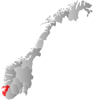
Country:
 Norway
Region:
City:
Latitude and Longitude:
Time Zone:
Postal Code:
IP information under different IP Channel
ip-api
Country
Region
City
ASN
Time Zone
ISP
Blacklist
Proxy
Latitude
Longitude
Postal
Route
IPinfo
Country
Region
City
ASN
Time Zone
ISP
Blacklist
Proxy
Latitude
Longitude
Postal
Route
MaxMind
Country
Region
City
ASN
Time Zone
ISP
Blacklist
Proxy
Latitude
Longitude
Postal
Route
Luminati
Country
NOASN
Time Zone
Europe/Oslo
ISP
Globalconnect As
Latitude
Longitude
Postal
db-ip
Country
Region
City
ASN
Time Zone
ISP
Blacklist
Proxy
Latitude
Longitude
Postal
Route
ipdata
Country
Region
City
ASN
Time Zone
ISP
Blacklist
Proxy
Latitude
Longitude
Postal
Route
Popular places and events near this IP address
Mossige
Village in Western Norway, Norway
Distance: Approx. 6084 meters
Latitude and longitude: 58.69277778,5.72055556
Mossige is a village in Time municipality in Rogaland county, Norway. The village is a small farming village composed of about one dozen farms and homes. It is located about 5 kilometres (3.1 mi) southeast of the town of Bryne, the same distance northeast of the village of Nærbø, and about 3.5 kilometres (2.2 mi) west of the village of Undheim.

Varhaug
Village in Western Norway, Norway
Distance: Approx. 5378 meters
Latitude and longitude: 58.61805556,5.65694444
Varhaug is the administrative centre of Hå municipality in Rogaland county, Norway. The village is located in the district of Jæren and it is the second largest village in Hå municipality after Nærbø. It was also the administrative centre for the former municipality of Varhaug from 1894 until its dissolution in 1964.

Nærbø
Village in Western Norway, Norway
Distance: Approx. 421 meters
Latitude and longitude: 58.66527778,5.63777778
Nærbø is the largest village in Hå municipality in Rogaland county, Norway. The village is located in the district of Jæren, about half-way between the town of Bryne and the village of Varhaug. The village sits about 38 kilometres (24 mi) south of Norway's fourth largest city, Stavanger.
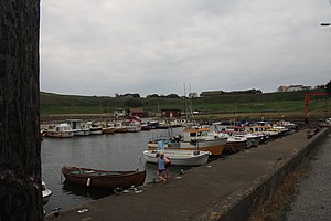
Obrestad
Village in Western Norway, Norway
Distance: Approx. 3790 meters
Latitude and longitude: 58.655,5.56777778
Obrestad is a very small farming village in Hå municipality in Rogaland county, Norway. The village is located in the district of Jæren on the shore of the North Sea, about 4 kilometres (2.5 mi) west of the village of Nærbø. A harbour was constructed in Obrestad in 1874 and it is still in use.
Nærbø Station
Railway station in Hå, Norway
Distance: Approx. 547 meters
Latitude and longitude: 58.66527778,5.64
Nærbø Station (Norwegian: Nærbø stasjon) is a railway station located at Nærbø in Hå, Norway on Sørlandet Line. The station is served by the Jæren Commuter Rail between Stavanger and Egersund, and one of the two bihourly train services as Nærbø as its terminal station. The station is 37.68 kilometers (23.41 mi) south of the city of Stavanger.
Varhaug Station
Railway station in Hå, Norway
Distance: Approx. 5205 meters
Latitude and longitude: 58.61833333,5.64611111
Varhaug Station (Norwegian: Varhaug stasjon) is a railway station located at Varhaug in Hå, Norway on the Sørlandet Line. The station is served by the Jæren Commuter Rail between Stavanger and Egersund. The station is 43.11 kilometres (26.79 mi) south of the city of Stavanger.
Åna Prison
Prison in Hå, Norway
Distance: Approx. 3812 meters
Latitude and longitude: 58.64369056,5.68311861
Åna Prison (Norwegian: Åna fengsel) is a prison in Hå municipality in Rogaland, Norway. It is one of the largest prisons and has capacity for 219 inmates, 140 in a closed prison and 24 in a department with an open prison. The prison is for male inmates.

Orre Church
Church in Rogaland, Norway
Distance: Approx. 6861 meters
Latitude and longitude: 58.715485,5.564353
Orre Church (Norwegian: Orre kyrkje) is a parish church of the Church of Norway in Klepp Municipality in Rogaland county, Norway. It is located in the village of Pollestad. It is the main church for the Orre parish which is part of the Jæren prosti (deanery) in the Diocese of Stavanger.
Nærbø (municipality)
Former municipality in Rogaland, Norway
Distance: Approx. 421 meters
Latitude and longitude: 58.66527778,5.63777778
Nærbø is a former municipality in Rogaland county, Norway. The administrative centre of the municipality was the village of Nærbø where the Old Nærbø Church is located. The 65-square-kilometre (25 sq mi) municipality was located in the district of Jæren inside the northern part of the present-day municipality of Hå.

Varhaug (municipality)
Former municipality in Rogaland, Norway
Distance: Approx. 5378 meters
Latitude and longitude: 58.61805556,5.65694444
Varhaug is a former municipality in Rogaland county, Norway. The 85-square-kilometre (33 sq mi) municipality existed from 1894 until 1964. The administrative centre of the municipality was the village of Varhaug where Varhaug Church is located.

Nærbø Church
Church in Rogaland, Norway
Distance: Approx. 1662 meters
Latitude and longitude: 58.658295,5.656895
Nærbø Church (Norwegian: Nærbø kirke) is a parish church of the Church of Norway in Hå Municipality in Rogaland county, Norway. It is located in the village of Nærbø. It is the main church for the Nærbø parish which is part of the Jæren prosti (deanery) in the Diocese of Stavanger.

Old Nærbø Church
Church in Rogaland, Norway
Distance: Approx. 339 meters
Latitude and longitude: 58.662441,5.626223
Old Nærbø Church (Norwegian: Nærbø gamle kirke) is a former parish church of the Church of Norway in Hå Municipality in Rogaland county, Norway. It is located in the village of Nærbø. It used to be the main church for the Nærbø parish which is part of the Jæren prosti (deanery) in the Diocese of Stavanger.
Weather in this IP's area
scattered clouds
11 Celsius
10 Celsius
10 Celsius
12 Celsius
1030 hPa
94 %
1030 hPa
1026 hPa
10000 meters
4.63 m/s
6.53 m/s
358 degree
42 %
07:11:47
19:52:10