Country:
 Norway
Region:
City:
Latitude and Longitude:
Time Zone:
Postal Code:
IP information under different IP Channel
ip-api
Country
Region
City
ASN
Time Zone
ISP
Blacklist
Proxy
Latitude
Longitude
Postal
Route
IPinfo
Country
Region
City
ASN
Time Zone
ISP
Blacklist
Proxy
Latitude
Longitude
Postal
Route
MaxMind
Country
Region
City
ASN
Time Zone
ISP
Blacklist
Proxy
Latitude
Longitude
Postal
Route
Luminati
Country
NOASN
Time Zone
Europe/Oslo
ISP
Globalconnect As
Latitude
Longitude
Postal
db-ip
Country
Region
City
ASN
Time Zone
ISP
Blacklist
Proxy
Latitude
Longitude
Postal
Route
ipdata
Country
Region
City
ASN
Time Zone
ISP
Blacklist
Proxy
Latitude
Longitude
Postal
Route
Popular places and events near this IP address
Strand, Norway
Municipality in Rogaland, Norway
Distance: Approx. 6233 meters
Latitude and longitude: 59.06333333,6.02777778
Strand is a municipality in Rogaland county, Norway. It is located in the traditional district of Ryfylke. The administrative centre of the municipality is the town of Jørpeland.

Holta
Village in Western Norway, Norway
Distance: Approx. 6850 meters
Latitude and longitude: 59.0875,6.02777778
Holta is a small farming village in the municipality of Strand in Rogaland county, Norway. The farm is situated on the northern hills overlooking the lake Bjørheimsvatn. It is approximately 9 kilometres (5.6 mi) northeast of the village of Tau and about 4 kilometres (2.5 mi) south of the village of Fiskå.

Haugaland
District in Rogaland and Vestland, Norway
Distance: Approx. 1169 meters
Latitude and longitude: 59.071,5.9291
Haugaland or Haugalandet is a traditional district situated on the western coast of Norway. Haugaland is one of the 15 traditional districts located within the Vestlandet region. Geographically, Haugaland is a peninsula between Bømlafjorden in Vestland county and Boknafjorden in the northern part of Rogaland county, Nord-Rogaland.

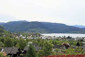
Tau, Norway
Village in Rogaland, Norway
Distance: Approx. 367 meters
Latitude and longitude: 59.06472222,5.92222222
Tau is a village in Strand municipality in Rogaland county, Norway. The village is located on the shore of the Horgefjorden, a branch of the main Boknafjorden. Strand Church is located in the village.
Vostervatnet
Lake in Strand, Norway
Distance: Approx. 5090 meters
Latitude and longitude: 59.0959,5.9784
Vostervatnet is a lake in the municipality of Strand in Rogaland county, Norway. The 2.62-square-kilometre (1.01 sq mi) lake lies in the northwestern part of Strand, just south of the Fognafjorden. The village of Tau lies about 3.5 kilometres (2.2 mi) southwest of the lake.

Ryfast
Sub-sea tunnel system in Rogaland county, Norway
Distance: Approx. 6850 meters
Latitude and longitude: 59.03138889,5.815
Ryfast is a subsea tunnel system in Rogaland county, Norway. The tunnel system is part of the Norwegian National Road 13, and it runs between the city of Stavanger in Stavanger Municipality, under a large fjord, and the area of Solbakk in the municipality of Strand. When the last section was drilled on 26 October 2017, Ryfast became the longest undersea road tunnel in the world, with its 14.3-kilometre (8.9 mi) length greater than the Eysturoyartunnilin in the Faroe Islands at 11.2 kilometres (7.0 mi), the Tokyo Bay Tunnel in Japan at 9.6 kilometres (6.0 mi), and the Shanghai Yangtze River Tunnel at nine kilometres (5.6 mi) in China.

Sør-Hidle
Island in Norway
Distance: Approx. 5706 meters
Latitude and longitude: 59.0447,5.825
Hidle or Sør-Hidle is an island in Strand municipality in Rogaland county, Norway. The 1.4-square-kilometre (0.54 sq mi) island lies at the southeastern edge of a large archipelago of islands located between the Boknafjorden and the mouth of the Høgsfjorden, just to the northeast of city of Stavanger. The village of Tau lies about 5 kilometres (3.1 mi) east of the island.
Flor og Fjære
Distance: Approx. 5585 meters
Latitude and longitude: 59.05238056,5.82310556
Flor og Fjære is a collection of man-made tropical gardens on the island of Sør-Hidle outside of Stavanger, Norway. The gardens and restaurant opened to the public in 1995, hosting two tours per day during their season from the beginning of May until the end of September. In 2013, Flor og Fjære hosted close to 35,000 guests during its five-month season.

Talgje Church
Church in Rogaland, Norway
Distance: Approx. 6633 meters
Latitude and longitude: 59.10627,5.84148
Talgje Church (Norwegian: Talgje kyrkje) is a parish church of the Church of Norway in the large Stavanger Municipality in Rogaland county, Norway. It is located on the island of Talgje. It is one of the two churches for the Talgje parish which is part of the Tungenes prosti (deanery) in the Diocese of Stavanger.

Heng, Rogaland
Island in Norway
Distance: Approx. 4815 meters
Latitude and longitude: 59.0206,5.8939
Heng is a small island in the Strand municipality of Rogaland, Norway. The 0.6-square-kilometre (150-acre) island lies in the Idsefjorden, about 3 kilometres (1.9 mi) southwest of the village of Tau on the mainland. Heng lies roughly halfway between the islands of Hidle and Idse.

Strand Church (Rogaland)
Church in Rogaland, Norway
Distance: Approx. 1372 meters
Latitude and longitude: 59.051204,5.93082
Strand Church (Norwegian: Strand kirke) is a parish church of the Church of Norway in Strand Municipality in Rogaland county, Norway. It is located in the village of Tau. It is the church for the Strand parish which is part of the Ryfylke prosti (deanery) in the Diocese of Stavanger.

Ryfylke Tunnel
Underwater road tunnel in Norway
Distance: Approx. 6850 meters
Latitude and longitude: 59.03138889,5.815
The Ryfylke Tunnel (Norwegian: Ryfylketunnelen) is an undersea road tunnel in Rogaland county, Norway. It is part of the Norwegian National Road 13 running between Stavanger and Ryfylke (district) under the Horgefjord (part of the Boknafjord). The tunnel is part of the Ryfast project.
Weather in this IP's area
scattered clouds
11 Celsius
10 Celsius
10 Celsius
12 Celsius
1030 hPa
64 %
1030 hPa
1028 hPa
10000 meters
2.56 m/s
2.67 m/s
3 degree
46 %
07:10:20
19:51:18