Country:
Region:
City:
Latitude and Longitude:
Time Zone:
Postal Code:
IP information under different IP Channel
ip-api
Country
Region
City
ASN
Time Zone
ISP
Blacklist
Proxy
Latitude
Longitude
Postal
Route
Luminati
Country
ASN
Time Zone
Europe/Oslo
ISP
Globalconnect As
Latitude
Longitude
Postal
IPinfo
Country
Region
City
ASN
Time Zone
ISP
Blacklist
Proxy
Latitude
Longitude
Postal
Route
db-ip
Country
Region
City
ASN
Time Zone
ISP
Blacklist
Proxy
Latitude
Longitude
Postal
Route
ipdata
Country
Region
City
ASN
Time Zone
ISP
Blacklist
Proxy
Latitude
Longitude
Postal
Route
Popular places and events near this IP address

Henie Onstad Kunstsenter
Distance: Approx. 440 meters
Latitude and longitude: 59.888775,10.55293333
The Henie Onstad Kunstsenter is an art museum located at Høvikodden in Bærum municipality in Akershus county, Norway. It is situated on a headland jutting into the Oslofjord, approximately 10 kilometres (6.2 mi) southwest of Oslo.

Blommenholm Station
Railway station in Bærum, Norway
Distance: Approx. 1386 meters
Latitude and longitude: 59.89722222,10.555
Blommenholm Station (Norwegian: Blommenholm stasjon) is a railway station of the Drammen Line situated at Blommenholm in Bærum, Norway. Located 12.23 kilometres (7.60 mi) from Oslo Central Station, it is served by line L1 of the Oslo Commuter Rail. It is located in a primarily residential area and has four regular hourly services operated by Vy.
Kalvøya, Bærum
Island in Bærum, Norway
Distance: Approx. 701 meters
Latitude and longitude: 59.88444444,10.53888889
Kalvøya (English: Calf Island) is situated in the inner Oslofjord. The island is right outside of Sandvika in Bærum. The island has been connected to the mainland by a suspension bridge to Kadettangen since 1963.
Høvikodden
Distance: Approx. 338 meters
Latitude and longitude: 59.88777778,10.55333333
Høvikodden is a headland in Bærum municipality, Norway, by the Oslofjord near the populated area Høvik, whence its name was taken. It is the site of the Henie Onstad Kunstsenter. A small beach is nearby.

Sandvikselva
River in Norway
Distance: Approx. 1401 meters
Latitude and longitude: 59.8882479,10.5272198
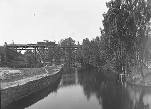
Sandvikselva, formerly known as Løxa, is a river in Bærum, Norway, originating at the intersection of the two rivers Lomma and Isielva at Wøyen. The river flows into the Oslo Fjord 4.5 km south at Sandvika, though the center of the city, where it is crossed by the historic Løkke Bridge, the first cast iron bridge in Norway. At the mouth there are three bridges over the river.
Høvik Verk
Village in Norway
Distance: Approx. 1275 meters
Latitude and longitude: 59.8934,10.5667
Høvik Verk is a district in the municipality of Bærum, Norway. Its population as of 2007 is 3,940.

Kjørbo
Distance: Approx. 1350 meters
Latitude and longitude: 59.8858,10.5273
Kjørbo is a former manor in Bærum, Norway. It is located slightly south of the city of Sandvika, near the outlet of the river Sandvikselva, at the opposite shore of Kadettangen. Originally a home farm under Nesøya manor, in 1630 it was made into a manor of its own and resident site of Nesøygodset.
Kadettangen
Topographical feature in Greater Oslo, Norway
Distance: Approx. 1270 meters
Latitude and longitude: 59.8889,10.5301
Kadettangen is a small peninsula outside of Sandvika in Bærum, Norway. Originally named Sandvikstangen, it got its current name from the cadet training conducted by the Norwegian Military Academy for the better part of the nineteenth century.
Sjøholmen
Distance: Approx. 982 meters
Latitude and longitude: 59.89212,10.5413
Sjøholmen is an area between Sandvika and Høvikodden in Bærum, Norway. Originally farmland, it was used as a residential property from 1898, and then for various municipal institutions since the 1970s.

DNV
Certification body and classification society
Distance: Approx. 721 meters
Latitude and longitude: 59.88801111,10.56273056
Det Norske Veritas (DNV), formerly DNV GL, is an international accredited registrar and classification society headquartered in Høvik, Norway. DNV provides services for several industries, including maritime, oil and gas, renewable energy, electrification, and healthcare. As of 10 January 2024, the company has about 15,000 employees and 350 offices operating in more than 100 countries and provides services for several industries.

Danmark (islet)
Distance: Approx. 1189 meters
Latitude and longitude: 59.8906,10.5334
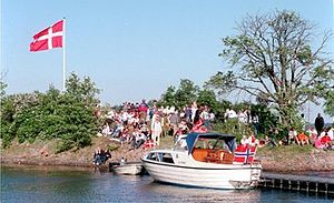
Danmark (English: Denmark) is an islet located near Sandvika in the Municipality of Bærum, Norway. While the original meaning is not exactly verified, the name of the islet reflects Norwegians' (friendly) joking about the relatively small geographical size of Denmark proper. Like Denmark, this islet is flat, small, and located overseas south of Bærum.
Borøya, Bærum
Distance: Approx. 706 meters
Latitude and longitude: 59.8791,10.5565
Borøya is an island in the western section of Oslofjord (Vestfjorden), within the borders of the municipality of Bærum.
Weather in this IP's area
overcast clouds
9 Celsius
8 Celsius
7 Celsius
9 Celsius
1018 hPa
89 %
1018 hPa
1018 hPa
10000 meters
2.22 m/s
2.85 m/s
358 degree
100 %
07:45:13
16:17:25


