Country:
Region:
City:
Latitude and Longitude:
Time Zone:
Postal Code:
IP information under different IP Channel
ip-api
Country
Region
City
ASN
Time Zone
ISP
Blacklist
Proxy
Latitude
Longitude
Postal
Route
Luminati
Country
Region
65
City
coppito
ASN
Time Zone
Europe/Rome
ISP
Fastweb
Latitude
Longitude
Postal
IPinfo
Country
Region
City
ASN
Time Zone
ISP
Blacklist
Proxy
Latitude
Longitude
Postal
Route
db-ip
Country
Region
City
ASN
Time Zone
ISP
Blacklist
Proxy
Latitude
Longitude
Postal
Route
ipdata
Country
Region
City
ASN
Time Zone
ISP
Blacklist
Proxy
Latitude
Longitude
Postal
Route
Popular places and events near this IP address

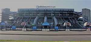
Forum di Milano
Indoor sports arena in Assago, Italy
Distance: Approx. 1957 meters
Latitude and longitude: 45.40111111,9.14222222
Unipol Forum (formerly the FilaForum, DatchForum and Mediolanum Forum; known as the Forum di Milano in events where commercial naming rights are prohibited) is an indoor sports arena that is located in Assago, a small town 3 km outside Milan, Italy. The arena has a seating capacity of 12,800 and is primarily used for basketball, ice hockey, tennis and live concerts. The venue is the home ground of the EuroLeague and Italian Serie A professional basketball team AX Armani Exchange Milan.
European Institute of Oncology
Hospital in Milan, Italy
Distance: Approx. 4096 meters
Latitude and longitude: 45.414194,9.208118
The European Institute of Oncology (Italian: Istituto Europeo di Oncologia, IEO) is a non-profit private-law comprehensive cancer centre located in Milan, Italy. It serves as a clinic, a research centre, and a training institution. IEO is a member of EU-LIFE, an alliance of leading life science research centres in Europe.

Assago
Comune in Lombardy, Italy
Distance: Approx. 2563 meters
Latitude and longitude: 45.4,9.13333333
Assago (Lombard: Assagh or Sagh [(a)ˈsaːk]) is a town and comune in the Metropolitan City of Milan, in the northern Italian region of Lombardy. It is home of the headquarters of Nestlé's Italian branch and the Mediolanum Forum.
Rozzano
Comune in Lombardy, Italy
Distance: Approx. 1618 meters
Latitude and longitude: 45.38333333,9.15
Rozzano (Lombard: Rozzan [ruˈsãː]) is a comune (municipality) in the Metropolitan City of Milan, in the Italian region Lombardy, located about 9 kilometres (6 mi) south of Milan. Rozzano borders the following municipalities: Milan, Assago, Zibido San Giacomo, Opera, Pieve Emanuele, Basiglio. Rozzano received the honorary title of city with a presidential decree on July 21, 2003.
Gratosoglio
Quartiere of Milan in Lombardy, Italy
Distance: Approx. 1766 meters
Latitude and longitude: 45.40861111,9.17166667
Gratosoglio (Italian: [ɡratoˈsɔʎʎo]; Milanese: Grattasoeuj [ɡrataˈsøj]) is a district (quartiere) of the city of Milan, Italy, part of the Zone 5 administrative division. It is located at southernmost end of the city, bordering on the comune of Rozzano, and it is traversed by the Lambro river. The district has an area of about 400,000 m2, centered on the main thoroughfare Via dei Missaglia.

Quintosole
Quartiere of Milan in Lombardy, Italy
Distance: Approx. 3248 meters
Latitude and longitude: 45.40222222,9.20444444
Quintosole is a district ("quartiere") of Milan, Italy, part of the Zone 5 administrative division. It is a rural district, located within the Parco Agricolo Sud Milano nature reserve, south of Milan's urban area. Before 1869, it was an autonomous comune.

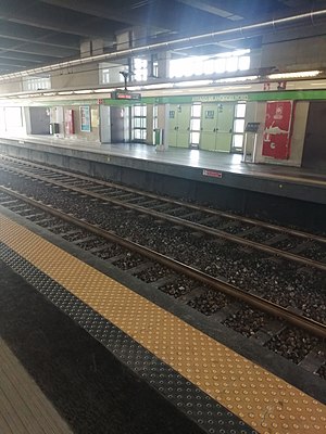
Assago Milanofiori Nord (Milan Metro)
Milan metro station
Distance: Approx. 2118 meters
Latitude and longitude: 45.40944444,9.15
Milanofiori Nord is a station on Line 2 of the Milan Metro, in the southern suburb of Assago. The line here runs beside Autostrada A7. The station was opened on 20 February 2011 as part of an extension from Famagosta to Assago Milanofiori Forum.

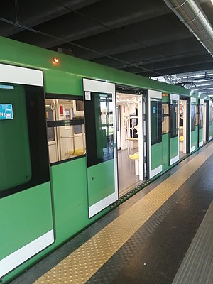
Assago Milanofiori Forum (Milan Metro)
Milan metro station
Distance: Approx. 1757 meters
Latitude and longitude: 45.40166667,9.14555556
Milanofiori Forum is a station on Line 2 of the Milan Metro, in the southern suburb of Assago. The line here runs beside Autostrada A7, and it is the southernmost station of the network. The station was opened on 20 February 2011 as the terminus of a two-station extension from Famagosta.

Mirasole Abbey
Church building in Opera, Italy
Distance: Approx. 3038 meters
Latitude and longitude: 45.3875,9.2027
Mirasole Abbey (Italian: Abbazia di Mirasole) is a monastery in the comune of Opera near Milan, Lombardy, Northern Italy. The monastery was initially founded by the Humiliati in the 13th century. The buildings have had diverse uses over the centuries.

Humanitas University
Italian private university
Distance: Approx. 2409 meters
Latitude and longitude: 45.3721,9.1694
Humanitas University, also recognized as Hunimed, is an Italian international private university dedicated to medical and biomedical sciences. Located within the municipality of Pieve Emanuele, a constituent of the Metropolitan City of Milan, the university's campus seamlessly integrates with the expansive Humanitas Research Hospital Campus.
Castello di Tosinasco, Pieve Emanuele
Building in the italian municipality of Pieve Emanuele
Distance: Approx. 3702 meters
Latitude and longitude: 45.364064,9.186809
The Castello di Tosinasco is a rural castle near the town of Pieve Emanuele, Province of Milan, region of Lombardy, Italy. The castle was constructed in the 16th century by the D'Adda family. It served to protect the agricultural production of the region.
San Giovanni Bono Church
Church in Milan, Italy
Distance: Approx. 4166 meters
Latitude and longitude: 45.43088,9.16219
San Giovanni Bono Church is a reinforced concrete Brutalist church in Quartiere Sant'Ambrogio Milan, Italy dedicated to John the Good. The building was designed by Arrigo Arrighetti and completed in 1968.
Weather in this IP's area
scattered clouds
7 Celsius
7 Celsius
6 Celsius
9 Celsius
1013 hPa
87 %
1013 hPa
1001 hPa
7000 meters
1.03 m/s
180 degree
40 %
07:25:18
16:51:43


