Country:
 Netherlands
Region:
City:
Latitude and Longitude:
Time Zone:
Postal Code:
IP information under different IP Channel
ip-api
Country
Region
City
ASN
Time Zone
ISP
Blacklist
Proxy
Latitude
Longitude
Postal
Route
IPinfo
Country
Region
City
ASN
Time Zone
ISP
Blacklist
Proxy
Latitude
Longitude
Postal
Route
MaxMind
Country
Region
City
ASN
Time Zone
ISP
Blacklist
Proxy
Latitude
Longitude
Postal
Route
Luminati
Country
NLRegion
zh
City
krimpenaandenijssel
ASN
Time Zone
Europe/Amsterdam
ISP
DELTA Fiber Nederland B.V.
Latitude
Longitude
Postal
db-ip
Country
Region
City
ASN
Time Zone
ISP
Blacklist
Proxy
Latitude
Longitude
Postal
Route
ipdata
Country
Region
City
ASN
Time Zone
ISP
Blacklist
Proxy
Latitude
Longitude
Postal
Route
Popular places and events near this IP address

Capelle aan den IJssel
Town and Municipality in South Holland, Netherlands
Distance: Approx. 1953 meters
Latitude and longitude: 51.93333333,4.58333333
Capelle aan den IJssel (Dutch pronunciation: [kaːˈpɛlə ʔaːn dən ˈɛisəl] or [- də ˈʔɛi-]; transl. "Capelle on the IJssel") is a large town and municipality in the western Netherlands, in the province of South Holland. The municipality had a population of 67,319 in 2021, and covers an area of 15.40 km2 (5.95 sq mi), of which 1.26 km2 (0.49 sq mi) is water. It is situated on the eastern edge of Rotterdam, on the Hollandse IJssel river.

Krimpen aan den IJssel
Town and municipality in South Holland, Netherlands
Distance: Approx. 769 meters
Latitude and longitude: 51.91666667,4.58333333
Krimpen aan den IJssel (Dutch pronunciation: [ˈkrɪmpə(n) aːn də(n) ˈɛisəl] ) is a town and municipality in the western Netherlands, in the province of South Holland. The municipality had a population of 29,410 in 2021, and covers an area of 8.95 km2 (3.46 sq mi) of which 1.26 km2 (0.49 sq mi) is water.
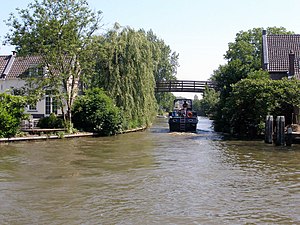
Hollandse IJssel
River in the Netherlands
Distance: Approx. 2509 meters
Latitude and longitude: 51.90805556,4.56111111
The Hollandse or Hollandsche IJssel (pronounced [ˌɦɔlɑntsə ˈʔɛisəl]; "Holland IJssel", as opposed to the 'regular' or Gelderland IJssel) is a branch of the Rhine delta that flows westward from Nieuwegein on river Lek through IJsselstein, Gouda and Capelle aan den IJssel to Krimpen aan den IJssel, where it ends in the Nieuwe Maas. Another branch called Enge IJssel ("Narrow IJssel") flows southwest from Nieuwegein. The name IJssel is thought to derive from the Germanic i sala, meaning "dark water".

Stormpolder
Place in South Holland, Netherlands
Distance: Approx. 769 meters
Latitude and longitude: 51.91666667,4.58333333
Stormpolder is a polder and a hamlet in the Dutch province of South Holland. It is located about 7 km east of the center of Rotterdam, in the municipality of Krimpen aan den IJssel. It lies between the Nieuwe Maas and Hollandsche IJssel rivers.

Bolnes
Place in South Holland, Netherlands
Distance: Approx. 2727 meters
Latitude and longitude: 51.8947,4.5788
Bolnes is a Dutch village in the municipality of Ridderkerk in the province of South Holland. It is situated on the island IJsselmonde on the south bank of the river Nieuwe Maas, just east of the junction with the Hollandse IJssel, bordering on the municipality of Rotterdam. In 2004, 7300 people lived in Bolnes.

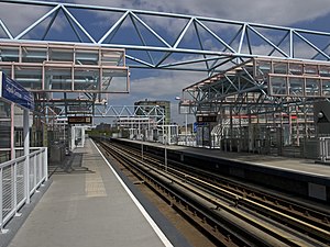
De Terp metro station
Metro station in Capelle aan den IJssel, Netherlands
Distance: Approx. 2129 meters
Latitude and longitude: 51.93596389,4.60047222
De Terp is a subway station on Line C of the Rotterdam Metro and is situated in the town of Capelle aan den IJssel, in the Oostgaarde area, just east of Rotterdam. It is the northern terminus of the line. The station was opened on 26 May 1994 as part of the extension of the East-West Line or Caland Line from Capelsebrug station.
Capelle Centrum metro station
Subway station in South Holland, Netherlands
Distance: Approx. 1615 meters
Latitude and longitude: 51.9314,4.58968889
Capelle Centrum is a subway station on Line C of the Rotterdam Metro and is situated in the town of Capelle aan den IJssel, just east of Rotterdam. The station was opened on 26 May 1994 as part of the extension of the East-West Line or Caland Line from Capelsebrug station towards De Terp station. The station consists of two tracks with a platform on both sides.

Slotlaan metro station
Metro station in Capelle aan den IJssel, Netherlands
Distance: Approx. 1671 meters
Latitude and longitude: 51.92850278,4.57848333
Slotlaan is an elevated station on Line C of the Rotterdam Metro and is situated in the town of Capelle aan den IJssel, just east of Rotterdam. The station was opened on 26 May 1994 as part of the extension of the East-West Line or Caland Line from Capelsebrug station towards De Terp station. The station consists of two tracks with a platform on both sides.

Schenkel metro station
Metro station in Rotterdam, Netherlands
Distance: Approx. 2682 meters
Latitude and longitude: 51.93194444,4.56361111
Schenkel is a subway station on Rotterdam Metro lines A and B, and is situated in the northeastern part of Rotterdam, in the borough Prins Alexander. The station is named after a neighbourhood in nearby Capelle aan den IJssel, situated to the southeast of the subway station. This station was opened on 28 May 1983 when the East-West Line (also formerly the Caland line) was extended from its previous terminus Capelsebrug.
Groenedijk Monument
Distance: Approx. 1403 meters
Latitude and longitude: 51.926829,4.607682
The Groenedijk Monument, also known as the Dukdalf, is a monument in Capelle aan den IJssel that serves as a memorial for the events that took place in 1574 related to the Eighty Years' War, also known as the Dutch Revolt. During the conflict, William the Silent ordered the destruction of several dykes to stop the Spaniards who were surrounding the Dutch city of Leiden. The tactic proved to be successful, as the Spanish troops were greatly affected by the incoming water, which took them by surprise.
Stormvloedkering Hollandse IJssel
Hydraulic engineering structure in the Netherlands
Distance: Approx. 1032 meters
Latitude and longitude: 51.91741667,4.57947222
The Stormvloedkering Hollandse IJssel (English: Hollandse IJssel Storm Surge Barrier), Hollandse IJsselkering (Hollandse IJssel Barrier) or Algerakering (Algera Barrier) is a storm surge barrier located on the Hollandse IJssel, at the municipal boundary of Capelle aan den IJssel and Krimpen aan den IJssel, east of Rotterdam in The Netherlands. The construction of the works comprised the first project of the Delta Works, undertaken in response to the disastrous effects of the North Sea flood of 1953. Prior to 1954, the spelling Hollandsche was used in the official name.

Capelle train accident
1899 accident in the Netherlands
Distance: Approx. 2220 meters
Latitude and longitude: 51.93694444,4.59
The Capelle train accident took place on 15 November 1899 in Capelle aan den IJssel, Netherlands, when a mail train collided with a passenger train in a heavy fog, resulting in the deaths of 8 people with a further 12 injured. It is the deadliest train accident in the Netherlands in the 19th century.
Weather in this IP's area
clear sky
5 Celsius
3 Celsius
3 Celsius
7 Celsius
1020 hPa
94 %
1020 hPa
1020 hPa
10000 meters
2.04 m/s
2.4 m/s
110 degree
07:49:29
19:10:10