81.162.208.248 - IP Lookup: Free IP Address Lookup, Postal Code Lookup, IP Location Lookup, IP ASN, Public IP
Country:
Region:
City:
Location:
Time Zone:
Postal Code:
IP information under different IP Channel
ip-api
Country
Region
City
ASN
Time Zone
ISP
Blacklist
Proxy
Latitude
Longitude
Postal
Route
Luminati
Country
Region
18
City
ropczyce
ASN
Time Zone
Europe/Warsaw
ISP
TELNET Ropczyce Sp. z o.o.
Latitude
Longitude
Postal
IPinfo
Country
Region
City
ASN
Time Zone
ISP
Blacklist
Proxy
Latitude
Longitude
Postal
Route
IP2Location
81.162.208.248Country
Region
podkarpackie
City
ropczyce
Time Zone
Europe/Warsaw
ISP
Language
User-Agent
Latitude
Longitude
Postal
db-ip
Country
Region
City
ASN
Time Zone
ISP
Blacklist
Proxy
Latitude
Longitude
Postal
Route
ipdata
Country
Region
City
ASN
Time Zone
ISP
Blacklist
Proxy
Latitude
Longitude
Postal
Route
Popular places and events near this IP address

Ropczyce
Town in Podkarpackie Voivodeship, Poland
Distance: Approx. 4149 meters
Latitude and longitude: 50.08611111,21.63333333
Ropczyce [rɔpˈt͡ʂɨt͡sɛ] (Yiddish: ראָפּשיץ, romanized: Ropshitz) is a town in the Subcarpathian Voivodeship in south-eastern Poland, situated in the valley of the Wielopolka River (a tributary of the Wisłoka River). The town has a population of 15,098 (as of 2 June 2009). and is the seat of Ropczyce-Sędziszów County.

Ropczyce-Sędziszów County
County in Subcarpathian Voivodeship, Poland
Distance: Approx. 4149 meters
Latitude and longitude: 50.08611111,21.63333333
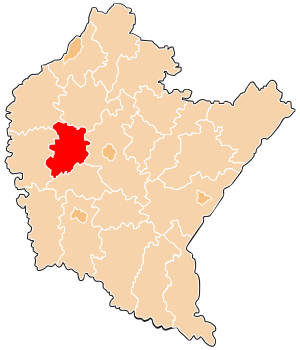
Ropczyce-Sędziszów County (Polish: powiat ropczycko-sędziszowski) is a unit of territorial administration and local government (powiat) in Subcarpathian Voivodeship, south-eastern Poland. It came into being on January 1, 1999, as a result of the Polish local government reforms passed in 1998. Its administrative seat and largest town is Ropczyce, which lies 28 kilometres (17 mi) west of the regional capital Rzeszów.
Gmina Ropczyce
Gmina in Subcarpathian Voivodeship, Poland
Distance: Approx. 56 meters
Latitude and longitude: 50.05277778,21.60916667
Gmina Ropczyce is an urban-rural gmina (administrative district) in Ropczyce-Sędziszów County, Subcarpathian Voivodeship, in south-eastern Poland. Its seat is the town of Ropczyce, which lies approximately 28 kilometres (17 mi) west of the regional capital Rzeszów. The gmina covers an area of 138.99 square kilometres (53.7 sq mi), and as of 2006 its total population is 26,008 (out of which the population of Ropczyce amounts to 15,045, and the population of the rural part of the gmina is 10,963).
Gmina Ostrów
Gmina in Subcarpathian Voivodeship, Poland
Distance: Approx. 3513 meters
Latitude and longitude: 50.08333333,21.6
Gmina Ostrów is a rural gmina (administrative district) in Ropczyce-Sędziszów County, Subcarpathian Voivodeship, in south-eastern Poland. Its seat is the village of Ostrów, which lies approximately 3 kilometres (2 mi) west of Ropczyce and 30 km (19 mi) west of the regional capital Rzeszów. The gmina covers an area of 96.62 square kilometres (37.3 sq mi), and as of 2006 its total population is 6,808.
Brzezówka, Ropczyce-Sędziszów County
Village in Subcarpathian Voivodeship, Poland
Distance: Approx. 4746 meters
Latitude and longitude: 50.07055556,21.54888889
Brzezówka [bʐɛˈzufka] is a village in the administrative district of Gmina Ropczyce, within Ropczyce-Sędziszów County, Subcarpathian Voivodeship, in south-eastern Poland. It lies approximately 7 kilometres (4 mi) west of Ropczyce and 33 km (21 mi) west of the regional capital Rzeszów.
Gnojnica
Village in Subcarpathian Voivodeship, Poland
Distance: Approx. 3618 meters
Latitude and longitude: 50.03333333,21.65
Gnojnica [ɡnɔi̯ˈnit͡sa] is a village in the administrative district of Gmina Ropczyce, within Ropczyce-Sędziszów County, Subcarpathian Voivodeship, in south-eastern Poland. It lies approximately 6 kilometres (4 mi) south of Ropczyce and 26 km (16 mi) west of the regional capital Rzeszów.
Okonin, Podkarpackie Voivodeship
Village in Subcarpathian Voivodeship, Poland
Distance: Approx. 4294 meters
Latitude and longitude: 50.03527778,21.555
Okonin [ɔˈkɔnin] is a village in the administrative district of Gmina Ropczyce, within Ropczyce-Sędziszów County, Subcarpathian Voivodeship, in south-eastern Poland. It lies approximately 8 kilometres (5 mi) south-west of Ropczyce and 33 km (21 mi) west of the regional capital Rzeszów.
Borek Mały
Village in Subcarpathian Voivodeship, Poland
Distance: Approx. 5589 meters
Latitude and longitude: 50.1,21.63333333
Borek Mały [ˈbɔrɛk ˈmawɨ] is a village in the administrative district of Gmina Ostrów, within Ropczyce-Sędziszów County, Subcarpathian Voivodeship, in south-eastern Poland. It lies approximately 4 kilometres (2 mi) north-east of Ostrów, 2 km (1 mi) north of Ropczyce, and 28 km (17 mi) west of the regional capital Rzeszów.
Kozodrza
Village in Subcarpathian Voivodeship, Poland
Distance: Approx. 5348 meters
Latitude and longitude: 50.1,21.6
Kozodrza [kɔˈzɔdʐa] is a village in the administrative district of Gmina Ostrów, within Ropczyce-Sędziszów County, Subcarpathian Voivodeship, in south-eastern Poland. It lies approximately 2 kilometres (1 mi) north of Ostrów, 3 km (2 mi) north-west of Ropczyce, and 30 km (19 mi) west of the regional capital Rzeszów.

Ostrów, Ropczyce-Sędziszów County
Village in Subcarpathian Voivodeship, Poland
Distance: Approx. 3513 meters
Latitude and longitude: 50.08333333,21.6
Ostrów [ˈɔstruf] is a village in Ropczyce-Sędziszów County, Subcarpathian Voivodeship, in south-eastern Poland. It is the seat of the gmina (administrative district) called Gmina Ostrów. It lies approximately 3 kilometres (2 mi) west of Ropczyce and 30 km (19 mi) west of the regional capital Rzeszów.
Skrzyszów, Podkarpackie Voivodeship
Village in Subcarpathian Voivodeship, Poland
Distance: Approx. 4503 meters
Latitude and longitude: 50.06666667,21.55
Skrzyszów [ˈskʂɨʂuf] is a village in the administrative district of Gmina Ostrów, within Ropczyce-Sędziszów County, Subcarpathian Voivodeship, in south-eastern Poland. It lies approximately 5 kilometres (3 mi) south-west of Ostrów, 7 km (4 mi) west of Ropczyce, and 33 km (21 mi) west of the regional capital Rzeszów.
Góra Ropczycka
Village in Subcarpathian Voivodeship, Poland
Distance: Approx. 5182 meters
Latitude and longitude: 50.05277778,21.68138889
Góra Ropczycka [ˈɡura rɔpˈt͡ʂɨt͡ska] is a village in the administrative district of Gmina Sędziszów Małopolski, within Ropczyce-Sędziszów County, Subcarpathian Voivodeship, in south-eastern Poland. It lies approximately 3 kilometres (2 mi) south-west of Sędziszów Małopolski, 6 km (4 mi) south-east of Ropczyce, and 24 km (15 mi) west of the regional capital Rzeszów.
Weather in this IP's area
overcast clouds
7 Celsius
3 Celsius
6 Celsius
8 Celsius
1003 hPa
93 %
1003 hPa
977 hPa
10000 meters
9.87 m/s
19.81 m/s
192 degree
90 %
