Country:
Region:
City:
Latitude and Longitude:
Time Zone:
Postal Code:
IP information under different IP Channel
ip-api
Country
Region
City
ASN
Time Zone
ISP
Blacklist
Proxy
Latitude
Longitude
Postal
Route
Luminati
Country
Region
43
City
yalta
ASN
Time Zone
Europe/Simferopol
ISP
Yalta-TV KOM Ltd.
Latitude
Longitude
Postal
IPinfo
Country
Region
City
ASN
Time Zone
ISP
Blacklist
Proxy
Latitude
Longitude
Postal
Route
db-ip
Country
Region
City
ASN
Time Zone
ISP
Blacklist
Proxy
Latitude
Longitude
Postal
Route
ipdata
Country
Region
City
ASN
Time Zone
ISP
Blacklist
Proxy
Latitude
Longitude
Postal
Route
Popular places and events near this IP address
Yalta
City on the southern Crimean Peninsula
Distance: Approx. 837 meters
Latitude and longitude: 44.49944444,34.17
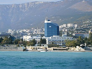
Yalta (Ukrainian and Russian: Ялта) is a resort city on the south coast of the Crimean Peninsula surrounded by the Black Sea. It serves as the administrative center of Yalta Municipality, one of the regions within Crimea. Yalta, along with the rest of Crimea, is internationally recognised as part of Ukraine, and is considered part of the Autonomous Republic of Crimea.

Alexander Nevsky Cathedral, Yalta
Crimean orthodox cathedral
Distance: Approx. 822 meters
Latitude and longitude: 44.49537,34.16388
The Alexander Nevsky Cathedral, named after St. Alexander Nevsky, is an Eastern Orthodoxy cathedral in Yalta, Crimea, built in 1902, and designed by Nikolay Krasnov.

Yalta Municipality
Municipality in Crimea, Ukraine
Distance: Approx. 837 meters
Latitude and longitude: 44.49944444,34.17
Yalta City Municipality (Russian: Я́лтинский городско́й сове́т; Ukrainian: Я́лтинська міська́ ра́да; Crimean Tatar: Yalta şeer şurası, Ялта шеэр шурасы), officially "the territory governed by the Yalta city council", also known as Greater Yalta (Russian: Большая Ялта) is one of the 25 regions of the Autonomous Republic of Crimea, a territory recognized by a majority of countries as part of Ukraine but forcibly incorporated into Russia after Russia invaded Ukraine in 2014. It is a resort region, located at the southern shore of Crimea – one of the most famous recreational territories of the former Soviet Union. Population: 133,675 (2014 Census).

Oreanda Hotel
Distance: Approx. 984 meters
Latitude and longitude: 44.4892,34.1617
The Oreanda Hotel is a 4-star, historic hotel in Yalta, Crimea, opened in 1907. It is considered a city landmark and overlooks the coastline and neighboring mountains.
Uchan-su (river)
River in Ukraine
Distance: Approx. 1362 meters
Latitude and longitude: 44.49027778,34.15638889
Uchan-su (Ukrainian: Учан-Су, Russian: Уча́н-Су or Водопадная Vodopadnaya, Crimean Tatar: Uçan Suv), is a river that flows in the South Coast of Crimea. The name translates from the Crimean Tatar language for 'swift water' . The river runs into the Black Sea in the center city of Yalta.

Roffe Bath
Historical monument in Yalta, Crimea
Distance: Approx. 1637 meters
Latitude and longitude: 44.49944444,34.15527778
Roffe Bath is a historical monument located in the center of Yalta, Crimea, part of the ensemble "France" built by the famous architect Nikolay Krasnov, designer of the Greater Livadia Palace, by the order of merchant Alexey I. Roffe, the owner of the guild "Rofe (Roffe) and Sons" with the pool added in front of the portal in Moorish style. Famous personalities as Ivan Bunin, Fyodor Shalyapin, Anton Chekhov and other members of the Society of Writers and scholars stayed at the Roffe Bath.
School of the Future (Yalta)
Public school
Distance: Approx. 2135 meters
Latitude and longitude: 44.4869,34.1475
The School of the Future (Yalta) is a secondary school in Yalta. By resolution of the city administration of Yalta November 18, 2016 №4954-p Municipal Public Educational Institution «Yalta Secondary School №2 «School of the Future» "District of Yalta, Republic of Crimea" was renamed the Municipal Budgetary General Educational Institution «Yalta Secondary School №2 «School of the Future» "District of Yalta, Republic of Crimea".

White Dacha
Anton Chekhov's house in Yalta, Crimea
Distance: Approx. 2515 meters
Latitude and longitude: 44.49111111,34.14166667
The White Dacha (Russian: белая дача; Ukrainian: біла дача) is the house that Anton Chekhov had built in Yalta and in which he wrote some of his greatest work. It is now a writer's house museum.

Villa Elena
Distance: Approx. 729 meters
Latitude and longitude: 44.4946,34.1647
Villa Elena is an historic building in Yalta in Crimea. Originally a private resident for a merchant, the building today is Crimea's first 5-star hotel.
Gulf of Yalta
Distance: Approx. 1129 meters
Latitude and longitude: 44.48333333,34.16666667
Gulf of Yalta (Russian: Ялтинский залив, Ukrainian: Ялтинська затока, Crimean Tatar: Yalta körfezi, Ялта корьфези) is a gulf in the Black Sea near Yalta, Crimea.

Saint Hripsime Church of Yalta
Armenian Apostolic church in Yalta, Crimea
Distance: Approx. 1166 meters
Latitude and longitude: 44.501094,34.165334
Saint Hripsime Church (Armenian: Սուրբ Հռիփսիմե եկեղեցի, Surp Hripsime Yekeghetsi), is a working Armenian church located in Yalta on the Crimean peninsula, Ukraine and completed in 1917. It is modeled after a church of the same name in Vagharshapat, Armenia. In fact, a piece of that UNESCO World Heritage site church was symbolically used in the base of this church.

Lesya Ukrainka Museum
Cultural museum in Yalta, Autonomous Republic of Crimea
Distance: Approx. 906 meters
Latitude and longitude: 44.4919,34.1619
The Lesya Ukrainka Museum in Yalta is a local history museum dedicated to one of Ukrainian literature's foremost writers, Lesya Ukrainka, who lived on the property for two years in her late twenties. In 1977, more than seventy years after her death, it became a museum dedicated to her memory, as well as a hub for Ukrainian culture and arts. Following the invasion of Crimea by the Russian Federation, its status as such is unknown.
Weather in this IP's area
broken clouds
12 Celsius
10 Celsius
12 Celsius
12 Celsius
1028 hPa
51 %
1028 hPa
1028 hPa
10000 meters
1.82 m/s
2.07 m/s
48 degree
79 %
07:31:48
17:22:35

