Country:
 Czech Republic
Region:
City:
Latitude and Longitude:
Time Zone:
Postal Code:
IP information under different IP Channel
ip-api
Country
Region
City
ASN
Time Zone
ISP
Blacklist
Proxy
Latitude
Longitude
Postal
Route
IPinfo
Country
Region
City
ASN
Time Zone
ISP
Blacklist
Proxy
Latitude
Longitude
Postal
Route
MaxMind
Country
Region
City
ASN
Time Zone
ISP
Blacklist
Proxy
Latitude
Longitude
Postal
Route
Luminati
Country
CZRegion
20
City
skvorec
ASN
Time Zone
Europe/Prague
ISP
WIA spol. s.r.o.
Latitude
Longitude
Postal
db-ip
Country
Region
City
ASN
Time Zone
ISP
Blacklist
Proxy
Latitude
Longitude
Postal
Route
ipdata
Country
Region
City
ASN
Time Zone
ISP
Blacklist
Proxy
Latitude
Longitude
Postal
Route
Popular places and events near this IP address

Sluštice
Municipality in Central Bohemian, Czech Republic
Distance: Approx. 3801 meters
Latitude and longitude: 50.03916667,14.68555556
Sluštice (‹See Tfd›German: Sluschtitz) is a municipality and village in Prague-East District in the Central Bohemian Region of the Czech Republic. It has about 800 inhabitants.

Zlatá
Municipality in Central Bohemian, Czech Republic
Distance: Approx. 2096 meters
Latitude and longitude: 50.04027778,14.71
Zlatá is a municipality and village in Prague-East District in the Central Bohemian Region of the Czech Republic. It has about 400 inhabitants.

Dobročovice
Municipality in Central Bohemian, Czech Republic
Distance: Approx. 2845 meters
Latitude and longitude: 50.05638889,14.7
Dobročovice is a municipality and village in Prague-East District in the Central Bohemian Region of the Czech Republic. It has about 300 inhabitants.

Doubek (Prague-East District)
Municipality in Central Bohemian, Czech Republic
Distance: Approx. 3287 meters
Latitude and longitude: 50.01777778,14.73777778
Doubek is a municipality and village in Prague-East District in the Central Bohemian Region of the Czech Republic. It has about 500 inhabitants.

Úvaly
Town in Central Bohemian, Czech Republic
Distance: Approx. 2970 meters
Latitude and longitude: 50.07361111,14.73027778
Úvaly (‹See Tfd›German: Auwal) is a town in Prague-East District in the Central Bohemian Region of the Czech Republic. It has about 7,500 inhabitants.

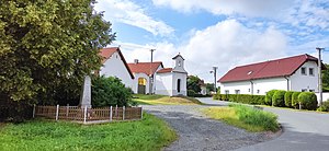
Škvorec
Market town in Central Bohemian, Czech Republic
Distance: Approx. 477 meters
Latitude and longitude: 50.04694444,14.73055556
Škvorec is a market town in Prague-East District in the Central Bohemian Region of the Czech Republic. It has about 2,200 inhabitants.

Škvorec Chateau
Chateau in the Central Bohemian Region of the Czech Republic
Distance: Approx. 304 meters
Latitude and longitude: 50.04583333,14.73361111
Škvorec Chateau (Czech: zámek Škvorec; ‹See Tfd›German: Schloss Squorz or Schkworetz) is a chateau, formerly a minor castle, located in Škvorec in the Central Bohemian Region of the Czech Republic, about 23 kilometres (14 mi) east of Prague. The chateau, locally also known as the Starý zámek ("Old Chateau"), was indirectly first mentioned in historical sources in 1279, yet fully documented as late as since 1404. This Gothic castle was rebuilt during the 1520s into a Renaissance palace; but in 1639 – during the devastating Thirty Years' War – the premises were looted, burned and until 1710 laid in ruins.

Hradešín
Municipality in Central Bohemian, Czech Republic
Distance: Approx. 1677 meters
Latitude and longitude: 50.03888889,14.75666667
Hradešín is a municipality and village in Kolín District in the Central Bohemian Region of the Czech Republic. It has about 600 inhabitants.
Masojedy
Municipality in Central Bohemian, Czech Republic
Distance: Approx. 3755 meters
Latitude and longitude: 50.02611111,14.77805556
Masojedy is a municipality and village in Kolín District in the Central Bohemian Region of the Czech Republic. It has about 100 inhabitants.

Přišimasy
Municipality in Central Bohemian, Czech Republic
Distance: Approx. 1825 meters
Latitude and longitude: 50.05055556,14.76222222
Přišimasy is a municipality and village in Kolín District in the Central Bohemian Region of the Czech Republic. It has about 900 inhabitants.

Květnice
Municipality in Central Bohemian, Czech Republic
Distance: Approx. 3948 meters
Latitude and longitude: 50.05722222,14.68416667
Květnice is a municipality and village in Prague-East District in the Central Bohemian Region of the Czech Republic. It has about 2,000 inhabitants.

Úvaly Railway Bridge
Railway bridge in Úvaly
Distance: Approx. 2757 meters
Latitude and longitude: 50.07145556,14.72865556
The Úvaly Railway Bridge (Czech: Úvalský železniční viadukt, also known as Devět kanálů) is a railway bridge in Úvaly in the Czech Republic. It is located on the Prague–Kolín railway line. The structure is 135 m (443 ft) long, built in a slight arc over the valley of the Výmola river.
Weather in this IP's area
light rain
8 Celsius
7 Celsius
7 Celsius
9 Celsius
1016 hPa
94 %
1016 hPa
977 hPa
6000 meters
2.57 m/s
320 degree
100 %
07:07:27
18:31:04