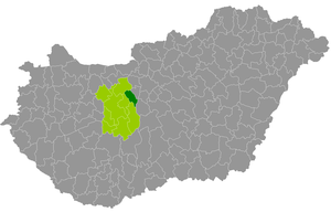
Country:
 Hungary
Region:
City:
Latitude and Longitude:
Time Zone:
Postal Code:
IP information under different IP Channel
ip-api
Country
Region
City
ASN
Time Zone
ISP
Blacklist
Proxy
Latitude
Longitude
Postal
Route
IPinfo
Country
Region
City
ASN
Time Zone
ISP
Blacklist
Proxy
Latitude
Longitude
Postal
Route
MaxMind
Country
Region
City
ASN
Time Zone
ISP
Blacklist
Proxy
Latitude
Longitude
Postal
Route
Luminati
Country
HURegion
fe
City
rackeresztur
ASN
Time Zone
Europe/Budapest
ISP
Invitech ICT Services Kft.
Latitude
Longitude
Postal
db-ip
Country
Region
City
ASN
Time Zone
ISP
Blacklist
Proxy
Latitude
Longitude
Postal
Route
ipdata
Country
Region
City
ASN
Time Zone
ISP
Blacklist
Proxy
Latitude
Longitude
Postal
Route
Popular places and events near this IP address

Csepel Island
Island in the Danube in Hungary
Distance: Approx. 8828 meters
Latitude and longitude: 47.25,18.95
Csepel Island (Hungarian: Csepel-sziget, Hungarian pronunciation: [ˈtʃɛpɛl]) is an island in the Danube in Hungary. It is 48 km (30 mi) long; its width after 3 km (2 mi) sections of bifurcation and rejoining (confluence) varies from 6 to 8 km (4 to 5 mi). It has an area of 257 km2 (99 sq mi) and its population is 165,000.

Ercsi
Town in Fejér, Hungary
Distance: Approx. 4826 meters
Latitude and longitude: 47.24964,18.89103
Ercsi is a town in central Hungary, located around 35 km south of Budapest in county Fejér.
Martonvásár
Town in Central Transdanubia, Hungary
Distance: Approx. 5792 meters
Latitude and longitude: 47.31396,18.78848
Martonvásár is the 11th largest town in Fejér county, Hungary. It's a popular tourist destination in Hungary because of the Brunszvik Palace where Ludwig van Beethoven stayed and wrote "Für Elise". There is also a museum for Beethoven.

Baracska
Place in Fejér, Hungary
Distance: Approx. 6351 meters
Latitude and longitude: 47.287439,18.756995
Baracska is a village in Fejér county, Hungary.

Százhalombatta
Town in Pest, Hungary
Distance: Approx. 6315 meters
Latitude and longitude: 47.30042,18.91362
Százhalombatta (Hungarian: [ˈsaːshɒlombɒttɒ]; Croatian: Bata; Latin: Matrica; Serbian: Бата, romanized: Bata) is a town in Pest County, Hungary. The name of this town in Hungarian literally means "One hundred tumuli" referring to the tumulus field at the edge of the town.
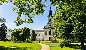
Ráckeresztúr
Place in Fejér, Hungary
Distance: Approx. 341 meters
Latitude and longitude: 47.27376,18.83476
Ráckeresztúr is a village in Fejér county, Hungary.
Szigetújfalu
Place in Central Hungary, Hungary
Distance: Approx. 8492 meters
Latitude and longitude: 47.23333333,18.93333333
Szigetújfalu is a village in Pest county, Hungary.
Pettend, Fejér
Place in Fejer County, Hungary
Distance: Approx. 9378 meters
Latitude and longitude: 47.26269,18.71614
Pettend is a village in Fejér County, Hungary.
Martonvásár District
Districts of Hungary in Fejér
Distance: Approx. 5389 meters
Latitude and longitude: 47.31,18.79
Martonvásár (Hungarian: Martonvásári járás) is a district in eastern part of Fejér County. Martonvásár is also the name of the town where the district seat is found. The district is located in the Central Transdanubia Statistical Region.
Dunai Solar Park
Photovoltaic power station in Hungary
Distance: Approx. 7979 meters
Latitude and longitude: 47.333333,18.9
Dunai (Százhalombatta) Solar Park is a large thin-film photovoltaic (PV) power system, built on a 40 ha (99 acres) plot of land located in Százhalombatta in Hungary. The solar park has around 76,000 state-of-the-art thin film PV panels for a total nameplate capacity of 17.6-megawatts, and was finished in October 2018. The solar park is expected to supply around 63 GWh of electricity per year enough to power some 9,000 average homes.
Weather in this IP's area
clear sky
15 Celsius
13 Celsius
14 Celsius
16 Celsius
1023 hPa
39 %
1023 hPa
1009 hPa
10000 meters
5.9 m/s
7.62 m/s
118 degree
4 %
07:07:26
17:51:43