Country:
Region:
City:
Latitude and Longitude:
Time Zone:
Postal Code:
IP information under different IP Channel
ip-api
Country
Region
City
ASN
Time Zone
ISP
Blacklist
Proxy
Latitude
Longitude
Postal
Route
Luminati
Country
Region
b
City
bucharest
ASN
Time Zone
Europe/Bucharest
ISP
Orange Romania S.A.
Latitude
Longitude
Postal
IPinfo
Country
Region
City
ASN
Time Zone
ISP
Blacklist
Proxy
Latitude
Longitude
Postal
Route
db-ip
Country
Region
City
ASN
Time Zone
ISP
Blacklist
Proxy
Latitude
Longitude
Postal
Route
ipdata
Country
Region
City
ASN
Time Zone
ISP
Blacklist
Proxy
Latitude
Longitude
Postal
Route
Popular places and events near this IP address

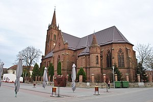
Pecica
Town in Arad, Romania
Distance: Approx. 941 meters
Latitude and longitude: 46.17,21.07
Pecica (Romanian pronunciation: [ˈpet͡ʃʲ.ka]; Hungarian: Pécska; German: Petschka; Serbian: Печка/Pečka) is a town in Arad County, western Romania. In ancient times it was a Dacian fortress called Ziridava and today it is an important archeological site. Situated at 25 kilometres (16 mi) from Arad, it was declared a town in 2004.

Felnac
Commune in Arad, Romania
Distance: Approx. 7860 meters
Latitude and longitude: 46.11666667,21.15
Felnac (Hungarian: Fönlak; Serbian: Фелнак) is a commune in Arad County, Romania. Felnac commune is situated in the Vingăi Plateau, on the left side of the Mureș Valley and it surface occupies 5120 ha. It is composed of two villages, Călugăreni (Újvinga) and Felnac (situated at 20 km from Arad).

Hodoș-Bodrog Monastery
Monastery in Romania
Distance: Approx. 9225 meters
Latitude and longitude: 46.133253,21.183798
The Hodoș-Bodrog Monastery is one of the oldest monastic institutions in Romania. It was originally a Roman Catholic (Benedictine) monastery, built before 1177 and destroyed before 1293. The present monastery, which belongs to the Romanian Orthodox Church, was built near the ruins of the first monastery in the late 14th or early 15th century.

Mureș Floodplain Natural Park
Nature reserve in western Romania
Distance: Approx. 7011 meters
Latitude and longitude: 46.135,20.989
The Mureș Floodplain Natural Park, set aside by the Romanian government in 2005, is located in western Romania outside the city of Arad. The park covers 17,455 ha and follows the river Mureș westward from the city of Arad to the Hungarian border. The park is a typical ecosystem for wetlands, with running waters, lakes, swamps and floodplains, with forests, an important place for the passage and nesting of bird species and is subjected to periodical floods (a flood every three years).

Makó District
Districts of Hungary in Csongrád
Distance: Approx. 9150 meters
Latitude and longitude: 46.2167,20.9833
Makó (Hungarian: Makói járás) is a district in south-eastern part of Csongrád County. Makó is also the name of the town where the district seat is found. The district is located in the Southern Great Plain Statistical Region.
Bezdin Monastery
Eastern Orthodox monastery in Romania
Distance: Approx. 4184 meters
Latitude and longitude: 46.1399,21.0271
Bezdin Monastery (Romanian: Mănăstirea Bezdin; Serbian: Манастир Бездин / Manastir Bezdin) is a monastery of the Serbian community, located near the village of Munar in Arad County, Romania, on the right bank of the Mureș River. Bezdin Monastery is one of the few remaining Serbian Orthodox monasteries in Romania, located 36 km (22 mi) west of Arad. The monastery was constructed in 1539 and is dedicated to the Assumption of the Blessed Virgin, celebrated on August 28 according to the New Style.
Weather in this IP's area
light rain
12 Celsius
11 Celsius
11 Celsius
13 Celsius
995 hPa
89 %
995 hPa
983 hPa
10000 meters
6.69 m/s
180 degree
75 %
07:44:02
16:59:06