Country:
 Romania
Region:
City:
Latitude and Longitude:
Time Zone:
Postal Code:
IP information under different IP Channel
ip-api
Country
Region
City
ASN
Time Zone
ISP
Blacklist
Proxy
Latitude
Longitude
Postal
Route
IPinfo
Country
Region
City
ASN
Time Zone
ISP
Blacklist
Proxy
Latitude
Longitude
Postal
Route
MaxMind
Country
Region
City
ASN
Time Zone
ISP
Blacklist
Proxy
Latitude
Longitude
Postal
Route
Luminati
Country
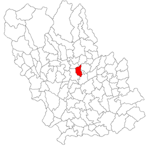
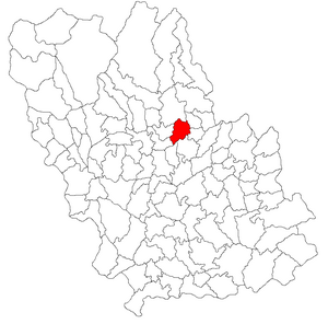
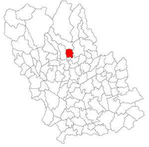
RORegion
if
City
voluntari
ASN
Time Zone
Europe/Bucharest
ISP
Orange Romania S.A.
Latitude
Longitude
Postal
db-ip
Country
Region
City
ASN
Time Zone
ISP
Blacklist
Proxy
Latitude
Longitude
Postal
Route
ipdata
Country
Region
City
ASN
Time Zone
ISP
Blacklist
Proxy
Latitude
Longitude
Postal
Route
Popular places and events near this IP address

Vălenii de Munte
Town in Prahova, Romania
Distance: Approx. 563 meters
Latitude and longitude: 45.18555556,26.03972222
Vălenii de Munte (Romanian pronunciation: [vəˈlenij de ˈmunte]) is a town in Prahova County, southern Romania (the historical region of Muntenia), with a population of 12,044 as of 2021. It lies In the Teleajen river valley, 28 kilometres (17 mi) north of the county seat of Ploiești. The town's sister cities are Eaubonne, Cimișlia, and Sarandë.

Drajna
Commune in Prahova, Romania
Distance: Approx. 3939 meters
Latitude and longitude: 45.21666667,26.05
Drajna is a commune in Prahova County, Muntenia, Romania. It is composed of eleven villages: Cătunu, Ciocrac, Drajna de Jos, Drajna de Sus (the commune centre), Făget, Ogretin, Piatra, Pițigoi, Plai, Podurile, and Poiana Mierlei. The river Drajna flows through the commune; it discharges into the Teleajen in Piatra.
Gornet
Commune in Prahova, Romania
Distance: Approx. 7867 meters
Latitude and longitude: 45.11666667,26.06666667
Gornet is a commune in Prahova County, Muntenia, Romania. It has a population of 3,126 (2002) and is composed of four villages: Bogdănești, Cuib, Gornet and Nucet. At the 2002 census, 100% of inhabitants were ethnic Romanians and 99.9% were Romanian Orthodox.
Bughea (Teleajen)
River in Prahova County, Romania
Distance: Approx. 6172 meters
Latitude and longitude: 45.128,26.0276
The Bughea is a right tributary of the river Teleajen in Romania. It flows into the Teleajen near Gura Vitioarei. Its length is 18 km (11 mi) and its basin size is 27 km2 (10 sq mi).
Drajna (river)
River in Prahova County, Romania
Distance: Approx. 3133 meters
Latitude and longitude: 45.2079,26.0527
The Drajna is a left tributary of the river Teleajen in Romania. It discharges into the Teleajen in Piatra. It flows through the villages Slon, Valea Lespezii, Cerașu, Valea Borului, Podurile, Drajna, Pițigoi and Drajna de Jos.

Slănic (Vărbilău)
River in Prahova County, Romania
Distance: Approx. 4923 meters
Latitude and longitude: 45.1749,25.9717
The Slănic is a left tributary of the river Vărbilău in Romania. It discharges into the Vărbilău in Vărbilău. Its length is 18 km (11 mi) and its basin size is 44 km2 (17 sq mi).

Gura Vitioarei
Commune in Prahova, Romania
Distance: Approx. 3707 meters
Latitude and longitude: 45.15,26.03333333
Gura Vitioarei is a commune in Prahova County, Muntenia, Romania. It is composed of five villages: Bughea de Jos, Făgetu, Fundeni, Gura Vitioarei, and Poiana Copăceni. The commune is located in the north-central part of the county, in the sub-Carpathian area of the Teleajen River valley.

Păcureți
Commune in Prahova, Romania
Distance: Approx. 8682 meters
Latitude and longitude: 45.15,26.13333333
Păcureți is a commune in Prahova County, Muntenia, Romania. It is composed of five villages: Bărzila, Curmătura, Matița, Păcureți and Slavu.
Predeal-Sărari
Commune in Prahova, Romania
Distance: Approx. 5320 meters
Latitude and longitude: 45.1878,26.1008
Predeal-Sărari is a commune in Prahova County, Muntenia, Romania. It is composed of nine villages: Bobicești, Poienile, Predeal (the commune centre), Sărari, Sărățel, Tulburea, Tulburea-Văleni, Vitioara de Sus and Zâmbroaia.
Teișani
Commune in Prahova, Romania
Distance: Approx. 5993 meters
Latitude and longitude: 45.2352,26.013
Teișani is a commune in Prahova County, Muntenia, Romania. It is composed of five villages: Bughea de Sus, Olteni, Ștubeiu, Teișani and Valea Stâlpului.

Vărbilău
Commune in Prahova, Romania
Distance: Approx. 3693 meters
Latitude and longitude: 45.21611111,26.02638889
Vărbilău is a commune in Prahova County, Muntenia, Romania. It is composed of five villages: Coțofenești, Livadea, Podu Ursului, Poiana Vărbilău, and Vărbilău.

Dacian fortress of Drajna de Sus
Distance: Approx. 7963 meters
Latitude and longitude: 45.25,26.07
It was a Dacian fortified town.
Weather in this IP's area
few clouds
21 Celsius
21 Celsius
21 Celsius
21 Celsius
1013 hPa
59 %
1013 hPa
972 hPa
10000 meters
1.34 m/s
2.68 m/s
133 degree
24 %
07:16:31
18:52:54