Country:
 Romania
Region:
City:
Latitude and Longitude:
Time Zone:
Postal Code:
IP information under different IP Channel
ip-api
Country
Region
City
ASN
Time Zone
ISP
Blacklist
Proxy
Latitude
Longitude
Postal
Route
IPinfo
Country
Region
City
ASN
Time Zone
ISP
Blacklist
Proxy
Latitude
Longitude
Postal
Route
MaxMind
Country
Region
City
ASN
Time Zone
ISP
Blacklist
Proxy
Latitude
Longitude
Postal
Route
Luminati
Country
RORegion
if
City
voluntari
ASN
Time Zone
Europe/Bucharest
ISP
Orange Romania S.A.
Latitude
Longitude
Postal
db-ip
Country
Region
City
ASN
Time Zone
ISP
Blacklist
Proxy
Latitude
Longitude
Postal
Route
ipdata
Country
Region
City
ASN
Time Zone
ISP
Blacklist
Proxy
Latitude
Longitude
Postal
Route
Popular places and events near this IP address

Brașov
City in Brașov County, Romania
Distance: Approx. 7574 meters
Latitude and longitude: 45.66666667,25.61666667
Brașov (UK: , US: , Romanian: [braˈʃov] ; ‹See Tfd›German: Kronstadt, also Brasau; Hungarian: Brassó; Latin: Corona; Transylvanian Saxon: Kruhnen) is a city in Transylvania, Romania and the county seat (i.e. administrative centre) of Brașov County. According to the 2021 census, with 237,589 inhabitants, Brașov is the 6th most populous city in Romania.

Burzenland
Historic area in Transylvania, Romania
Distance: Approx. 7485 meters
Latitude and longitude: 45.71666667,25.58333333
Țara Bârsei (‹See Tfd›German: Burzenland, ; Hungarian: Barcaság) is a historic and ethnographic area in southeastern Transylvania, Romania with a mixed population of Romanians, Germans, and Hungarians.
Sânpetru
Commune in Brașov, Romania
Distance: Approx. 3605 meters
Latitude and longitude: 45.7167,25.6333
Sânpetru (German: Petersberg; Hungarian: Barcaszentpéter) is a commune in Brașov County, Transylvania, Romania, located just north of the county seat, Brașov. It is composed of a single village, Sânpetru. The commune is located in the Burzenland ethnographic area, in the eastern part of the county, at the foot of the Carpathian Mountains.

Prejmer
Commune in Brașov, Romania
Distance: Approx. 6770 meters
Latitude and longitude: 45.71666667,25.76666667
Prejmer (‹See Tfd›German: Tartlau; Hungarian: Prázsmár) is a commune in Brașov County, Transylvania, Romania. It is composed of three villages: Lunca Câlnicului (Farkasvágó), Prejmer, and Stupinii Prejmerului (Rohrau; Méheskert). Located 18 km (11 mi) northeast of Brașov, the Olt River passes through the commune.

Centru (development region)
Region in Romania
Distance: Approx. 7574 meters
Latitude and longitude: 45.66666667,25.61666667
Centru (Centre) is a development region in Romania. As other development regions, it does not have any administrative powers, its main function being to co-ordinate regional development projects and manage funds from the European Union.
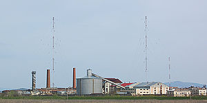
Bod Transmitter
Distance: Approx. 6948 meters
Latitude and longitude: 45.75472222,25.60666667
The Bod Transmitter (also known as the Brașov Transmitter) is the name of the transmitter facility for the central longwave radio station near Bod, Romania. The transmitter was designed by the engineer Gheorghe Cartianu-Popescu and built in 1933–34. At the time it was one of the tallest structures in Europe.

Bod, Brașov
Commune in Brașov, Romania
Distance: Approx. 5824 meters
Latitude and longitude: 45.76666667,25.65
Bod (‹See Tfd›German: Brenndorf; Hungarian: Botfalu) is a commune in Brașov County, Transylvania, Romania. It is composed of two villages, Bod and Colonia Bod (Botfalusi Cukorgyártelep).
Timiș (Olt)
River in Brașov County, Romania
Distance: Approx. 6185 meters
Latitude and longitude: 45.72305556,25.60027778
The Timiș or Timișul Sec is a right tributary of the river Ghimbășel in Romania. Its source is in the Piatra Mare Mountains, northeast of Predeal. It discharges into the Ghimbășel in Sânpetru.
Durbav
River in Brașov County, Romania
Distance: Approx. 5977 meters
Latitude and longitude: 45.73,25.60444444
The Durbav or Sânpetru is a right tributary of the river Ghimbășel in Romania. Its source is in the Piatra Mare Mountains. It discharges into the Ghimbășel in Sânpetru.

Șcheiu
River in Brașov County, Romania
Distance: Approx. 7016 meters
Latitude and longitude: 45.66472222,25.63277778
The Șcheiu or Cheu is a small river in the city of Brașov, Romania. It is intercepted by the Canalul Timiș (Timiș Canal). The upper reach of the river, upstream of Brașov, is also known as the Oabăn.

Hărman
Commune in Brașov, Romania
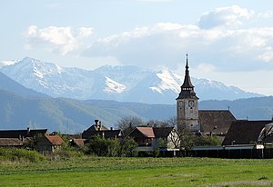
Distance: Approx. 361 meters
Latitude and longitude: 45.71666667,25.68333333
Hărman (German: Honigberg; Hungarian: Szászhermány) is a commune in Brașov County, Transylvania, Romania. It is composed of two villages, Hărman and Podu Oltului (Vámoshíd). The commune is located some 10 km east of Brașov, in the Burzenland region of southeastern Transylvania.

Prejmer fortified church
Lutheran fortified church in Prejmer, Romania
Distance: Approx. 7305 meters
Latitude and longitude: 45.7220793,25.7734555
The Prejmer fortified church (Romanian: Biserica fortificată din Prejmer; ‹See Tfd›German: Kirchenburg von Tartlau) is a Lutheran fortified church in Prejmer (Tartlau), Brașov County, in the Transylvania region of Romania and the ethnographic area of the Burzenland. The church was founded by the Germanic Teutonic Knights, and then was eventually taken over by the Transylvanian Saxon community. Initially Roman Catholic, it became Lutheran following the Reformation.
Weather in this IP's area
broken clouds
17 Celsius
17 Celsius
16 Celsius
18 Celsius
1011 hPa
54 %
1011 hPa
952 hPa
10000 meters
0.89 m/s
1.79 m/s
90 degree
59 %
07:18:12
18:54:03