80.95.51.102 - IP Lookup: Free IP Address Lookup, Postal Code Lookup, IP Location Lookup, IP ASN, Public IP
Country:
Region:
City:
Location:
Time Zone:
Postal Code:
IP information under different IP Channel
ip-api
Country
Region
City
ASN
Time Zone
ISP
Blacklist
Proxy
Latitude
Longitude
Postal
Route
Luminati
Country
Region
eng
City
birmingham
ASN
Time Zone
Europe/London
ISP
TGL Services (UK) Ltd
Latitude
Longitude
Postal
IPinfo
Country
Region
City
ASN
Time Zone
ISP
Blacklist
Proxy
Latitude
Longitude
Postal
Route
IP2Location
80.95.51.102Country
Region
england
City
crabbs cross
Time Zone
Europe/London
ISP
Language
User-Agent
Latitude
Longitude
Postal
db-ip
Country
Region
City
ASN
Time Zone
ISP
Blacklist
Proxy
Latitude
Longitude
Postal
Route
ipdata
Country
Region
City
ASN
Time Zone
ISP
Blacklist
Proxy
Latitude
Longitude
Postal
Route
Popular places and events near this IP address

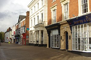
Redditch
Town and borough in England
Distance: Approx. 2293 meters
Latitude and longitude: 52.3,-1.933333
Redditch is a town and non-metropolitan district with borough status in Worcestershire, England. It is located south of Birmingham, east of Bromsgrove, north-west of Alcester and north-east of Worcester. In 2021, the town had a population of 81,637 and the district had a population of 87,037.
Tudor Grange Academy, Redditch
Academy in Redditch, Worcestershire, England
Distance: Approx. 2113 meters
Latitude and longitude: 52.28269,-1.91001
Tudor Grange Academy (formally Leys High School and Kingsley College) is a secondary school and sixth form centre in Redditch, Worcestershire, England. As of October 2010 the school has approximately 250 students on roll, of which 28 are in the sixth form.

Astwood Bank
Human settlement in England
Distance: Approx. 2200 meters
Latitude and longitude: 52.260238,-1.937501
Astwood Bank is a district within Redditch. Astwood Bank is near the Warwickshire - Worcestershire border, near villages such as Studley, Sambourne, Callow Hill, Feckenham, and Cookhill. Astwood Bank is noted for its successful cricket team, who have twice played at Lord's in the National Village Knock Out Final.

Callow Hill, Worcestershire
Area of Redditch, Worcestershire, England
Distance: Approx. 1835 meters
Latitude and longitude: 52.282731,-1.967239
Callow Hill is an area of Redditch, in Worcestershire, England. Other villages nearby include Astwood Bank, Feckenham, Cookhill, and Webheath.

Crabbs Cross
Human settlement in England
Distance: Approx. 223 meters
Latitude and longitude: 52.281903,-1.940889
Crabbs Cross is a district of Redditch in Worcestershire, England. Crabbs Cross gets its name from the crossroads, known nowadays as the 'Star and Garter Island'. Historically, Crabbs Cross was the junction of Crabbs Cross Lane, with Evesham Road (A441) and the Slough.
Hunt End
Human settlement in England
Distance: Approx. 645 meters
Latitude and longitude: 52.276541,-1.94841
Hunt End is a district of Redditch in Worcestershire, England. Saint Augustine's Catholic High School is in Hunt End, it is the only Catholic high school in the town. A number of businesses operate in Hunt End Industrial Estate.
St Augustine's High School, Redditch
Academy in Redditch, Worcestershire, England
Distance: Approx. 571 meters
Latitude and longitude: 52.27523,-1.94417
Saint Augustine's Catholic High School and Sixth Form is a Catholic High School in Hunt End in the town of Redditch, Worcestershire, England. The school was opened in 1974. The school converted to academy status on 1 July 2014.
Districts of Redditch
Human settlement in England
Distance: Approx. 729 meters
Latitude and longitude: 52.28,-1.93
Redditch is a town and local government district in Worcestershire, England. The town is divided into separate districts. All street-name signs in Redditch have the street name in white lettering on a blue background and the district name in black lettering on a white background at the bottom of the sign.
Holmwood, Redditch
Country house in Worcestershire, England
Distance: Approx. 2649 meters
Latitude and longitude: 52.30277778,-1.95138889
Holmwood House in Redditch, Worcestershire, is a country house built for Canon Horace Newton of Glencripesdale Estate and Barrells Hall in 1893 by the famed Victorian architect Temple Lushington Moore, who was a vague relative of the Newton family. Rev Canon Newton was brother of Goodwin Newton of Barrells Hall, where Canon Newton also grew up.

Alexandra Hospital (Redditch)
Hospital in Worcestershire, England
Distance: Approx. 1907 meters
Latitude and longitude: 52.28,-1.9127
Alexandra Hospital is an acute general hospital in Redditch, Worcestershire, England. It is managed by the Worcestershire Acute Hospitals NHS Trust.

Studley & Astwood Bank railway station
Former railway station in Warwickshire, England
Distance: Approx. 2066 meters
Latitude and longitude: 52.2711,-1.914
Studley & Astwood Bank railway station was a station in Studley, Warwickshire, England. The station was opened on 4 May 1868, passenger train service withdrawn in 1962 officially closed to passengers on 17 June 1963 and closed completely on 6 July 1964.

Redditch Town Hall
Municipal building in Redditch, Worcestershire, England
Distance: Approx. 2809 meters
Latitude and longitude: 52.3051,-1.9386
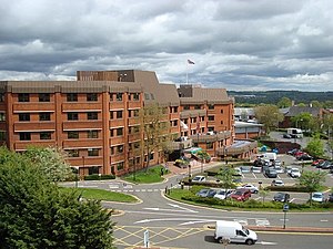
Redditch Town Hall is a municipal building in Walter Stranz Square in Redditch, a town in Worcestershire, in England. It is the headquarters of Redditch Borough Council.
Weather in this IP's area
overcast clouds
3 Celsius
-0 Celsius
2 Celsius
4 Celsius
1022 hPa
90 %
1022 hPa
1011 hPa
10000 meters
3.39 m/s
8.77 m/s
256 degree
100 %