80.93.34.234 - IP Lookup: Free IP Address Lookup, Postal Code Lookup, IP Location Lookup, IP ASN, Public IP
Country:
Region:
City:
Location:
Time Zone:
Postal Code:
ISP:
ASN:
language:
User-Agent:
Proxy IP:
Blacklist:
IP information under different IP Channel
ip-api
Country
Region
City
ASN
Time Zone
ISP
Blacklist
Proxy
Latitude
Longitude
Postal
Route
db-ip
Country
Region
City
ASN
Time Zone
ISP
Blacklist
Proxy
Latitude
Longitude
Postal
Route
IPinfo
Country
Region
City
ASN
Time Zone
ISP
Blacklist
Proxy
Latitude
Longitude
Postal
Route
IP2Location
80.93.34.234Country
Region
tirol
City
kufstein
Time Zone
Europe/Vienna
ISP
Language
User-Agent
Latitude
Longitude
Postal
ipdata
Country
Region
City
ASN
Time Zone
ISP
Blacklist
Proxy
Latitude
Longitude
Postal
Route
Popular places and events near this IP address

Kufstein
Municipality in Tyrol, Austria
Distance: Approx. 4 meters
Latitude and longitude: 47.58333333,12.16666667
Kufstein (German pronunciation: [ˈkʊfˌʃtaɪ̯n] ; Central Bavarian: Kufstoa) is a town in the Austrian state of Tyrol, the administrative seat of Kufstein District. With a population of about 20,000 it is the second largest Tyrolean town after the state capital Innsbruck. The greatest landmark is Kufstein Fortress, first mentioned in the 13th century.

Kufstein Fortress
Austrian castle
Distance: Approx. 406 meters
Latitude and longitude: 47.58,12.169
The Kufstein Fortress (German: Festung Kufstein) is the main landmark of Kufstein, a town in Tyrol, Austria. It is sometimes wrongly referred to as Geroldseck Fortress. It is on a hill commanding Kufstein proper.

Thierberg
Distance: Approx. 1867 meters
Latitude and longitude: 47.6,12.16444444
Thierberg is a mountain located in the north and southwest of the town of Kiefersfelden and thus extends over the border between Austria and Germany and it extends up to Bavaria, Germany but the most part is in Tyrol. In the not-too-high mountain, the Inn Valley is located at approximately 500 meters above sea level. There are several lakes: Egelsee, Hechtsee and Längsee.

Längsee (Tyrol)
Lake in Tyrol, Austria
Distance: Approx. 2010 meters
Latitude and longitude: 47.59944444,12.15472222
Längsee is a lake of Tyrol, Austria.
Maistaller Lacke
Lake in Tyrol, Austria
Distance: Approx. 715 meters
Latitude and longitude: 47.58555556,12.15777778
Maistaller Lacke is a lake of Tyrol, Austria.

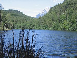
Pfrillsee
Distance: Approx. 1850 meters
Latitude and longitude: 47.59416667,12.14805556
Pfrillsee is a lake of Tyrol, Austria.

Stimmersee
Lake in Tyrol, Austria
Distance: Approx. 2802 meters
Latitude and longitude: 47.57166667,12.13361111
Stimmersee is a lake of Tyrol, Austria.

Kaiserbach
River in Tyrol, Austria
Distance: Approx. 2060 meters
Latitude and longitude: 47.6001,12.1782
The Kaiserbach (also called Sparchenbach) is a river of Tyrol, Austria, in the valley Kaisertal in the Kaiser Mountains in the Tyrolean Unterland. It is a right tributary of the Inn. The Kaiserbach rises at about 1,500 m above sea level (NN) near the Stripsenjoch saddle and empties in Untere Sparchen, a quarter of Kufstein, into the Inn.

Tischofer Cave
Cave and archaeological site in Austria
Distance: Approx. 2447 meters
Latitude and longitude: 47.59194,12.19667
The Tischofer Cave (German: Tischofer Höhle) is a cave in the Kaisertal valley in the Kaisergebirge mountains in Austria. It was a locally important gathering place and weapons cache during the Tyrolean Rebellion in the Napoleonic Wars. The roughly 40 m (130 ft) long cave, which is about 8.5 m (28 ft) high at the entrance, was occupied by cave bears and other predators as shelter during the Paleolithic as evidenced by numerous excavated skeletal remains.
Kufstein railway station
Railway station in Tyrol, Austria
Distance: Approx. 71 meters
Latitude and longitude: 47.58305556,12.16583333
Kufstein railway station serves the city of Kufstein, in the Kufstein district of the Austrian federal state of Tyrol. Opened in 1876, it is an Austrian-German border station, close to the border between Tyrol and Bavaria. The station forms part of the Lower Inn Valley railway, and is also a terminus of the Rosenheim–Kufstein railway.

University of Applied Sciences Kufstein
University in Tyrol, Austria
Distance: Approx. 523 meters
Latitude and longitude: 47.58388889,12.17361111
The University of Applied Sciences Kufstein, is an Austrian Fachhochschule in Kufstein, Tyrol.

Festungsbahn (Kufstein)
Funicular in Kufstein, Austria
Distance: Approx. 246 meters
Latitude and longitude: 47.58205889,12.169415
The Festungsbahn is a funicular railway which links Kufstein Fortress with the town of Kufstein below. The carriage holds a maximum of eight people at a time. Named after Emperor Maximilian I, The Kaiser Maximilian Funicular is on the site of the former hoist up to the fortress.
Weather in this IP's area
overcast clouds
3 Celsius
1 Celsius
0 Celsius
3 Celsius
1022 hPa
77 %
1022 hPa
914 hPa
10000 meters
1.5 m/s
1.53 m/s
192 degree
99 %

