Country:
 Russian Federation
Region:
City:
Latitude and Longitude:
Time Zone:
Postal Code:
IP information under different IP Channel
ip-api
Country
Region
City
ASN
Time Zone
ISP
Blacklist
Proxy
Latitude
Longitude
Postal
Route
IPinfo
Country
Region
City
ASN
Time Zone
ISP
Blacklist
Proxy
Latitude
Longitude
Postal
Route
MaxMind
Country
Region
City
ASN
Time Zone
ISP
Blacklist
Proxy
Latitude
Longitude
Postal
Route
Luminati
Country
RUASN
Time Zone
Europe/Moscow
ISP
Joint Stock Company TransTeleCom
Latitude
Longitude
Postal
db-ip
Country
Region
City
ASN
Time Zone
ISP
Blacklist
Proxy
Latitude
Longitude
Postal
Route
ipdata
Country
Region
City
ASN
Time Zone
ISP
Blacklist
Proxy
Latitude
Longitude
Postal
Route
Popular places and events near this IP address
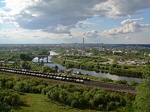
Ukhta
Town in the Komi Republic, Russia
Distance: Approx. 2340 meters
Latitude and longitude: 63.56666667,53.7
Ukhta (Russian: Ухта́; Komi: Уква, Ukva) is an important industrial town in the Komi Republic of Russia. Population: 97,899 (2021 Census); 99,591 (2010 Census); 103,340 (2002 Census); 110,548 (1989 Soviet census). It was previously known as Chibyu (until 1939).

Sosnogorsk
Town in the Komi Republic, Russia
Distance: Approx. 8397 meters
Latitude and longitude: 63.6,53.9
Sosnogorsk (Russian: Сосного́рск; Komi: Сӧснагорт, Sösnagort) is a town in the Komi Republic, Russia, located on the Izhma River. Population: 27,757 (2010 Census); 29,587 (2002 Census); 30,439 (1989 Soviet census).

Ukhta Airport
Airport in Russia
Distance: Approx. 2783 meters
Latitude and longitude: 63.56666667,53.80333333
Ukhta Airport (also referred to as Ust Ukhta) (IATA: UCT, ICAO: UUYH) is a civilian airport in Russia located 5 km east of Ukhta (near Sosnogorsk). It services medium-sized airliners.

Ukhta (river)
River in Russia
Distance: Approx. 8781 meters
Latitude and longitude: 63.6139,53.8903
The Ukhta (Russian: Ухта́, Komi: Уква - Ukva) is a river in the Komi Republic of Russia. It is a left tributary of the Izhma (in the Pechora's drainage basin). It is 199 kilometres (124 mi) long, with a drainage basin of 4,510 square kilometres (1,740 sq mi).

Ukhta State Technical University
Technical university in Ukhta, Russia
Distance: Approx. 2905 meters
Latitude and longitude: 63.5566776,53.6936572
Ukhta State Technical University is a representative of Russian oil and gas universities and a technical higher education institution of the European North of Russia. The University was founded on the basis of the Ukhta Industrial Institute (the Institute was founded in 1967). By this time, more than 25000 engineers and economists had graduated in oil, geology, building, and timber industry majors.

Ukhtpechlag
Soviet Gulag labor camp
Distance: Approx. 2340 meters
Latitude and longitude: 63.56666667,53.7
Ukhtpechlag or UPITLag (Russian: Ухтпечла́г (Ухти́нско-Печо́рский исправи́тельно-трудово́й ла́герь, УПИТЛа́г)) was a Gulag labor camp in Komi ASSR. It existed during June 6, 1931 – May 10, 1938. Its headquarters were in Chibyu, now Ukhta. Its main work was oil and coal mining in Ukhta-Pechora Basin, as well as construction works and logging.
Weather in this IP's area
overcast clouds
3 Celsius
-2 Celsius
3 Celsius
3 Celsius
1004 hPa
79 %
1004 hPa
994 hPa
10000 meters
5.29 m/s
10.47 m/s
276 degree
100 %
05:53:26
16:31:17