Country:
Region:
City:
Latitude and Longitude:
Time Zone:
Postal Code:
IP information under different IP Channel
ip-api
Country
Region
City
ASN
Time Zone
ISP
Blacklist
Proxy
Latitude
Longitude
Postal
Route
IPinfo
Country
Region
City
ASN
Time Zone
ISP
Blacklist
Proxy
Latitude
Longitude
Postal
Route
MaxMind
Country
Region
City
ASN
Time Zone
ISP
Blacklist
Proxy
Latitude
Longitude
Postal
Route
Luminati
Country
Region
nw
City
monschau
ASN
Time Zone
Europe/Berlin
ISP
SkyLink Data Center BV
Latitude
Longitude
Postal
db-ip
Country
Region
City
ASN
Time Zone
ISP
Blacklist
Proxy
Latitude
Longitude
Postal
Route
ipdata
Country
Region
City
ASN
Time Zone
ISP
Blacklist
Proxy
Latitude
Longitude
Postal
Route
Popular places and events near this IP address

Monschau
Resort town in North Rhine-Westphalia, Germany
Distance: Approx. 1441 meters
Latitude and longitude: 50.56,6.25638889
Monschau (German pronunciation: [ˈmɔnʃaʊ̯] ; French: Montjoie, French pronunciation: [mɔ̃ʒwa]; Walloon: Mondjoye) is a small resort town in the Eifel region of western Germany, located in the Aachen district of North Rhine-Westphalia.

Simmerath
Municipality in North Rhine-Westphalia, Germany
Distance: Approx. 7432 meters
Latitude and longitude: 50.60694444,6.3
Simmerath is a municipality in the district of Aachen, in North Rhine-Westphalia, Germany. It is located approximately 20 km south-east of Aachen, near the border to Belgium.
Belgenbach
River in Germany
Distance: Approx. 4277 meters
Latitude and longitude: 50.5636,6.2981
Belgenbach is a river of North Rhine-Westphalia, Germany. It flows into the Rur near Monschau.
Holzbach (Belgenbach)
River of North Rhine-Westphalia, Germany
Distance: Approx. 3972 meters
Latitude and longitude: 50.5747,6.2837
Holzbach is a river of North Rhine-Westphalia, Germany. It is a left tributary of the Belgenbach.

Perlenbach-Fuhrtsbachtal
Distance: Approx. 3136 meters
Latitude and longitude: 50.5256,6.2564
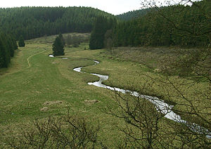
The Perlenbach-Fuhrtsbachtal nature reserve is a 331 hectare reserve in the Aachen region, in the south west corner of North Rhine-Westphalia, Germany. It is characterised by fen vegetation and wet grassland zones with sedge and reed beds. It is situated at a height of 465 – 615 metres above sea level at Monschau, west of Kalterherberg and south of Höfen (two districts of Monschau) and thus forms part of the Monschauer-Hellentaler forest plateau.
Battle of Heartbreak Crossroads
Engagement prior to the Battle of the Bulge
Distance: Approx. 8296 meters
Latitude and longitude: 50.50194444,6.3275
The Battle of Heartbreak Crossroads was fought, beginning one day prior to the start of the Battle of the Bulge, at a vital three-way junction near a forester's cabin and former border post named Wahlerscheid, astride the Siegfried Line (Westwall). The road ran along the Höfen-Alzen and Dreiborn ridges, about 5.6 miles (9.0 km) north of Krinkelt-Rocherath, Belgium. In early December 1944, the U.S. V Corps trucked the experienced 2nd Infantry Division from positions it had held in the south to Krinkelt-Rocherath, twin villages adjacent to Elsenborn Ridge and near the southern tip of the Hürtgen Forest.

Richelsley
Rock formation in Liège Province, Belgium
Distance: Approx. 3913 meters
Latitude and longitude: 50.535935,6.191225
The Richelsley, also written Richel Ley, is an 80-metre-long and up to 12-metre-high rock formation on the edge of the High Fens, part of the Eifel Mountains, in Belgium. It bears a large cross and is a well-known pilgrimage site. Ley is a German word for "crag" or "rock".

Perlenbach Valley
River valley in Belgium and Germany
Distance: Approx. 4483 meters
Latitude and longitude: 50.512062,6.249762
The Perlenbach Valley (German: Perlenbachtal or Perlbachtal) is the valley of the Perlenbach stream in the Eifel mountains in the countries of Belgium and Germany. The Perlenbach itself is a tributary of the Rur. The Perlenbach Valley is host to two outstanding, cultural-historical nature reserves along the state border which have a total area of 398 ha.

Monschau Castle
Distance: Approx. 140 meters
Latitude and longitude: 50.55306,6.23972
Monschau Castle (German: Burg Monschau) is a castle in the eponymous town of Monschau in the southern part of the Region of Aachen in Germany. It is used today as a youth hostel and in summer as a venue for concerts and operas.

Steling
Mountain on the German-Belgian border
Distance: Approx. 3594 meters
Latitude and longitude: 50.5786,6.21192
The Steling is a mountain, 658.3 m above sea level (NN) on the High Fens plateau. The German-Belgian border runs 60 meters from the mountaintop. The closest borderpoint near the summit is also the highest point in the municipal region of Aachen.

Perlenbach (Rur)
River in Germany
Distance: Approx. 762 meters
Latitude and longitude: 50.5488,6.2309
Perlenbach is a river of North Rhine-Westphalia, Germany and eastern Belgium. Its source is in the Belgian High Fens, north of Büllingen. It is dammed up to create a lake, before flowing from the right into the Rur near Monschau.

Mützenich (Monschau)
Stadtteil of Monschau in North Rhine-Westphalia, Germany
Distance: Approx. 2354 meters
Latitude and longitude: 50.56666667,6.21666667
Mützenich is a village and former municipality in the district of Aachen, North Rhine-Westphalia, Germany. It is part of the municipality of Monschau since 1972. Notably, Mützenich is a German exclave surrounded by Belgian territory due to the track bed of the former Vennbahn railway line being part of Belgium following the implementation of the Treaty of Versailles, among other small areas.
Weather in this IP's area
moderate rain
11 Celsius
10 Celsius
10 Celsius
12 Celsius
984 hPa
98 %
984 hPa
928 hPa
10000 meters
4.63 m/s
330 degree
100 %
07:49:48
18:53:47

