80.75.26.92 - IP Lookup: Free IP Address Lookup, Postal Code Lookup, IP Location Lookup, IP ASN, Public IP
Country:
Region:
City:
Location:
Time Zone:
Postal Code:
ISP:
ASN:
language:
User-Agent:
Proxy IP:
Blacklist:
IP information under different IP Channel
ip-api
Country
Region
City
ASN
Time Zone
ISP
Blacklist
Proxy
Latitude
Longitude
Postal
Route
db-ip
Country
Region
City
ASN
Time Zone
ISP
Blacklist
Proxy
Latitude
Longitude
Postal
Route
IPinfo
Country
Region
City
ASN
Time Zone
ISP
Blacklist
Proxy
Latitude
Longitude
Postal
Route
IP2Location
80.75.26.92Country
Region
campania
City
pastorano
Time Zone
Europe/Rome
ISP
Language
User-Agent
Latitude
Longitude
Postal
ipdata
Country
Region
City
ASN
Time Zone
ISP
Blacklist
Proxy
Latitude
Longitude
Postal
Route
Popular places and events near this IP address

Samnium
Historical region of southern Italy; part of the Roman Republic/Empire
Distance: Approx. 3419 meters
Latitude and longitude: 41.16944444,14.23611111
Samnium (Italian: Sannio) is a Latin exonym for a region of Southern Italy anciently inhabited by the Samnites. Their own endonyms were Safinim for the country (attested in one inscription and one coin legend) and Safineis for the people. The language of these endonyms and of the population was the Oscan language.

Province of Caserta
Province of Italy
Distance: Approx. 2207 meters
Latitude and longitude: 41.16666667,14.21666667
The province of Caserta (Italian: provincia di Caserta) is a province in the Campania region of Italy. Its capital is the city of Caserta, situated about 36 kilometres (22 mi) by road north of Naples. The province has an area of 2,651.35 square kilometres (1,023.69 sq mi), and had a total population of 924,414 in 2016.

Cales
Ancient city of Campania
Distance: Approx. 5943 meters
Latitude and longitude: 41.2,14.132
Cales was an ancient city of Campania, in today's comune of Calvi Risorta in southern Italy, belonging originally to the Aurunci/Ausoni, on the Via Latina. The Romans captured it in 335 BC and established a colony with Latin rights of 2,500 citizens. Cales was initially the centre of the Roman dominion in Campania.

Roman Catholic Archdiocese of Capua
Archdiocese in Campania, Italy
Distance: Approx. 7301 meters
Latitude and longitude: 41.1667,14.2833
The Archdiocese of Capua (Latin: Archidioecesis Capuana) is a Latin diocese of the Catholic Church in Capua, in Campania, Italy, but its archbishop no longer holds metropolitan rank and has no ecclesiastical province. Since 1979, it is a suffragan of the Archdiocese of Napoli, i.e. no longer has its own ecclesiastical province nor metropolitan status.

Principality of Capua
Medieval State
Distance: Approx. 7301 meters
Latitude and longitude: 41.1667,14.2833
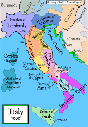
The Principality of Capua (Latin: Principatus Capuae or Capue, Modern Italian: Principato di Capua) was a Lombard state centred on Capua in Southern Italy. Towards the end of the 10th century the Principality reached its apogee, occupying most of the Terra di Lavoro area. It was originally a gastaldate, then a county, within the principality of Salerno.
Tecnam
Italian aircraft manufacturer
Distance: Approx. 6833 meters
Latitude and longitude: 41.1203,14.18444
Costruzioni Aeronautiche TECNAM S.p.A., commonly known as simply Tecnam, is an Italian aircraft manufacturer. The company has two primary activities: producing aircraft components for various other manufacturers, and manufacturing its own range of light aircraft. The company was founded in 1986 by Italian brothers Luigi Pascale and Giovanni Pascale, veteran aircraft designers and manufacturers.

Camigliano
Comune in Campania, Italy
Distance: Approx. 1573 meters
Latitude and longitude: 41.18333333,14.21666667
Camigliano is a comune (municipality) in the Province of Caserta in the Italian region Campania, located about 40 kilometres (25 mi) north of Naples and about 15 kilometres (9 mi) northwest of Caserta. Camigliano borders the following municipalities: Bellona, Formicola, Giano Vetusto, Pastorano, Pontelatone, Vitulazio. The mayor of Camigliano is Vincenzo Cenname, elected in 2011.

Vitulazio
Comune in Campania, Italy
Distance: Approx. 2207 meters
Latitude and longitude: 41.16666667,14.21666667
Vitulazio is a comune (municipality) in the Province of Caserta in the Italian region Campania, located about 35 kilometres (22 mi) north of Naples and about 15 kilometres (9 mi) northwest of Caserta. Vitulazio borders the following municipalities: Bellona, Camigliano, Capua, Grazzanise, Pastorano, Pignataro Maggiore.

Trebula Balliensis
Ancient city of Campania, Italy
Distance: Approx. 4837 meters
Latitude and longitude: 41.2,14.25
Trebula or Trebula Balliensis or Trebula Baliensis (Greek: Τρήβουλα), was an ancient city of Campania, Italy, the location of which is occupied by the modern village of Treglia in the comune of Pontelatone. The Monti Trebulani, a small mountain group in the modern province of Caserta, take their name from it. It was situated in the district north of the Vulturnus (modern Volturno), in the mountain tract which extends from near Caiatia (modern Caiazzo) to the Via Latina.
Italian Aerospace Research Centre
Distance: Approx. 6807 meters
Latitude and longitude: 41.12111111,14.18055556
The Italian Aerospace Research Centre (Italian: Centro Italiano Ricerche Aerospaziali, CIRA) is a consortium established in July 1984 to promote the growth and success of the aerospace industry in Italy (its head-office is in Capua). The majority of CIRA share capital is held by government organizations: the Italian Space Agency (ASI) and the National Research Council of Italy (Consiglio Nazionale delle Ricerche - CNR).

Museo Campano
Museum in Capua, Italy
Distance: Approx. 7886 meters
Latitude and longitude: 41.11086667,14.21319167
The Museo Provinciale Campano di Capua (commonly referred to as Museo Campano) is a provincial museum located in Capua, southern Italy. Established in 1870 and inaugurated in 1874, it is housed in the historic Palazzo Antignano. The museum is dedicated to ancient Italian civilization in Campania, and is home to an extensive collection of ritual statues representing matres matutae coming from the ancient Roman site of Capua antica.

Monti Trebulani
Mountain range in Italy
Distance: Approx. 5743 meters
Latitude and longitude: 41.18333333,14.26666667
The Monti Trebulani or Colli Caprensi is a mountain range in the province of Caserta, Campania, southern Italy. They take their name from the ancient city of Trebula Balliensis, a Roman colony founded in the 3rd-2nd century BC, whose remains are in the frazione Treglia of the comune of Pontelatone. The range has a length of some 20 km, from north to south, starting from the territory of Pietravairano to Bellona.
Weather in this IP's area
scattered clouds
15 Celsius
14 Celsius
15 Celsius
15 Celsius
1020 hPa
77 %
1020 hPa
1002 hPa
10000 meters
5.14 m/s
160 degree
40 %