80.75.119.50 - IP Lookup: Free IP Address Lookup, Postal Code Lookup, IP Location Lookup, IP ASN, Public IP
Country:
Region:
City:
Location:
Time Zone:
Postal Code:
IP information under different IP Channel
ip-api
Country
Region
City
ASN
Time Zone
ISP
Blacklist
Proxy
Latitude
Longitude
Postal
Route
Luminati
Country
Region
zh
City
oberhaslioberhaslidorf
ASN
Time Zone
Europe/Zurich
ISP
Antares Kommunikationstechnik AG
Latitude
Longitude
Postal
IPinfo
Country
Region
City
ASN
Time Zone
ISP
Blacklist
Proxy
Latitude
Longitude
Postal
Route
IP2Location
80.75.119.50Country
Region
zurich
City
hinwil
Time Zone
Europe/Zurich
ISP
Language
User-Agent
Latitude
Longitude
Postal
db-ip
Country
Region
City
ASN
Time Zone
ISP
Blacklist
Proxy
Latitude
Longitude
Postal
Route
ipdata
Country
Region
City
ASN
Time Zone
ISP
Blacklist
Proxy
Latitude
Longitude
Postal
Route
Popular places and events near this IP address

Sauber Motorsport
Swiss Motorsport engineering company
Distance: Approx. 2562 meters
Latitude and longitude: 47.3085163,8.8172027
Sauber Motorsport AG, currently competing in Formula One as Stake F1 Team Kick Sauber, and also known simply as Kick Sauber or Sauber, is a Swiss motorsport engineering company. It was founded in 1970 (as PP Sauber AG) by Peter Sauber, who progressed through hillclimbing and the World Sportscar Championship to reach Formula One in 1993. Sauber operated under their own name from 1993 until 2005 and from 2011 until 2018.
Hinwil
Municipality in Zurich, Switzerland
Distance: Approx. 784 meters
Latitude and longitude: 47.3,8.85
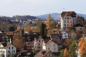
Hinwil is a municipality in the district of Hinwil in the canton of Zürich in Switzerland.
Dürnten
Municipality in Zürich, Switzerland
Distance: Approx. 1305 meters
Latitude and longitude: 47.28333333,8.85
Dürnten is a municipality in the district of Hinwil in the canton of Zürich in Switzerland.

Rüti, Zürich
Municipality in Zürich, Switzerland
Distance: Approx. 3110 meters
Latitude and longitude: 47.26666667,8.85
Rüti (sometimes written as Rüti ZH in order to distinguish it from other "Rütis") is a Swiss town and a municipality in the district of Hinwil in the canton of Zürich. The river Jona flows through the town.
Hinwil District
District in Switzerland
Distance: Approx. 784 meters
Latitude and longitude: 47.3,8.85
Hinwil District is one of the twelve districts of the German-speaking canton of Zurich, Switzerland. It lies to the southeast of the canton, bordering the adjacent St. Gallen.
Girenbad
Village in Switzerland
Distance: Approx. 2666 meters
Latitude and longitude: 47.30861111,8.87222222
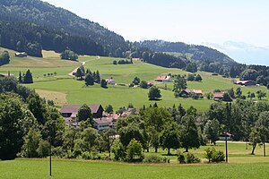
Girenbad is a village in the municipality of Hinwil in the Canton of Zürich, Switzerland.
Bachtel
Distance: Approx. 3208 meters
Latitude and longitude: 47.29472222,8.88638889
Bachtel is a mountain of the Zurich Oberland, located between Hinwil and Wald in the canton of Zurich. It lies approximately halfway between the Schnebelhorn (the highest point of the canton) and Lake Zurich. On the summit is the Bachtel Tower, a 60 metres (200 ft) tall radio tower.
Bubikon railway station
Railway station in the canton of Zürich, Switzerland
Distance: Approx. 3068 meters
Latitude and longitude: 47.270705,8.822907
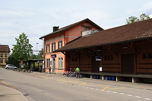
Bubikon is a railway station in the Swiss canton of Zurich and municipality of Bubikon. The station is located on the Wallisellen to Uster and Rapperswil railway line.

Hinwil railway station
Railway station in Switzerland
Distance: Approx. 697 meters
Latitude and longitude: 47.2997,8.839231
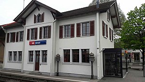
Hinwil railway station (German: Bahnhof Hinwil) is a railway station in the Swiss canton of Zurich and municipality of Hinwil. The station is situated at the junction of the Effretikon to Hinwil via Wetzikon railway line, which is still in full use, and the Uerikon to Bauma railway (UeBB), which is partly closed and partly used as a heritage railway.
Tann-Dürnten railway station
Railway station in Switzerland
Distance: Approx. 2951 meters
Latitude and longitude: 47.268457,8.852596
Tann-Dürnten railway station is a railway station in the Swiss canton of Zurich. The station is situated in the municipality of Dürnten and takes its name from the nearby village of Tann.

Sri Vishnu Thurkkai Amman Temple
Swiss Hindu temple
Distance: Approx. 1305 meters
Latitude and longitude: 47.28333333,8.85
The Sri Vishnu Thurkkai Amman Temple is a Hindu temple located in the municipality of Dürnten in the canton of Zürich in Switzerland.

Arulmihu Sivan Temple
Hindu temple in Switzerland
Distance: Approx. 1305 meters
Latitude and longitude: 47.28333333,8.85
The Arulmiku Sivan Temple is a Hindu temple located in the municipality of Glattbrugg in the Canton of Zürich in Switzerland.
Weather in this IP's area
fog
-2 Celsius
-2 Celsius
-3 Celsius
-0 Celsius
1032 hPa
100 %
1032 hPa
960 hPa
1000 meters
1.03 m/s
130 degree
100 %


