80.73.118.0 - IP Lookup: Free IP Address Lookup, Postal Code Lookup, IP Location Lookup, IP ASN, Public IP
Country:
Region:
City:
Location:
Time Zone:
Postal Code:
IP information under different IP Channel
ip-api
Country
Region
City
ASN
Time Zone
ISP
Blacklist
Proxy
Latitude
Longitude
Postal
Route
Luminati
Country
Region
by
City
metten
ASN
Time Zone
Europe/Berlin
ISP
DegNet GmbH
Latitude
Longitude
Postal
IPinfo
Country
Region
City
ASN
Time Zone
ISP
Blacklist
Proxy
Latitude
Longitude
Postal
Route
IP2Location
80.73.118.0Country
Region
bayern
City
deggendorf
Time Zone
Europe/Berlin
ISP
Language
User-Agent
Latitude
Longitude
Postal
db-ip
Country
Region
City
ASN
Time Zone
ISP
Blacklist
Proxy
Latitude
Longitude
Postal
Route
ipdata
Country
Region
City
ASN
Time Zone
ISP
Blacklist
Proxy
Latitude
Longitude
Postal
Route
Popular places and events near this IP address
Deggendorf (district)
District in Bavaria, Germany
Distance: Approx. 3125 meters
Latitude and longitude: 48.83,13
Deggendorf is a Landkreis (district) in Bavaria, Germany. It is bordered by (from the north and clockwise) the districts of Regen, Freyung-Grafenau, Passau, Rottal-Inn, Dingolfing-Landau and Straubing-Bogen.

Deggendorf
Town in Bavaria, Germany
Distance: Approx. 949 meters
Latitude and longitude: 48.83333333,12.96666667
Deggendorf (Bavarian: Degndorf, Deggndorf) is a town in Bavaria, Germany, capital of the Deggendorf district. It is located on the left bank approximately in the middle between the Danube cities of Regensburg and Passau. The Danube forms the town's natural border towards the south.

Metten Abbey
Distance: Approx. 3528 meters
Latitude and longitude: 48.85527778,12.91777778
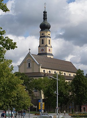
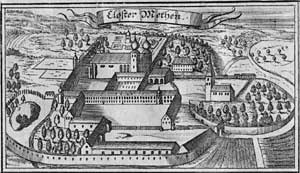
Metten Abbey, or St. Michael's Abbey at Metten (in German Abtei Metten or Kloster Metten) is a house of the Benedictine Order in Metten near Deggendorf, situated between the fringes of the Bavarian Forest and the valley of the Danube, in Bavaria in Germany.
Deggendorf Institute of Technology
University in Lower Bavaria, Germany
Distance: Approx. 1319 meters
Latitude and longitude: 48.82972222,12.95472222
Founded in 1994, the Deggendorf Institute of Technology is an applied sciences university in Lower Bavaria, Germany. In addition to its undergraduate and graduate courses, the institute offers doctoral programs in cooperation with Charles Sturt University.

Grafling
Municipality in Bavaria, Germany
Distance: Approx. 6785 meters
Latitude and longitude: 48.9,12.98333333
Grafling is a municipality in the district of Deggendorf in Bavaria in Germany.

Metten
Municipality in Bavaria, Germany
Distance: Approx. 4316 meters
Latitude and longitude: 48.86666667,12.91666667
Metten is a municipality in the district of Deggendorf in Bavaria in Germany. The town grew up around the Benedictine Metten Abbey, founded in 766. Metten is also the birthplace of former Bayern Munich goalkeeper Sepp Maier.
Offenberg
Municipality in Bavaria, Germany
Distance: Approx. 7461 meters
Latitude and longitude: 48.86666667,12.86666667
Offenberg is a municipality in the district of Deggendorf in Bavaria in Germany.
Schaufling
Municipality in Bavaria, Germany
Distance: Approx. 7829 meters
Latitude and longitude: 48.85,13.06666667
Schaufling is a municipality in the district of Deggendorf in Bavaria in Germany.
Dreitannenriegel
Mountain in Bavaria, Germany
Distance: Approx. 7740 meters
Latitude and longitude: 48.8974,13.0223
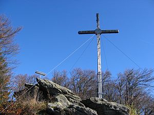
The Dreitannenriegel is a mountain, 1,090.2 m above sea level (NHN), in the Bavarian Forest. The mountain rises from the crest of the Anterior Bavarian Forest high above the Lower Bavarian county town of Deggendorf and lies in the municipality of Grafling. Nearby mountains are the Breitenauriegel, the Geißkopf and the Einödriegel.
Geißriegel
Mountain in Germany
Distance: Approx. 7878 meters
Latitude and longitude: 48.9041,13.0091
The 1,043-metre-high Geißriegel is a mountain in the Danube Hills, the anterior part of the Bavarian Forest, southwest of the Lower Bavarian county town of Regen and northeast of the county town of Deggendorf. It lies within the municipality of Grafling in the county of Deggendorf. Together with the Dreitannenriegel (1090.2 m), the Steinberg (999 m), the Hochoberndorfer Berg (806.7 m) and the Ulrichsberg (636 m), it forms a group of mountains to the east of the valley of Graflinger Tal that separate the villages of Grafling and Bischofsmais.

Deggendorf Hauptbahnhof
Railway station in Bavaria, Germany
Distance: Approx. 792 meters
Latitude and longitude: 48.839434,12.950116
Deggendorf Hauptbahnhof a railway station in the German state of Bavaria, classified by Deutsche Bahn as a category 5 station. It is not currently part of any transport association, so standard DB fares apply. It is planned that it will be integrated in the network area of the Transport Community of Deggendorf District (Verkehrsgemeinschaft Landkreis Deggendorf).

Selimiye Mosque, Deggendorf
Mosque in Bavaria, Germany
Distance: Approx. 2567 meters
Latitude and longitude: 48.818771,12.950861
The Selimiye-Mosque in Deggendorf (Turkish: Selimiye Camii; German: Selimiye-Moschee) is a DİTİB mosque opened in 2016 in Fischerdorf. The construction costed around 3.2 million Euros.
Weather in this IP's area
scattered clouds
-2 Celsius
-5 Celsius
-6 Celsius
-2 Celsius
1041 hPa
89 %
1041 hPa
984 hPa
10000 meters
1.71 m/s
1.15 m/s
30 degree
31 %


