Country:
 Germany
Region:
City:
Latitude and Longitude:
Time Zone:
Postal Code:
IP information under different IP Channel
ip-api
Country
Region
City
ASN
Time Zone
ISP
Blacklist
Proxy
Latitude
Longitude
Postal
Route
IPinfo
Country
Region
City
ASN
Time Zone
ISP
Blacklist
Proxy
Latitude
Longitude
Postal
Route
MaxMind
Country
Region
City
ASN
Time Zone
ISP
Blacklist
Proxy
Latitude
Longitude
Postal
Route
Luminati
Country
DERegion
he
City
usingen
ASN
Time Zone
Europe/Berlin
ISP
true global communications GmbH
Latitude
Longitude
Postal
db-ip
Country
Region
City
ASN
Time Zone
ISP
Blacklist
Proxy
Latitude
Longitude
Postal
Route
ipdata
Country
Region
City
ASN
Time Zone
ISP
Blacklist
Proxy
Latitude
Longitude
Postal
Route
Popular places and events near this IP address
Hochtaunuskreis
District in Hesse, Germany
Distance: Approx. 3344 meters
Latitude and longitude: 50.28333333,8.51666667
The Hochtaunuskreis is a Kreis (district) in the middle of Hesse, Germany and is part of the Frankfurt/Rhine-Main Metropolitan Region. Neighbouring districts are Lahn-Dill, Wetteraukreis, district-free Frankfurt, Main-Taunus, Rheingau-Taunus, Limburg-Weilburg. The Hochtaunuskreis and the Landkreis Starnberg regularly compete for the title of the wealthiest district in Germany.

Neu-Anspach
Town in Hesse, Germany
Distance: Approx. 3433 meters
Latitude and longitude: 50.29305556,8.50888889
Neu-Anspach is a town in the Hochtaunuskreis in Hesse, Germany.
Christian-Wirth-Schule
Distance: Approx. 4047 meters
Latitude and longitude: 50.3345,8.539
Christian-Wirth-Schule (Christian Wirth School) is a secondary school located in Usingen, Germany. Originally established as a school of education (German historical designation: Lehrerbildungsanstalt für evangelische Seminaristen) in 1851, it was later renamed in 1922 to Christian-Wirth-Schule, named after the accomplished attorney at law, Christian Wirth, who resided in the area. CWS publishes its own independent newspaper called the Knorke.

Saalburg
Roman fort in Hesse, Germany
Distance: Approx. 3252 meters
Latitude and longitude: 50.27138889,8.56666667
The Saalburg is a Roman fort located on the main ridge of the Taunus, northwest of Bad Homburg, Hesse, Germany. It is a cohort fort, part of the Limes Germanicus, the Roman linear border fortification of the German provinces. The Saalburg, located just off the main road roughly halfway between Bad Homburg and Wehrheim is the most completely reconstructed Roman fort in Germany.
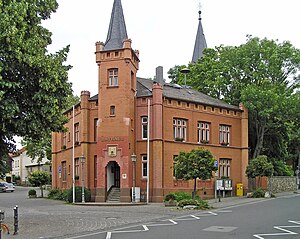
Wehrheim
Municipality in Hesse, Germany
Distance: Approx. 759 meters
Latitude and longitude: 50.3,8.56666667
Wehrheim is a municipality in Hesse, Germany some 30 km (20 mi) north of Frankfurt am Main. The town's nickname is "Apfeldorf Wehrheim" (Apple-village Wehrheim).
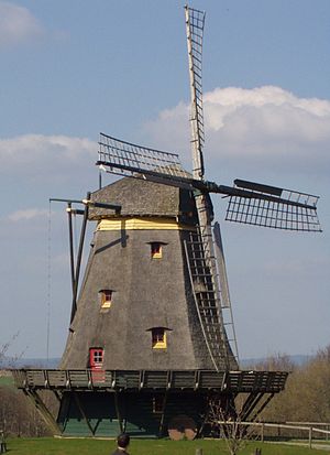
Hessenpark
Open-air museum in Neu-Anspach, Germany
Distance: Approx. 3280 meters
Latitude and longitude: 50.275,8.53111111
The Hessenpark is an open-air museum in Neu-Anspach (near Wehrheim-Obernhain), Hesse, Germany. It was founded in 1974 by the Hesse State Government headed by Albert Osswald (SPD). The museum showcases half-timbered buildings from the land of Hesse.

Arnsbach (Usa)
River in Germany
Distance: Approx. 2979 meters
Latitude and longitude: 50.31611111,8.52277778
Arnsbach is a small river of Hesse, Germany. It flows into the Usa near Usingen.
Bizzenbach
River in Germany
Distance: Approx. 1596 meters
Latitude and longitude: 50.2926,8.5754
Bizzenbach is a small river of Hesse, Germany. It flows into the Erlenbach in Wehrheim.

Röllbach (Usa)
River in Germany
Distance: Approx. 3686 meters
Latitude and longitude: 50.3329,8.5545
Röllbach is a small river of Hesse, Germany. It is a right tributary of the Usa near Usingen.

Stockheimer Bach
River in Germany
Distance: Approx. 3652 meters
Latitude and longitude: 50.3325,8.55194444
Stockheimer Bach is a small river of Hesse, Germany. It flows into the Usa near Usingen.

Usingen station
Railway station in Usingen, Germany
Distance: Approx. 4001 meters
Latitude and longitude: 50.33089,8.527761
Usingen station is the station of Usingen in the German state of Hesse) and the operations centre of the Taunus Railway from Brandoberndorf via Grävenwiesbach and Usingen to Bad Homburg. The entrance building is heritage-listed.

Wehrheim station
Railway station in Wehrheim, Germany
Distance: Approx. 842 meters
Latitude and longitude: 50.296443,8.566606
Wehrheim station is the station of Wehrheim in the German state of Hesse. It is located on the Taunus Railway and the station building is heritage-listed.
Weather in this IP's area
overcast clouds
18 Celsius
18 Celsius
17 Celsius
19 Celsius
1009 hPa
89 %
1009 hPa
970 hPa
10000 meters
3.26 m/s
5.91 m/s
210 degree
94 %
06:51:27
19:55:39