Country:
Region:
City:
Latitude and Longitude:
Time Zone:
Postal Code:
IP information under different IP Channel
ip-api
Country
Region
City
ASN
Time Zone
ISP
Blacklist
Proxy
Latitude
Longitude
Postal
Route
Luminati
Country
ASN
Time Zone
Europe/Helsinki
ISP
EPTE Oy
Latitude
Longitude
Postal
IPinfo
Country
Region
City
ASN
Time Zone
ISP
Blacklist
Proxy
Latitude
Longitude
Postal
Route
db-ip
Country
Region
City
ASN
Time Zone
ISP
Blacklist
Proxy
Latitude
Longitude
Postal
Route
ipdata
Country
Region
City
ASN
Time Zone
ISP
Blacklist
Proxy
Latitude
Longitude
Postal
Route
Popular places and events near this IP address

Klaukkala
Urban area in Uusimaa, Finland
Distance: Approx. 1892 meters
Latitude and longitude: 60.382,24.74916667
Klaukkala (Finnish: [ˈklɑu̯kːɑlɑ]; Swedish: Klövskog [ˈklø̂ːvskuːɡ], Finland Swedish: [ˈkløːvskuːɡ]) is the southern-most urban area (Finnish: taajama) of the Nurmijärvi municipality in Uusimaa, Finland, located near Lake Valkjärvi. It is the largest urban area in Nurmijärvi, and despite the fact that it officially has the status of a village, it is often mistakenly thought to be a separate town due to its size and structure. In the 2010s, Klaukkala's urban area grew to be part of the larger Helsinki urban area.

Lepsämä
Village in Nurmijärvi
Distance: Approx. 5628 meters
Latitude and longitude: 60.38333333,24.63333333
Lepsämä is a village in the municipality of Nurmijärvi, Finland. There is a comprehensive school in Lepsämä, which was partially destroyed by arson fire in October 2019. With the exception of the village kiosk, there are no grocery stores or other daily services in Lepsämä, but the nearest ones are available less than five kilometers from Klaukkala, the largest village in the Nurmijärvi municipality; in the past, however, the village had a shop, a bank and a post office.

Mäntysalo
Neighbourhood in Helsinki sub-region, Uusimaa, Finland
Distance: Approx. 3699 meters
Latitude and longitude: 60.39833333,24.75666667
Mäntysalo (Finnish pronunciation: [ˈmæntyˌsɑlo], literally translated "pine woodland") is a residential area of about one thousand inhabitants in the northern part of Klaukkala in Nurmijärvi municipality. It is one of the largest growth areas in Klaukkala. Haikala and Ripatti, the other residential areas of Klaukkala, are located around Mäntysalo.

Harjula
Neighbourhood in Helsinki sub-region, Uusimaa, Finland
Distance: Approx. 628 meters
Latitude and longitude: 60.3645,24.74
Harjula is a residential area of about 2,000 inhabitants in the southern part of Klaukkala in Nurmijärvi municipality, by the River Lepsämä and the road leading to Lahnus. There are spacious detached houses, terraced houses, small blocks of flats and some private services in the area. Harjula has an elementary school for about 250 students with grades 1–6, and kindergarten alongside of school.

Luhtajoki
River in the country of Finland
Distance: Approx. 3798 meters
Latitude and longitude: 60.34816667,24.78716667
The Luhtajoki is a 46-kilometre (29 mi) long river in Southern Finland. The river starts from Hyvinkää and flows as Kyläjoki into the church village of Nurmijärvi, where it flows 23 kilometers (14 mi) into the Klaukkala and from there to the River Vantaa where it connects. The Luhtajoki River is lush and its water is clayey.

Klaukkala Church
Church in Uusimaa, Finland
Distance: Approx. 2014 meters
Latitude and longitude: 60.382778,24.750833
Klaukkala Church (Finnish: Klaukkalan kirkko, Swedish: Klövskogs kyrka) is a copper-plated modern church in Klaukkala of the Nurmijärvi municipality, built in 2004. The church was designed by Anssi Lassila; interior furniture and lamps were designed by interior architect Antti Paatero and liturgical textiles by Hanna Korvela. Mikko Heikka, a bishop of the Evangelic Lutheran Church, dedicated it on November 28, 2004.

Viiri (shopping centre)
Shopping mall in Klaukkala, Nurmijärvi Finland
Distance: Approx. 1929 meters
Latitude and longitude: 60.37811111,24.75861111
Kauppakeskus Viiri is a shopping mall in the southeast part of Klaukkala, Finland. It is the largest shopping centre in the Nurmijärvi municipality. The mall is divided into Big Viiri (Isoviiri) and Little Viiri (Pikkuviiri).

Hotel Korpilampi
Hotel in Lahnus, Espoo, Finland
Distance: Approx. 4723 meters
Latitude and longitude: 60.32527778,24.72972222
Hotel Korpilampi is a hotel in Lahnus, Espoo, Finland, operated by Pandox. Construction of this first so-called "wilderness hotel" in the Helsinki capital region started in 1975 and the hotel was opened in 1977. The hotel became publicly known in connection with the Korpilampi seminar in 1977.

Serena Waterpark
Finnish water park in Lahnus, Espoo
Distance: Approx. 4715 meters
Latitude and longitude: 60.32555556,24.73916667
Serena Waterpark (Finnish: Vesipuisto Serena) is a water park located along to the Vihdintie road in the Lahnus district of Espoo, Finland. It was opened after extensive excavation and construction work in 1989. Serena is the largest indoor water park in the Nordic countries, and it is also one of the most popular travel destinations in Southern Finland, with more than 200,000 people visiting the water park every year.

Valkjärvi (lake)
Lake in the country of Finland
Distance: Approx. 3918 meters
Latitude and longitude: 60.4025,24.72
Valkjärvi is a lake located in the Nurmijärvi municipality in Southern Finland. It is an island-free lake in the immediate vicinity of Klaukkala's urban area. The water flows from the lake along the Luhtajoki River all the way to the Vantaa River.

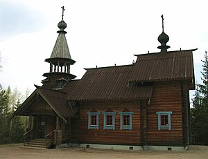
Klaukkala Orthodox Church
Church in Uusimaa, Finland
Distance: Approx. 985 meters
Latitude and longitude: 60.37377778,24.74361111
The Klaukkala Orthodox Church (Finnish: Klaukkalan ortodoksinen kirkko; Swedish: Klövskog ortodoxa kyrka), also known as St. Nectarios Church (Finnish: Pyhän Nektarios Eginalaisen kirkko; Swedish: Sankt Nektarios kyrka), is the 20th-century wooden Orthodox church located in Klaukkala, an urban area in the Nurmijärvi municipality in Uusimaa, Finland. The church was named after the Greek saint Nectarios of Aegina.

Klaukkala Library
Public library in Uusimaa, Finland
Distance: Approx. 1792 meters
Latitude and longitude: 60.37848,24.75479
Klaukkala Library (Finnish: Klaukkalan kirjasto; Swedish: Klövskog bibliotek) is a public library of the town of Klaukkala, located in the Nurmijärvi municipality in Uusimaa, Finland.
Weather in this IP's area
broken clouds
3 Celsius
1 Celsius
2 Celsius
4 Celsius
1033 hPa
93 %
1033 hPa
1026 hPa
10000 meters
2.06 m/s
340 degree
75 %
08:09:02
16:01:07